Property Record
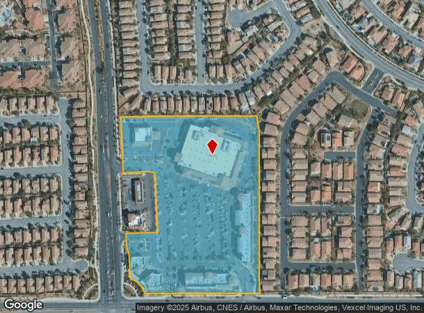
11710 W Charleston Blvd, Las Vegas, NV 89135


NEARBY LISTINGS FOR SALE OR LEASE
Property Detail
11710 W Charleston Blvd
Las Vegas-Henderson-Paradise, NV
Summerlin Village 20 Parcel A
137-34-818-002
SUMMERLIN VILLAGE 20 PARCEL A PLAT BOOK 131 PAGE 54 PT LOT 1
Regionalshoppingcenterormallwithanchorstore
Clark
X
Nevada
32003C2150E
1
2025
10.30 AC
2025
West Las Vegas
005822
Las Vegas
95,875 SF
DEMOGRAPHICS near 11710 W Charleston Blvd
1 Mile
3 Mile
5 Mile
2024 Total Population
17,483
83,482
207,750
2029 Population
18,954
90,811
224,535
Pop Growth 2024-2029
+ 8.41%
+ 8.78%
+ 8.08%
Average Age
38
42
44
2024 Total Households
6,301
33,627
86,815
HH Growth 2024-2029
+ 8.41%
+ 8.54%
+ 7.95%
Median Household Inc
$141,424
$105,824
$78,367
Avg Household Size
2.80
2.50
2.40
2024 Avg HH Vehicles
2.00
2.00
2.00
Median Home Value
$625,295
$573,882
$461,583
Median Year Built
2007
2002
1998
Nearby Places
Map Layers
Map Styles
 Street
 Aerial
- Restaurants
- Banks
- Shops
- Fitness
- Groceries
PUBLIC TRANSPORTATION
AIRPORT
Harry Reid International
DRIVE
WALK
Distance
Harry Reid International
24 min
18.5 mi
Freight Ports
Port of Long Beach
DRIVE
WALK
Distance
Port of Long Beach
326 min
290.2 mi
Nearby Properties
Address
Land Use
TOTAL SIZE
Lot Size
Zoning
Address
Land Use
TOTAL SIZE
Lot Size
Zoning
421,874 SF
59.43 AC
H1
Address
Land Use
TOTAL SIZE
Lot Size
Zoning
157,011 SF
31.41 AC
Address
Land Use
TOTAL SIZE
Lot Size
Zoning
42.15 AC
PF
Address
Land Use
TOTAL SIZE
Lot Size
Zoning
100.61 AC
Address
Land Use
TOTAL SIZE
Lot Size
Zoning
29,374 SF
7.06 AC
Address
Land Use
TOTAL SIZE
Lot Size
Zoning
40.55 AC
PC
Address
Land Use
TOTAL SIZE
Lot Size
Zoning
38.56 AC
PF
Address
Land Use
TOTAL SIZE
Lot Size
Zoning
52,690 SF
17.65 AC
RU
Address
Land Use
TOTAL SIZE
Lot Size
Zoning
280,968 SF
1.45 AC
Address
Land Use
TOTAL SIZE
Lot Size
Zoning
41,331 SF
1.59 AC
Address
Land Use
TOTAL SIZE
Lot Size
Zoning
Address
Land Use
TOTAL SIZE
Lot Size
Zoning
33.24 AC
C1
Address
Land Use
TOTAL SIZE
Lot Size
Zoning
3,520 SF
28.42 AC
R3
Address
Land Use
TOTAL SIZE
Lot Size
Zoning
6,825 SF
9.11 AC
Address
Land Use
TOTAL SIZE
Lot Size
Zoning
15,405 SF
16.74 AC
Address
Land Use
TOTAL SIZE
Lot Size
Zoning
5,427 SF
17.57 AC
Address
Land Use
TOTAL SIZE
Lot Size
Zoning
259,832 SF
3.79 AC
Address
Land Use
TOTAL SIZE
Lot Size
Zoning
2,754 SF
17.17 AC
RPD20
Address
Land Use
TOTAL SIZE
Lot Size
Zoning
223,030 SF
18.11 AC
C1
Address
Land Use
TOTAL SIZE
Lot Size
Zoning
246,947 SF
6.56 AC
RU
Address
Land Use
TOTAL SIZE
Lot Size
Zoning
3,895 SF
15.40 AC
PC
Address
Land Use
TOTAL SIZE
Lot Size
Zoning
12,031 SF
17.45 AC
PC
Address
Land Use
TOTAL SIZE
Lot Size
Zoning
7,408 SF
10.99 AC
R4
Address
Land Use
TOTAL SIZE
Lot Size
Zoning
5,979 SF
17.27 AC
RPD21
Address
Land Use
TOTAL SIZE
Lot Size
Zoning
7,191 SF
16.56 AC
PC
Address
Land Use
TOTAL SIZE
Lot Size
Zoning
450 SF
48.82 AC
Address
Land Use
TOTAL SIZE
Lot Size
Zoning
242,467 SF
6.09 AC
C:C-2
Address
Land Use
TOTAL SIZE
Lot Size
Zoning
151,168 SF
4.65 AC
Address
Land Use
TOTAL SIZE
Lot Size
Zoning
3,706 SF
13.94 AC
PC
The World's #1 Commercial Real Estate Marketplace
Connect with us
© 2025 CoStar Group
The information above has been obtained from sources believed reliable. While we do not doubt its accuracy we have not verified it and make no guarantee, warranty or representation about it. It is your responsibility to independently confirm its accuracy and completeness. Any projections, opinions, assumptions, or estimates used are for example only and do not represent the current or future performance of the property. The value of this transaction to you depends on tax and other factors which should be evaluated by your tax, financial, and legal advisors. You and your advisors should conduct a careful, independent investigation of the property to determine to your satisfaction the suitability of the property for your needs.