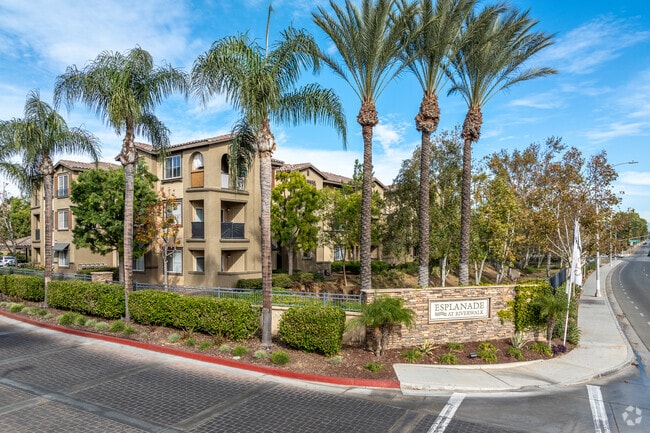
Property Record
11711 Collett Ave, Riverside, CA 92505

Property Detail
11711 Collett Ave
Riverside-San Bernardino-Ontario, CA
2.72 ACRES M/L IN LOTS 1, 2, 3 & 4 MB 013/069 WILDOMAR VISTA TR FOR TOTAL DESCRIPTION SEE ASSESSORS MAPS
141-260-023
Riverside
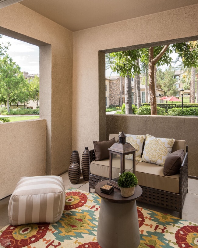
Apartment
California
B and X Area of moderate flood hazard, usually the area between the limits of the 100-year and 500-year floods.
4
2024
26.55 AC
2025
La Sierra
040901
Inland Empire (California)
167,068 SF
NEARBY LISTINGS FOR SALE OR LEASE
-
-
View all Riverside listings for sale on LoopNet.com
DEMOGRAPHICS near 11711 Collett Ave
1 mile
3 mile
5 mile
2025 Total Population
19,520
126,667
256,160
2030 Population
19,879
128,913
261,194
Pop Growth 2025-2030
+ 1.84%
+ 1.77%
+ 1.97%
Average Age
37
37
37
2025 Total Households
6,320
35,984
72,111
HH Growth 2025-2030
+ 1.39%
+ 1.30%
+ 1.50%
Median Household Inc
$87,833
$94,903
$93,942
Avg Household Size
3.00
3.30
3.30
2025 Avg HH Vehicles
2.00
2.00
2.00
Median Home Value
$650,981
$668,996
$675,826
Median Year Built
1991
1983
1980
Nearby Places
Map Layers
Map Styles
 Street
 Aerial
Layers
 Traffic
 Biking
Places
Listings with unknown addresses are not visible on the map
- Restaurants
- Banks
- Shops
- Fitness
- Groceries
PUBLIC TRANSPORTATION
COMMUTER RAIL
Riverside-La Sierra (91 Line - Southern California Regional Rail Authority (Metrolink), Inland Empire-Orange County Line - Southern California Regional Rail Authority (Metrolink))
Drive
Walk
Distance
Riverside-La Sierra (91 Line - Southern California Regional Rail Authority (Metrolink), Inland Empire-Orange County Line - Southern California Regional Rail Authority (Metrolink))
6 min
2.5 mi
North Main Corona (91 Line - Southern California Regional Rail Authority (Metrolink), Inland Empire-Orange County Line - Southern California Regional Rail Authority (Metrolink))
Drive
Walk
Distance
North Main Corona (91 Line - Southern California Regional Rail Authority (Metrolink), Inland Empire-Orange County Line - Southern California Regional Rail Authority (Metrolink))
9 min
5.8 mi
AIRPORT
Ontario International
Drive
Walk
Distance
Ontario International
28 min
19.9 mi
John Wayne/Orange County
Drive
Walk
Distance
John Wayne/Orange County
41 min
33.5 mi
Freight Ports
Port of Long Beach
Drive
Walk
Distance
Port of Long Beach
62 min
47.5 mi
Nearby Properties
Address
Land Use
TOTAL SIZE
Lot Size
Zoning
Address
Land Use
TOTAL SIZE
Lot Size
Zoning
1,662,289 SF
37.05 AC
Address
Land Use
TOTAL SIZE
Lot Size
Zoning
263,807 SF
13.14 AC
Address
Land Use
TOTAL SIZE
Lot Size
Zoning
32,924 SF
24.04 AC
Address
Land Use
TOTAL SIZE
Lot Size
Zoning
76,546 SF
13.53 AC
R
Address
Land Use
TOTAL SIZE
Lot Size
Zoning
335,820 SF
15.18 AC
Address
Land Use
TOTAL SIZE
Lot Size
Zoning
71,440 SF
14.37 AC
Address
Land Use
TOTAL SIZE
Lot Size
Zoning
152,369 SF
5.38 AC
Address
Land Use
TOTAL SIZE
Lot Size
Zoning
20.08 AC
R020
Address
Land Use
TOTAL SIZE
Lot Size
Zoning
27,916 SF
8.50 AC
R3
Address
Land Use
TOTAL SIZE
Lot Size
Zoning
46,694 SF
7.16 AC
Address
Land Use
TOTAL SIZE
Lot Size
Zoning
14 AC
R1
Address
Land Use
TOTAL SIZE
Lot Size
Zoning
359,304 SF
8.86 AC
R3
Address
Land Use
TOTAL SIZE
Lot Size
Zoning
52,928 SF
9.69 AC
Address
Land Use
TOTAL SIZE
Lot Size
Zoning
25,808 SF
6.21 AC
Address
Land Use
TOTAL SIZE
Lot Size
Zoning
4,562 SF
6.42 AC
Address
Land Use
TOTAL SIZE
Lot Size
Zoning
129,911 SF
6.10 AC
Address
Land Use
TOTAL SIZE
Lot Size
Zoning
116,787 SF
2.37 AC
Address
Land Use
TOTAL SIZE
Lot Size
Zoning
156,599 SF
6.27 AC
Address
Land Use
TOTAL SIZE
Lot Size
Zoning
73,538 SF
4.11 AC
R3150
Address
Land Use
TOTAL SIZE
Lot Size
Zoning
196,470 SF
11.43 AC
M1
Address
Land Use
TOTAL SIZE
Lot Size
Zoning
7.56 AC
R3
Address
Land Use
TOTAL SIZE
Lot Size
Zoning
100,000 SF
4.76 AC
CR
Address
Land Use
TOTAL SIZE
Lot Size
Zoning
88,402 SF
2.03 AC
Address
Land Use
TOTAL SIZE
Lot Size
Zoning
96,543 SF
3.34 AC
Address
Land Use
TOTAL SIZE
Lot Size
Zoning
100,000 SF
4.49 AC
CR
Address
Land Use
TOTAL SIZE
Lot Size
Zoning
39,232 SF
8.24 AC
Address
Land Use
TOTAL SIZE
Lot Size
Zoning
163,056 SF
8.43 AC
Address
Land Use
TOTAL SIZE
Lot Size
Zoning
142,039 SF
0.61 AC
M2
The World's #1 Commercial Real Estate Marketplace
Connect with us
© 2026 CoStar Group
The information above has been obtained from sources believed reliable. While we do not doubt its accuracy we have not verified it and make no guarantee, warranty or representation about it. It is your responsibility to independently confirm its accuracy and completeness. Any projections, opinions, assumptions, or estimates used are for example only and do not represent the current or future performance of the property. The value of this transaction to you depends on tax and other factors which should be evaluated by your tax, financial, and legal advisors. You and your advisors should conduct a careful, independent investigation of the property to determine to your satisfaction the suitability of the property for your needs.