Property Record
11716 Six Forks Rd, Raleigh, NC 27614


NEARBY LISTINGS FOR SALE OR LEASE
-
-
View all Raleigh listings for sale on LoopNet.com
Property Detail
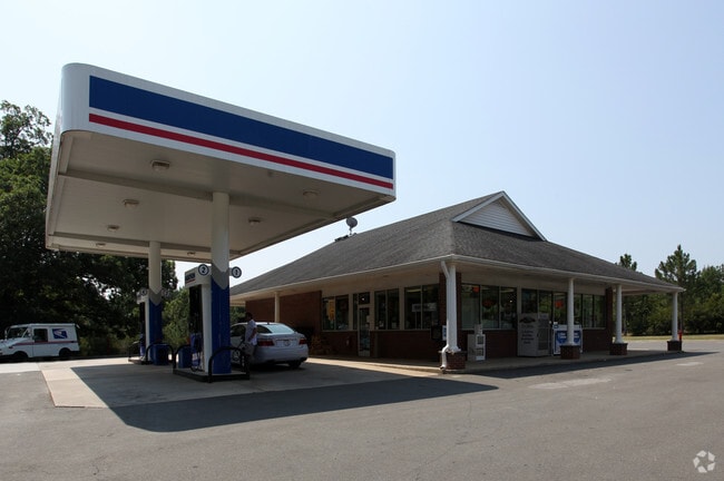
11716 Six Forks Rd
1709.02-69-2074-000
MANGUM LD
Supermarket
Wake
X
North Carolina
3720170900K
2 AC
2025
Six Forks/Falls of Neuse
2025
Raleigh/Durham
053806
Raleigh, NC
2,730 SF
DEMOGRAPHICS near 11716 Six Forks Rd
1 Mile
3 Mile
5 Mile
2024 Total Population
2,486
16,634
87,631
2029 Population
2,668
17,958
94,577
Pop Growth 2024-2029
+ 7.32%
+ 7.96%
+ 7.93%
Average Age
45
44
43
2024 Total Households
881
5,875
34,854
HH Growth 2024-2029
+ 7.26%
+ 7.95%
+ 7.92%
Median Household Inc
$154,459
$162,333
$122,604
Avg Household Size
2.80
2.80
2.50
2024 Avg HH Vehicles
3.00
3.00
2.00
Median Home Value
$541,921
$599,731
$461,837
Median Year Built
1987
1991
1993
Nearby Places
Map Layers
Map Styles
 Street
 Aerial
- Restaurants
- Banks
- Shops
- Fitness
- Groceries
PUBLIC TRANSPORTATION
AIRPORT
Raleigh-Durham International
DRIVE
WALK
Distance
Raleigh-Durham International
19 min
12.6 mi
Freight Ports
Virginia Port Authority - Richmond
DRIVE
WALK
Distance
Virginia Port Authority - Richmond
174 min
143.9 mi
Nearby Properties
Address
Land Use
TOTAL SIZE
Lot Size
Zoning
Address
Land Use
TOTAL SIZE
Lot Size
Zoning
303,067 SF
22.85 AC
RX-7
Address
Land Use
TOTAL SIZE
Lot Size
Zoning
77,891 SF
27.10 AC
R-1
Address
Land Use
TOTAL SIZE
Lot Size
Zoning
60,106 SF
6.32 AC
CX-5
Address
Land Use
TOTAL SIZE
Lot Size
Zoning
73,949 SF
15.39 AC
R-1
Address
Land Use
TOTAL SIZE
Lot Size
Zoning
69,418 SF
27.61 AC
R-40W
Address
Land Use
TOTAL SIZE
Lot Size
Zoning
70,147 SF
15.15 AC
R-80W
Address
Land Use
TOTAL SIZE
Lot Size
Zoning
72,904 SF
24.02 AC
R-80W
Address
Land Use
TOTAL SIZE
Lot Size
Zoning
5,556 SF
148.76 AC
R-80W
Address
Land Use
TOTAL SIZE
Lot Size
Zoning
30,510 SF
21.83 AC
R-80W
Address
Land Use
TOTAL SIZE
Lot Size
Zoning
40,612 SF
8.39 AC
R-1-C
Address
Land Use
TOTAL SIZE
Lot Size
Zoning
51,942 SF
8.06 AC
CX-5
Address
Land Use
TOTAL SIZE
Lot Size
Zoning
13,871 SF
14.10 AC
R-10
Address
Land Use
TOTAL SIZE
Lot Size
Zoning
16,405 SF
16.64 AC
R-40W
Address
Land Use
TOTAL SIZE
Lot Size
Zoning
42.09 AC
R-1
Address
Land Use
TOTAL SIZE
Lot Size
Zoning
24,067 SF
2.51 AC
CX-5
Address
Land Use
TOTAL SIZE
Lot Size
Zoning
47.16 AC
R-80W
Address
Land Use
TOTAL SIZE
Lot Size
Zoning
7,843 SF
41.89 AC
R-80W
Address
Land Use
TOTAL SIZE
Lot Size
Zoning
11,742 SF
5.43 AC
R-40W
Address
Land Use
TOTAL SIZE
Lot Size
Zoning
16,440 SF
1.51 AC
CX-5
Address
Land Use
TOTAL SIZE
Lot Size
Zoning
29.96 AC
R-40W
Address
Land Use
TOTAL SIZE
Lot Size
Zoning
27.83 AC
R-40W
Address
Land Use
TOTAL SIZE
Lot Size
Zoning
15,924 SF
2.53 AC
R-80W
Address
Land Use
TOTAL SIZE
Lot Size
Zoning
1,530 SF
29.85 AC
R-80W
Address
Land Use
TOTAL SIZE
Lot Size
Zoning
29.66 AC
R-1
Address
Land Use
TOTAL SIZE
Lot Size
Zoning
10,058 SF
7.65 AC
R-80W
Address
Land Use
TOTAL SIZE
Lot Size
Zoning
9,440 SF
4.71 AC
R-1
Address
Land Use
TOTAL SIZE
Lot Size
Zoning
59.89 AC
R-80W
Address
Land Use
TOTAL SIZE
Lot Size
Zoning
11,880 SF
7.38 AC
R-40W
Address
Land Use
TOTAL SIZE
Lot Size
Zoning
5,840 SF
0.67 AC
CX-5
Address
Land Use
TOTAL SIZE
Lot Size
Zoning
13,800 SF
0.01 AC
R-80W
The World's #1 Commercial Real Estate Marketplace
Connect with us
© 2026 CoStar Group
The information above has been obtained from sources believed reliable. While we do not doubt its accuracy we have not verified it and make no guarantee, warranty or representation about it. It is your responsibility to independently confirm its accuracy and completeness. Any projections, opinions, assumptions, or estimates used are for example only and do not represent the current or future performance of the property. The value of this transaction to you depends on tax and other factors which should be evaluated by your tax, financial, and legal advisors. You and your advisors should conduct a careful, independent investigation of the property to determine to your satisfaction the suitability of the property for your needs.