Property Record
11718 Winterpock Rd, Chesterfield, VA 23838

NEARBY LISTINGS FOR SALE OR LEASE
Property Detail
11718 Winterpock Rd
Richmond, VA
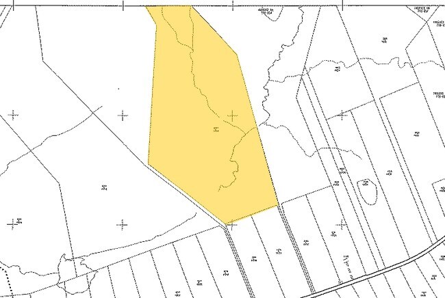
E/L Coalboro Rd Parcel 26R
715-65-28-48-700-000
E/L COALBORO RD PARCEL 26R
Agriculturalland
Chesterfield
A
Virginia
51041C0280E
50 AC
2025
Outlying Chesterfield
2025
Richmond VA
101004
DEMOGRAPHICS near 11718 Winterpock Rd
1 Mile
3 Mile
5 Mile
2024 Total Population
557
17,156
51,961
2029 Population
609
19,012
57,414
Pop Growth 2024-2029
+ 9.34%
+ 10.82%
+ 10.49%
Average Age
43
39
39
2024 Total Households
196
5,704
17,631
HH Growth 2024-2029
+ 9.69%
+ 10.82%
+ 10.48%
Median Household Inc
$113,257
$122,362
$126,142
Avg Household Size
2.80
3.00
2.90
2024 Avg HH Vehicles
3.00
2.00
2.00
Median Home Value
$371,232
$373,086
$364,635
Median Year Built
1986
2004
2000
Nearby Places
Map Layers
Map Styles
 Street
 Aerial
- Restaurants
- Banks
- Shops
- Fitness
- Groceries
PUBLIC TRANSPORTATION
AIRPORT
Richmond International
DRIVE
WALK
Distance
Richmond International
53 min
32.8 mi
Freight Ports
Virginia Port Authority - Richmond
DRIVE
WALK
Distance
Virginia Port Authority - Richmond
41 min
22.5 mi
Nearby Properties
Address
Land Use
TOTAL SIZE
Lot Size
Zoning
Address
Land Use
TOTAL SIZE
Lot Size
Zoning
100 SF
21.18 AC
R9 - SINGL
Address
Land Use
TOTAL SIZE
Lot Size
Zoning
95,857 SF
24.56 AC
C3 - COMMU
Address
Land Use
TOTAL SIZE
Lot Size
Zoning
88,847 SF
23.04 AC
R12 - SING
Address
Land Use
TOTAL SIZE
Lot Size
Zoning
58,250 SF
21.74 AC
I1 - LT IN
Address
Land Use
TOTAL SIZE
Lot Size
Zoning
50,668 SF
8.29 AC
C3 - COMMU
Address
Land Use
TOTAL SIZE
Lot Size
Zoning
6,943 SF
20.05 AC
I1 - LT IN
Address
Land Use
TOTAL SIZE
Lot Size
Zoning
100,086 SF
5.72 AC
C5 - GEN B
Address
Land Use
TOTAL SIZE
Lot Size
Zoning
174.79 AC
A - AGRICU
Address
Land Use
TOTAL SIZE
Lot Size
Zoning
44,100 SF
3.17 AC
C5 - GEN B
Address
Land Use
TOTAL SIZE
Lot Size
Zoning
21,998 SF
3.08 AC
C3 - COMMU
Address
Land Use
TOTAL SIZE
Lot Size
Zoning
9,020 SF
6.33 AC
A - AGRICU
Address
Land Use
TOTAL SIZE
Lot Size
Zoning
12,265 SF
4.68 AC
A - AGRICU
Address
Land Use
TOTAL SIZE
Lot Size
Zoning
11,945 SF
4.27 AC
C5 - GEN B
Address
Land Use
TOTAL SIZE
Lot Size
Zoning
5,456 SF
2.59 AC
C3 - COMMU
Address
Land Use
TOTAL SIZE
Lot Size
Zoning
19,757 SF
5.11 AC
A - AGRICU
Address
Land Use
TOTAL SIZE
Lot Size
Zoning
9,593 SF
1.89 AC
C3 - COMMU
Address
Land Use
TOTAL SIZE
Lot Size
Zoning
15,651 SF
13.02 AC
A - AGRICU
Address
Land Use
TOTAL SIZE
Lot Size
Zoning
9,095 SF
1.42 AC
C2 - NBHD
Address
Land Use
TOTAL SIZE
Lot Size
Zoning
8,096 SF
1.34 AC
C2 - NBHD
Address
Land Use
TOTAL SIZE
Lot Size
Zoning
2.48 AC
A - AGRICU
Address
Land Use
TOTAL SIZE
Lot Size
Zoning
4,050 SF
1.68 AC
C3 - COMMU
Address
Land Use
TOTAL SIZE
Lot Size
Zoning
5,550 SF
5.69 AC
C3 - COMMU
Address
Land Use
TOTAL SIZE
Lot Size
Zoning
61.44 AC
R12 - SING
Address
Land Use
TOTAL SIZE
Lot Size
Zoning
6,000 SF
2.89 AC
C5 - GEN B
Address
Land Use
TOTAL SIZE
Lot Size
Zoning
7,382 SF
1.30 AC
C3 - COMMU
Address
Land Use
TOTAL SIZE
Lot Size
Zoning
2,624 SF
0.85 AC
C2 - NBHD
Address
Land Use
TOTAL SIZE
Lot Size
Zoning
78.08 AC
I1 - LT IN
Address
Land Use
TOTAL SIZE
Lot Size
Zoning
3,234 SF
5.89 AC
R12 - SING
Address
Land Use
TOTAL SIZE
Lot Size
Zoning
1,825 SF
0.80 AC
C2 - NBHD
Address
Land Use
TOTAL SIZE
Lot Size
Zoning
51.98 AC
R12 - SING
The World's #1 Commercial Real Estate Marketplace
Connect with us
© 2026 CoStar Group
The information above has been obtained from sources believed reliable. While we do not doubt its accuracy we have not verified it and make no guarantee, warranty or representation about it. It is your responsibility to independently confirm its accuracy and completeness. Any projections, opinions, assumptions, or estimates used are for example only and do not represent the current or future performance of the property. The value of this transaction to you depends on tax and other factors which should be evaluated by your tax, financial, and legal advisors. You and your advisors should conduct a careful, independent investigation of the property to determine to your satisfaction the suitability of the property for your needs.