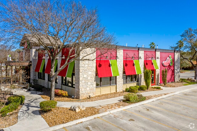
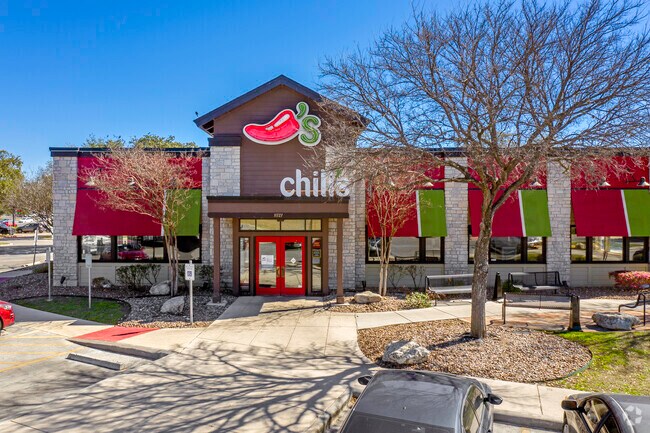
Property Record
11727 Bandera Rd, San Antonio, TX 78250
NEARBY LISTINGS FOR SALE OR LEASE
Property Detail
11727 Bandera Rd
San Antonio-New Braunfels, TX
Layla Oaks Sub
15664-008-0100
NCB 15664 BLK 8 LOT 10 LAYLA OAKS SUBD UT-6
Restaurantbuilding
Bexar
X
Texas
48029C0220G
10
2024
1.89 AC
2025
Northwest
181721
San Antonio
5,968 SF
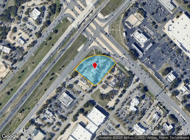
DEMOGRAPHICS near 11727 Bandera Rd
1 Mile
3 Mile
5 Mile
2024 Total Population
10,332
97,453
244,377
2029 Population
10,751
102,691
259,620
Pop Growth 2024-2029
+ 4.06%
+ 5.37%
+ 6.24%
Average Age
37
37
36
2024 Total Households
3,785
34,118
88,542
HH Growth 2024-2029
+ 3.88%
+ 5.51%
+ 6.43%
Median Household Inc
$99,945
$93,124
$82,999
Avg Household Size
2.70
2.80
2.70
2024 Avg HH Vehicles
2.00
2.00
2.00
Median Home Value
$256,228
$248,230
$241,173
Median Year Built
2001
1997
1997
Nearby Places
Map Layers
Map Styles
 Street
 Aerial
- Restaurants
- Banks
- Shops
- Fitness
- Groceries
PUBLIC TRANSPORTATION
AIRPORT
San Antonio International
DRIVE
WALK
Distance
San Antonio International
23 min
15.2 mi
Freight Ports
Calhoun Port
DRIVE
WALK
Distance
Calhoun Port
201 min
169.0 mi
SALE & LEASE HISTORY
LISTING DATE
SALE/LEASE

Oct 05, 2018
For Sale
Nearby Properties
Address
Land Use
TOTAL SIZE
Lot Size
Zoning
Address
Land Use
TOTAL SIZE
Lot Size
Zoning
520,686 SF
53.63 AC
Address
Land Use
TOTAL SIZE
Lot Size
Zoning
413,362 SF
33.77 AC
Address
Land Use
TOTAL SIZE
Lot Size
Zoning
149,500 SF
9.36 AC
Address
Land Use
TOTAL SIZE
Lot Size
Zoning
305,600 SF
30.64 AC
Address
Land Use
TOTAL SIZE
Lot Size
Zoning
307,272 SF
24.14 AC
Address
Land Use
TOTAL SIZE
Lot Size
Zoning
237,499 SF
37.26 AC
Address
Land Use
TOTAL SIZE
Lot Size
Zoning
220,719 SF
25.86 AC
Address
Land Use
TOTAL SIZE
Lot Size
Zoning
289,158 SF
31.78 AC
Address
Land Use
TOTAL SIZE
Lot Size
Zoning
217,267 SF
17.63 AC
Address
Land Use
TOTAL SIZE
Lot Size
Zoning
229,430 SF
11.92 AC
Address
Land Use
TOTAL SIZE
Lot Size
Zoning
255,890 SF
14.23 AC
Address
Land Use
TOTAL SIZE
Lot Size
Zoning
230,048 SF
10.70 AC
Address
Land Use
TOTAL SIZE
Lot Size
Zoning
232,610 SF
13.16 AC
Address
Land Use
TOTAL SIZE
Lot Size
Zoning
185,896 SF
26.12 AC
Address
Land Use
TOTAL SIZE
Lot Size
Zoning
1,080 SF
92.05 AC
Address
Land Use
TOTAL SIZE
Lot Size
Zoning
193,004 SF
16.43 AC
Address
Land Use
TOTAL SIZE
Lot Size
Zoning
228,364 SF
16.14 AC
Address
Land Use
TOTAL SIZE
Lot Size
Zoning
191,361 SF
15.02 AC
Address
Land Use
TOTAL SIZE
Lot Size
Zoning
246,381 SF
10.56 AC
Address
Land Use
TOTAL SIZE
Lot Size
Zoning
215,505 SF
11.21 AC
Address
Land Use
TOTAL SIZE
Lot Size
Zoning
194,289 SF
13.32 AC
Address
Land Use
TOTAL SIZE
Lot Size
Zoning
248,352 SF
14.72 AC
Address
Land Use
TOTAL SIZE
Lot Size
Zoning
74,514 SF
15.57 AC
Address
Land Use
TOTAL SIZE
Lot Size
Zoning
169,822 SF
7 AC
Address
Land Use
TOTAL SIZE
Lot Size
Zoning
157,714 SF
16.22 AC
Address
Land Use
TOTAL SIZE
Lot Size
Zoning
52,631 SF
5.54 AC
Address
Land Use
TOTAL SIZE
Lot Size
Zoning
122,275 SF
3.51 AC
Address
Land Use
TOTAL SIZE
Lot Size
Zoning
62,157 SF
7.64 AC
Address
Land Use
TOTAL SIZE
Lot Size
Zoning
67.52 AC
Address
Land Use
TOTAL SIZE
Lot Size
Zoning
27,712 SF
11.48 AC
The World's #1 Commercial Real Estate Marketplace
Connect with us
© 2025 CoStar Group
The information above has been obtained from sources believed reliable. While we do not doubt its accuracy we have not verified it and make no guarantee, warranty or representation about it. It is your responsibility to independently confirm its accuracy and completeness. Any projections, opinions, assumptions, or estimates used are for example only and do not represent the current or future performance of the property. The value of this transaction to you depends on tax and other factors which should be evaluated by your tax, financial, and legal advisors. You and your advisors should conduct a careful, independent investigation of the property to determine to your satisfaction the suitability of the property for your needs.