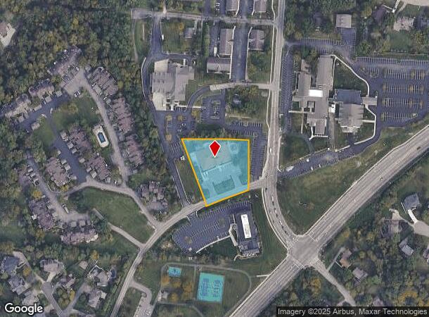
Property Record
11737 7 Gables Rd, Cincinnati, OH 45249


NEARBY LISTINGS FOR SALE OR LEASE
Property Detail
11737 7 Gables Rd
Cincinnati, OH-KY-IN
Park Place Add
620-0204-0030
MONTGOMERY RD 1.42 AC 76.22 X 189.13 IRRNS MONTG RD 108 FT W OF E L SEC
Privateschool
Hamilton
X
Ohio
39165C0212F
1.31 AC
2025
Mason/Montgomery
2025
Cincinnati/Dayton
024301
DEMOGRAPHICS near 11737 7 Gables Rd
1 mile
3 mile
5 mile
2024 Total Population
7,164
61,380
140,107
2029 Population
7,059
63,072
144,564
Pop Growth 2024-2029
(1.47%)
+ 2.76%
+ 3.18%
Average Age
39
40
41
2024 Total Households
2,695
23,839
53,956
HH Growth 2024-2029
(1.67%)
+ 2.79%
+ 3.14%
Median Household Inc
$110,375
$104,507
$106,167
Avg Household Size
2.60
2.50
2.50
2024 Avg HH Vehicles
2.00
2.00
2.00
Median Home Value
$420,049
$318,856
$303,689
Median Year Built
1986
1986
1986
Nearby Places
Map Layers
Map Styles
 Street
 Aerial
Transit
 Traffic
 Biking
Places
Listings with unknown addresses are not visible on the map
- Restaurants
- Banks
- Shops
- Fitness
- Groceries
PUBLIC TRANSPORTATION
AIRPORT
Cincinnati/Northern Kentucky International
Drive
Walk
Distance
Cincinnati/Northern Kentucky International
52 min
33.8 mi
Freight Ports
Port of Toledo
Drive
Walk
Distance
Port of Toledo
227 min
191.7 mi
Nearby Properties
Address
Land Use
TOTAL SIZE
Lot Size
Zoning
Address
Land Use
TOTAL SIZE
Lot Size
Zoning
74.81 AC
Address
Land Use
TOTAL SIZE
Lot Size
Zoning
232.72 AC
Address
Land Use
TOTAL SIZE
Lot Size
Zoning
232.72 AC
Address
Land Use
TOTAL SIZE
Lot Size
Zoning
274,436 SF
27.12 AC
Address
Land Use
TOTAL SIZE
Lot Size
Zoning
17,484 SF
35.55 AC
Address
Land Use
TOTAL SIZE
Lot Size
Zoning
80,767 SF
7.31 AC
Address
Land Use
TOTAL SIZE
Lot Size
Zoning
58.52 AC
Address
Land Use
TOTAL SIZE
Lot Size
Zoning
29.31 AC
DD
Address
Land Use
TOTAL SIZE
Lot Size
Zoning
47,424 SF
32.35 AC
Address
Land Use
TOTAL SIZE
Lot Size
Zoning
67,636 SF
8.74 AC
Address
Land Use
TOTAL SIZE
Lot Size
Zoning
71,866 SF
14.33 AC
Address
Land Use
TOTAL SIZE
Lot Size
Zoning
42,906 SF
23.76 AC
Address
Land Use
TOTAL SIZE
Lot Size
Zoning
140,876 SF
64.04 AC
Address
Land Use
TOTAL SIZE
Lot Size
Zoning
47,788 SF
25.84 AC
Address
Land Use
TOTAL SIZE
Lot Size
Zoning
28.73 AC
DD
Address
Land Use
TOTAL SIZE
Lot Size
Zoning
10.87 AC
OO
Address
Land Use
TOTAL SIZE
Lot Size
Zoning
25,339 SF
14.59 AC
Address
Land Use
TOTAL SIZE
Lot Size
Zoning
12,102 SF
8.17 AC
Address
Land Use
TOTAL SIZE
Lot Size
Zoning
Address
Land Use
TOTAL SIZE
Lot Size
Zoning
211,734 SF
18.14 AC
Address
Land Use
TOTAL SIZE
Lot Size
Zoning
37,906 SF
8.94 AC
Address
Land Use
TOTAL SIZE
Lot Size
Zoning
26.04 AC
DD
Address
Land Use
TOTAL SIZE
Lot Size
Zoning
19.25 AC
E
Address
Land Use
TOTAL SIZE
Lot Size
Zoning
116,775 SF
12.37 AC
Address
Land Use
TOTAL SIZE
Lot Size
Zoning
2,173 SF
22 AC
E
Address
Land Use
TOTAL SIZE
Lot Size
Zoning
16.76 AC
EE
Address
Land Use
TOTAL SIZE
Lot Size
Zoning
85,759 SF
13.80 AC
Address
Land Use
TOTAL SIZE
Lot Size
Zoning
30,844 SF
15.87 AC
Address
Land Use
TOTAL SIZE
Lot Size
Zoning
11,880 SF
23.07 AC
DD
Address
Land Use
TOTAL SIZE
Lot Size
Zoning
76,844 SF
18.74 AC
The World's #1 Commercial Real Estate Marketplace
Connect with us
© 2026 CoStar Group
The information above has been obtained from sources believed reliable. While we do not doubt its accuracy we have not verified it and make no guarantee, warranty or representation about it. It is your responsibility to independently confirm its accuracy and completeness. Any projections, opinions, assumptions, or estimates used are for example only and do not represent the current or future performance of the property. The value of this transaction to you depends on tax and other factors which should be evaluated by your tax, financial, and legal advisors. You and your advisors should conduct a careful, independent investigation of the property to determine to your satisfaction the suitability of the property for your needs.