Property Record
11767 Katy Fwy, Houston, TX 77079

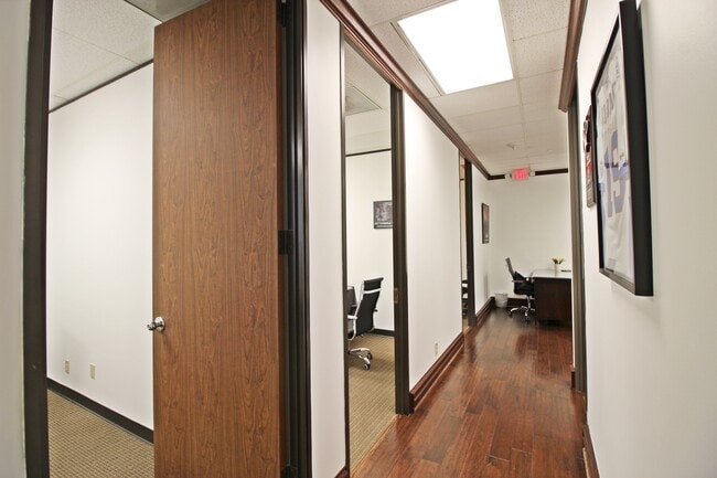

Current Lease Availabilities
NEARBY LISTINGS FOR SALE OR LEASE
Property Detail
11767 Katy Fwy
0440490000003
Abst 623 W G Perkinson
Officebuilding
TR 11 ABST 623 W G PERKINSON
X
Harris
48201C0640M
Texas
2024
2.51 AC
2025
Katy Freeway West
450302
Houston
443,584 SF
Houston-The Woodlands-Sugar Land, TX
DEMOGRAPHICS near 11767 Katy Fwy
1 Mile
3 Mile
5 Mile
2024 Total Population
14,418
113,250
299,463
2029 Population
14,647
116,049
307,069
Pop Growth 2024-2029
+ 1.59%
+ 2.47%
+ 2.54%
Average Age
36
38
38
2024 Total Households
5,483
46,849
123,615
HH Growth 2024-2029
+ 1.51%
+ 2.38%
+ 2.51%
Median Household Inc
$68,331
$73,185
$64,105
Avg Household Size
2.60
2.40
2.30
2024 Avg HH Vehicles
2.00
2.00
2.00
Median Home Value
$416,781
$397,097
$369,040
Median Year Built
1975
1982
1984
Nearby Places
- Restaurants
- Banks
- Shops
- Fitness
- Groceries
PUBLIC TRANSPORTATION
AIRPORT
William P Hobby
DRIVE
WALK
Distance
William P Hobby
41 min
27.5 mi
George Bush Intcntl/Houston
DRIVE
WALK
Distance
George Bush Intcntl/Houston
36 min
28.8 mi
Freight Ports
Port of Houston
DRIVE
WALK
Distance
Port of Houston
35 min
24.3 mi
Nearby Properties
Address
Land Use
TOTAL SIZE
Lot Size
Zoning
Address
Land Use
TOTAL SIZE
Lot Size
Zoning
2,976,779 SF
41.36 AC
Address
Land Use
TOTAL SIZE
Lot Size
Zoning
1,385,616 SF
6.48 AC
Address
Land Use
TOTAL SIZE
Lot Size
Zoning
797,516 SF
2.91 AC
Address
Land Use
TOTAL SIZE
Lot Size
Zoning
797,509 SF
3.11 AC
Address
Land Use
TOTAL SIZE
Lot Size
Zoning
1,131,022 SF
6.26 AC
Address
Land Use
TOTAL SIZE
Lot Size
Zoning
730,107 SF
2.92 AC
Address
Land Use
TOTAL SIZE
Lot Size
Zoning
1,208,144 SF
6.15 AC
Address
Land Use
TOTAL SIZE
Lot Size
Zoning
730,107 SF
2.57 AC
Address
Land Use
TOTAL SIZE
Lot Size
Zoning
955,731 SF
3.40 AC
Address
Land Use
TOTAL SIZE
Lot Size
Zoning
759,908 SF
4.54 AC
Address
Land Use
TOTAL SIZE
Lot Size
Zoning
1,543,856 SF
10.03 AC
Address
Land Use
TOTAL SIZE
Lot Size
Zoning
1,045,896 SF
11.14 AC
Address
Land Use
TOTAL SIZE
Lot Size
Zoning
683,397 SF
2.97 AC
Address
Land Use
TOTAL SIZE
Lot Size
Zoning
569,641 SF
5.69 AC
Address
Land Use
TOTAL SIZE
Lot Size
Zoning
306,572 SF
25.46 AC
Address
Land Use
TOTAL SIZE
Lot Size
Zoning
690,519 SF
26.57 AC
Address
Land Use
TOTAL SIZE
Lot Size
Zoning
617,832 SF
9.24 AC
Address
Land Use
TOTAL SIZE
Lot Size
Zoning
794,526 SF
21.25 AC
Address
Land Use
TOTAL SIZE
Lot Size
Zoning
320,534 SF
2.32 AC
Address
Land Use
TOTAL SIZE
Lot Size
Zoning
422,801 SF
12.71 AC
Address
Land Use
TOTAL SIZE
Lot Size
Zoning
520,277 SF
10.04 AC
Address
Land Use
TOTAL SIZE
Lot Size
Zoning
207,841 SF
1.19 AC
Address
Land Use
TOTAL SIZE
Lot Size
Zoning
601,167 SF
14.93 AC
Address
Land Use
TOTAL SIZE
Lot Size
Zoning
845,902 SF
16.27 AC
Address
Land Use
TOTAL SIZE
Lot Size
Zoning
544,102 SF
2.99 AC
Address
Land Use
TOTAL SIZE
Lot Size
Zoning
519,220 SF
6.23 AC
Address
Land Use
TOTAL SIZE
Lot Size
Zoning
337,964 SF
9.30 AC
Address
Land Use
TOTAL SIZE
Lot Size
Zoning
341,801 SF
9.72 AC
Address
Land Use
TOTAL SIZE
Lot Size
Zoning
533,048 SF
5.80 AC
Address
Land Use
TOTAL SIZE
Lot Size
Zoning
672,183 SF
8.80 AC
The World's #1 Commercial Real Estate Marketplace
Connect with us
© 2025 CoStar Group
The information above has been obtained from sources believed reliable. While we do not doubt its accuracy we have not verified it and make no guarantee, warranty or representation about it. It is your responsibility to independently confirm its accuracy and completeness. Any projections, opinions, assumptions, or estimates used are for example only and do not represent the current or future performance of the property. The value of this transaction to you depends on tax and other factors which should be evaluated by your tax, financial, and legal advisors. You and your advisors should conduct a careful, independent investigation of the property to determine to your satisfaction the suitability of the property for your needs.