Property Record
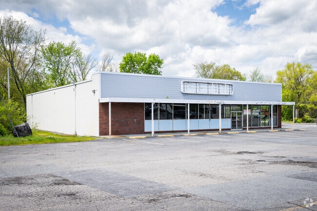
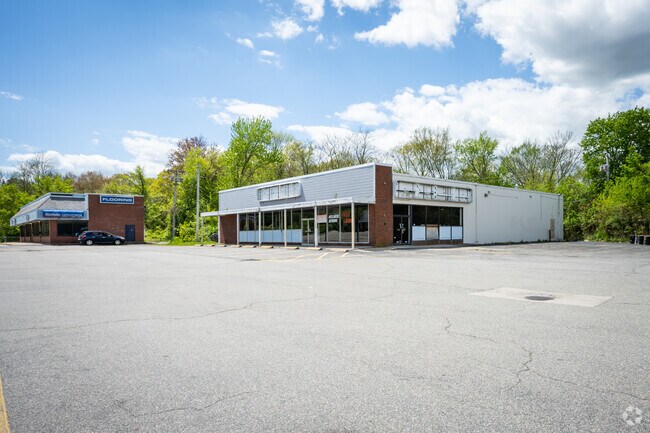
1177 Central Ave, Pawtucket, RI 02861

Property Detail
1177 Central Ave
PAWT-000013-000000-000293
Providence
Storebuilding
Rhode Island
CG
293
AE The base floodplain where base flood elevations are provided. AE Zones are now used on new format FIRMs instead of A1-A30 Zones.
0.98 AC
2025
Pawtucket
2025
Providence
015800
Providence-Warwick, RI-MA
8,200 SF
NEARBY LISTINGS FOR SALE OR LEASE
DEMOGRAPHICS near 1177 Central Ave
1 mile
3 mile
5 mile
2025 Total Population
13,728
96,756
223,057
2030 Population
14,067
98,837
228,642
Pop Growth 2025-2030
+ 2.47%
+ 2.15%
+ 2.50%
Average Age
42
40
40
2025 Total Households
5,555
38,556
90,490
HH Growth 2025-2030
+ 2.36%
+ 2.21%
+ 2.53%
Median Household Inc
$90,460
$73,082
$77,418
Avg Household Size
2.40
2.40
2.40
2025 Avg HH Vehicles
2.00
2.00
2.00
Median Home Value
$330,415
$356,374
$397,146
Median Year Built
1953
1955
1954
Nearby Places
Map Layers
Map Styles
 Street
 Aerial
Layers
 Traffic
 Biking
Places
Listings with unknown addresses are not visible on the map
- Restaurants
- Banks
- Shops
- Fitness
- Groceries
PUBLIC TRANSPORTATION
COMMUTER RAIL
South Attleboro (Providence/Stoughton Line - Massachusetts Bay Transportation Authority Commuter Rail (Purple Line))
Drive
Walk
Distance
South Attleboro (Providence/Stoughton Line - Massachusetts Bay Transportation Authority Commuter Rail (Purple Line))
5 min
1.6 mi
Drive
Walk
Distance
6 min
3.2 mi
AIRPORT
Rhode Island Tf Green International
Drive
Walk
Distance
Rhode Island Tf Green International
29 min
15.9 mi
Nearby Properties
Address
Land Use
TOTAL SIZE
Lot Size
Zoning
Address
Land Use
TOTAL SIZE
Lot Size
Zoning
79.57 AC
O1
Address
Land Use
TOTAL SIZE
Lot Size
Zoning
170,531 SF
3 AC
M-2
Address
Land Use
TOTAL SIZE
Lot Size
Zoning
28,208 SF
38.19 AC
PHB
Address
Land Use
TOTAL SIZE
Lot Size
Zoning
193.69 AC
PO
Address
Land Use
TOTAL SIZE
Lot Size
Zoning
168,150 SF
2.77 AC
PO
Address
Land Use
TOTAL SIZE
Lot Size
Zoning
21 AC
RM
Address
Land Use
TOTAL SIZE
Lot Size
Zoning
134,113 SF
0.74 AC
RM
Address
Land Use
TOTAL SIZE
Lot Size
Zoning
5,059 SF
217.41 AC
Address
Land Use
TOTAL SIZE
Lot Size
Zoning
312,784 SF
11.53 AC
MO
Address
Land Use
TOTAL SIZE
Lot Size
Zoning
14,841 SF
15.70 AC
PHB
Address
Land Use
TOTAL SIZE
Lot Size
Zoning
88,698 SF
1.44 AC
RM
Address
Land Use
TOTAL SIZE
Lot Size
Zoning
109,700 SF
3.73 AC
RT
Address
Land Use
TOTAL SIZE
Lot Size
Zoning
14.66 AC
CG
Address
Land Use
TOTAL SIZE
Lot Size
Zoning
10,920 SF
11.03 AC
Address
Land Use
TOTAL SIZE
Lot Size
Zoning
214,701 SF
3.14 AC
RE
Address
Land Use
TOTAL SIZE
Lot Size
Zoning
2.97 AC
MB
Address
Land Use
TOTAL SIZE
Lot Size
Zoning
6.89 AC
RS
Address
Land Use
TOTAL SIZE
Lot Size
Zoning
339,222 SF
32.67 AC
PA
Address
Land Use
TOTAL SIZE
Lot Size
Zoning
55,103 SF
2.98 AC
RT
Address
Land Use
TOTAL SIZE
Lot Size
Zoning
147,170 SF
2.23 AC
R-3
Address
Land Use
TOTAL SIZE
Lot Size
Zoning
15,086 SF
2.61 AC
C-2
Address
Land Use
TOTAL SIZE
Lot Size
Zoning
97,858 SF
2.02 AC
R-3
Address
Land Use
TOTAL SIZE
Lot Size
Zoning
98,968 SF
1.66 AC
R-2
Address
Land Use
TOTAL SIZE
Lot Size
Zoning
200,200 SF
11.64 AC
I1
Address
Land Use
TOTAL SIZE
Lot Size
Zoning
189,308 SF
19.76 AC
I
Address
Land Use
TOTAL SIZE
Lot Size
Zoning
85,626 SF
2.22 AC
RT
Address
Land Use
TOTAL SIZE
Lot Size
Zoning
155,731 SF
41.03 AC
PHB
Address
Land Use
TOTAL SIZE
Lot Size
Zoning
2.23 AC
RE
Address
Land Use
TOTAL SIZE
Lot Size
Zoning
69,053 SF
0.87 AC
C-2
Address
Land Use
TOTAL SIZE
Lot Size
Zoning
27,264 SF
6.20 AC
The World's #1 Commercial Real Estate Marketplace
Connect with us
© 2026 CoStar Group
The information above has been obtained from sources believed reliable. While we do not doubt its accuracy we have not verified it and make no guarantee, warranty or representation about it. It is your responsibility to independently confirm its accuracy and completeness. Any projections, opinions, assumptions, or estimates used are for example only and do not represent the current or future performance of the property. The value of this transaction to you depends on tax and other factors which should be evaluated by your tax, financial, and legal advisors. You and your advisors should conduct a careful, independent investigation of the property to determine to your satisfaction the suitability of the property for your needs.