Property Record
11795 Nw Cedar Falls Dr, Portland, OR 97229
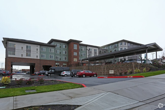


Property Detail
11795 Nw Cedar Falls Dr
R2191365
2015-019 PARTITION PLAT, LOT 1, ACRES 2.98
Commercialbuilding
WASHINGTON
TC-HDR
Oregon
B and X Area of moderate flood hazard, usually the area between the limits of the 100-year and 500-year floods.
1
2024
2.98 AC
2026
North Beaverton
030105
Portland
142,263 SF
Portland-Vancouver-Hillsboro, OR-WA
NEARBY LISTINGS FOR SALE OR LEASE
-
-
View all Portland listings for sale on LoopNet.com
DEMOGRAPHICS near 11795 Nw Cedar Falls Dr
1 mile
3 mile
5 mile
2025 Total Population
16,714
120,152
315,947
2030 Population
16,837
121,404
318,385
Pop Growth 2025-2030
+ 0.74%
+ 1.04%
+ 0.77%
Average Age
40
40
40
2025 Total Households
7,007
47,497
125,300
HH Growth 2025-2030
+ 0.80%
+ 1.16%
+ 0.81%
Median Household Inc
$108,190
$113,944
$106,970
Avg Household Size
2.40
2.50
2.50
2025 Avg HH Vehicles
2.00
2.00
2.00
Median Home Value
$667,084
$722,799
$682,881
Median Year Built
1983
1989
1986
Nearby Places
Map Layers
Map Styles
 Street
 Aerial
Transit
 Traffic
 Biking
Places
Listings with unknown addresses are not visible on the map
- Restaurants
- Banks
- Shops
- Fitness
- Groceries
Nearby Properties
Address
Land Use
TOTAL SIZE
Lot Size
Zoning
Address
Land Use
TOTAL SIZE
Lot Size
Zoning
0.05 AC
IND
Address
Land Use
TOTAL SIZE
Lot Size
Zoning
2,936,291 SF
72.49 AC
TO:EMP
Address
Land Use
TOTAL SIZE
Lot Size
Zoning
0.08 AC
IND
Address
Land Use
TOTAL SIZE
Lot Size
Zoning
58.68 AC
IND
Address
Land Use
TOTAL SIZE
Lot Size
Zoning
716,311 SF
75.07 AC
TO:EMP
Address
Land Use
TOTAL SIZE
Lot Size
Zoning
303,158 SF
18.18 AC
R10
Address
Land Use
TOTAL SIZE
Lot Size
Zoning
194.52 AC
R1
Address
Land Use
TOTAL SIZE
Lot Size
Zoning
1,031,421 SF
22.20 AC
SC-HDR
Address
Land Use
TOTAL SIZE
Lot Size
Zoning
461,858 SF
36.37 AC
CS
Address
Land Use
TOTAL SIZE
Lot Size
Zoning
704,877 SF
18.72 AC
OI-NC
Address
Land Use
TOTAL SIZE
Lot Size
Zoning
1,380,937 SF
36.42 AC
INST
Address
Land Use
TOTAL SIZE
Lot Size
Zoning
8,967 SF
13.12 AC
GC
Address
Land Use
TOTAL SIZE
Lot Size
Zoning
281,695 SF
7.41 AC
SC-HDR
Address
Land Use
TOTAL SIZE
Lot Size
Zoning
44.66 AC
IND
Address
Land Use
TOTAL SIZE
Lot Size
Zoning
359,574 SF
6.75 AC
R-9
Address
Land Use
TOTAL SIZE
Lot Size
Zoning
179,180 SF
36.77 AC
INST
Address
Land Use
TOTAL SIZE
Lot Size
Zoning
152,339 SF
28.70 AC
R1
Address
Land Use
TOTAL SIZE
Lot Size
Zoning
253,727 SF
38.06 AC
OI
Address
Land Use
TOTAL SIZE
Lot Size
Zoning
120,400 SF
16.28 AC
TC-HDR
Address
Land Use
TOTAL SIZE
Lot Size
Zoning
22.13 AC
R-15
Address
Land Use
TOTAL SIZE
Lot Size
Zoning
234,391 SF
0.13 AC
CS
Address
Land Use
TOTAL SIZE
Lot Size
Zoning
37.55 AC
IND
Address
Land Use
TOTAL SIZE
Lot Size
Zoning
372,200 SF
34.75 AC
CS
Address
Land Use
TOTAL SIZE
Lot Size
Zoning
214,045 SF
21.70 AC
R2
Address
Land Use
TOTAL SIZE
Lot Size
Zoning
210,649 SF
15.51 AC
R-15
Address
Land Use
TOTAL SIZE
Lot Size
Zoning
18.15 AC
SC-E
Address
Land Use
TOTAL SIZE
Lot Size
Zoning
155,788 SF
16.84 AC
R-6
Address
Land Use
TOTAL SIZE
Lot Size
Zoning
270,237 SF
22.44 AC
R-15
Address
Land Use
TOTAL SIZE
Lot Size
Zoning
62,693 SF
16.43 AC
CC
Address
Land Use
TOTAL SIZE
Lot Size
Zoning
431,653 SF
10.76 AC
R1
The World's #1 Commercial Real Estate Marketplace
Connect with us
© 2026 CoStar Group
The information above has been obtained from sources believed reliable. While we do not doubt its accuracy we have not verified it and make no guarantee, warranty or representation about it. It is your responsibility to independently confirm its accuracy and completeness. Any projections, opinions, assumptions, or estimates used are for example only and do not represent the current or future performance of the property. The value of this transaction to you depends on tax and other factors which should be evaluated by your tax, financial, and legal advisors. You and your advisors should conduct a careful, independent investigation of the property to determine to your satisfaction the suitability of the property for your needs.