Property Record
118 3Rd St, Underwood, IA 51576


Save to a Folder
{{folder.Name}}
{{folder.ListingIds.length}} Properties
{{folder.ListingIds.length}} Property
Create a New Folder
Property Detail
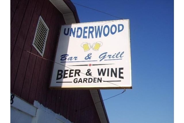
118 3Rd St
Omaha, NE-IA
UNDERWOOD TOWN-ORIG PLAT LTS 13 & 14 BLK 6
7642-16-212-009
POTTAWATTAMIE
Restaurantbuilding
Iowa
B and X Area of moderate flood hazard, usually the area between the limits of the 100-year and 500-year floods.
14
2025
0.16 AC
2025
W Pottawattamie County
021603
Omaha/Council Bluffs
2,484 SF
NEARBY LISTINGS FOR SALE OR LEASE
-
-
View all Underwood listings for sale on LoopNet.com
DEMOGRAPHICS near 118 3Rd St
1 mile
3 mile
5 mile
2025 Total Population
1,052
1,442
2,376
2030 Population
1,061
1,452
2,376
Pop Growth 2025-2030
+ 0.86%
+ 0.69%
0.00%
Average Age
38
39
40
2025 Total Households
383
527
878
HH Growth 2025-2030
+ 0.78%
+ 0.57%
(0.11%)
Median Household Inc
$99,492
$101,420
$110,369
Avg Household Size
2.70
2.70
2.70
2025 Avg HH Vehicles
2.00
2.00
3.00
Median Home Value
$251,456
$256,204
$288,324
Median Year Built
1975
1975
1976
Nearby Places
Map Layers
Map Styles
 Street
 Aerial
Layers
 Traffic
 Biking
Places
Listings with unknown addresses are not visible on the map
- Restaurants
- Banks
- Shops
- Fitness
- Groceries
PUBLIC TRANSPORTATION
AIRPORT
Eppley Airfield
Drive
Walk
Distance
Eppley Airfield
36 min
24.8 mi
Freight Ports
Tulsa Port Of Catoosa
Drive
Walk
Distance
Tulsa Port Of Catoosa
470 min
427.2 mi
SALE & LEASE HISTORY
LISTING DATE
SALE/LEASE

May 07, 2018
For Sale
Mar 23, 2017
For Sale
Jul 26, 2018
For Sale
Apr 09, 2019
For Sale
Nearby Properties
Address
Land Use
TOTAL SIZE
Lot Size
Zoning
Address
Land Use
TOTAL SIZE
Lot Size
Zoning
385,000 SF
161.03 AC
Address
Land Use
TOTAL SIZE
Lot Size
Zoning
18.14 AC
Address
Land Use
TOTAL SIZE
Lot Size
Zoning
12.48 AC
I-1
Address
Land Use
TOTAL SIZE
Lot Size
Zoning
2,000 SF
8.87 AC
Address
Land Use
TOTAL SIZE
Lot Size
Zoning
3,769 SF
3.50 AC
Address
Land Use
TOTAL SIZE
Lot Size
Zoning
6.96 AC
Address
Land Use
TOTAL SIZE
Lot Size
Zoning
0.92 AC
Address
Land Use
TOTAL SIZE
Lot Size
Zoning
0.81 AC
Address
Land Use
TOTAL SIZE
Lot Size
Zoning
1.37 AC
Address
Land Use
TOTAL SIZE
Lot Size
Zoning
9,600 SF
0.73 AC
Address
Land Use
TOTAL SIZE
Lot Size
Zoning
7,500 SF
3 AC
I-1
Address
Land Use
TOTAL SIZE
Lot Size
Zoning
3.76 AC
R-1
Address
Land Use
TOTAL SIZE
Lot Size
Zoning
8.20 AC
R-2
Address
Land Use
TOTAL SIZE
Lot Size
Zoning
0.61 AC
Address
Land Use
TOTAL SIZE
Lot Size
Zoning
6,300 SF
1.67 AC
Address
Land Use
TOTAL SIZE
Lot Size
Zoning
7,152 SF
1.26 AC
Address
Land Use
TOTAL SIZE
Lot Size
Zoning
0.47 AC
Address
Land Use
TOTAL SIZE
Lot Size
Zoning
3,750 SF
0.68 AC
Address
Land Use
TOTAL SIZE
Lot Size
Zoning
3,600 SF
0.47 AC
Address
Land Use
TOTAL SIZE
Lot Size
Zoning
3.40 AC
R-1
Address
Land Use
TOTAL SIZE
Lot Size
Zoning
1,800 SF
1.25 AC
Address
Land Use
TOTAL SIZE
Lot Size
Zoning
1,920 SF
0.40 AC
Address
Land Use
TOTAL SIZE
Lot Size
Zoning
0.16 AC
Address
Land Use
TOTAL SIZE
Lot Size
Zoning
1,600 SF
38 AC
R-1
Address
Land Use
TOTAL SIZE
Lot Size
Zoning
4,426 SF
0.82 AC
Address
Land Use
TOTAL SIZE
Lot Size
Zoning
0.57 AC
Address
Land Use
TOTAL SIZE
Lot Size
Zoning
3,136 SF
0.30 AC
Address
Land Use
TOTAL SIZE
Lot Size
Zoning
Address
Land Use
TOTAL SIZE
Lot Size
Zoning
0.47 AC
The World's #1 Commercial Real Estate Marketplace
Connect with us
© 2026 CoStar Group
The information above has been obtained from sources believed reliable. While we do not doubt its accuracy we have not verified it and make no guarantee, warranty or representation about it. It is your responsibility to independently confirm its accuracy and completeness. Any projections, opinions, assumptions, or estimates used are for example only and do not represent the current or future performance of the property. The value of this transaction to you depends on tax and other factors which should be evaluated by your tax, financial, and legal advisors. You and your advisors should conduct a careful, independent investigation of the property to determine to your satisfaction the suitability of the property for your needs.