Property Record
118 5Th St E, Northfield, MN 55057
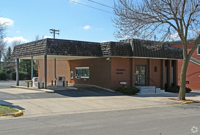


Property Detail
118 5Th St E
Faribault-Northfield, MN
LOT 1 BLOCK 1 OF FIFTH STREET LOFTS
22.06.2.30.001
Rice
Apartment
Minnesota
B and X Area of moderate flood hazard, usually the area between the limits of the 100-year and 500-year floods.
1
2026
0.75 AC
2026
Minnesota South Area
070501
Other Market Areas
19,129 SF
NEARBY LISTINGS FOR SALE OR LEASE
DEMOGRAPHICS near 118 5Th St E
1 mile
3 mile
5 mile
2025 Total Population
11,634
24,383
26,201
2030 Population
11,822
24,901
26,767
Pop Growth 2025-2030
+ 1.62%
+ 2.12%
+ 2.16%
Average Age
35
38
38
2025 Total Households
3,160
7,909
8,561
HH Growth 2025-2030
+ 1.80%
+ 2.41%
+ 2.45%
Median Household Inc
$85,668
$92,915
$94,739
Avg Household Size
2.30
2.40
2.40
2025 Avg HH Vehicles
2.00
2.00
2.00
Median Home Value
$296,973
$330,007
$337,984
Median Year Built
1963
1982
1983
Nearby Places
Map Layers
Map Styles
 Street
 Aerial
Layers
 Traffic
 Biking
Places
Listings with unknown addresses are not visible on the map
- Restaurants
- Banks
- Shops
- Fitness
- Groceries
PUBLIC TRANSPORTATION
AIRPORT
Minneapolis-St Paul International/Wold-Chamberlain
Drive
Walk
Distance
Minneapolis-St Paul International/Wold-Chamberlain
50 min
39.5 mi
Freight Ports
Port Milwaukee
Drive
Walk
Distance
Port Milwaukee
373 min
330.8 mi
Nearby Properties
Address
Land Use
TOTAL SIZE
Lot Size
Zoning
Address
Land Use
TOTAL SIZE
Lot Size
Zoning
15,356 SF
3.05 AC
Address
Land Use
TOTAL SIZE
Lot Size
Zoning
15,169 SF
8.60 AC
Address
Land Use
TOTAL SIZE
Lot Size
Zoning
66,106 SF
14.60 AC
Address
Land Use
TOTAL SIZE
Lot Size
Zoning
79,085 SF
61.10 AC
Address
Land Use
TOTAL SIZE
Lot Size
Zoning
7,561 SF
1.86 AC
Address
Land Use
TOTAL SIZE
Lot Size
Zoning
180,663 SF
36 AC
Address
Land Use
TOTAL SIZE
Lot Size
Zoning
76,608 SF
30.10 AC
Address
Land Use
TOTAL SIZE
Lot Size
Zoning
169,869 SF
31.01 AC
Address
Land Use
TOTAL SIZE
Lot Size
Zoning
104,445 SF
27.13 AC
Address
Land Use
TOTAL SIZE
Lot Size
Zoning
3,499 SF
13.50 AC
Address
Land Use
TOTAL SIZE
Lot Size
Zoning
3,080 SF
41.80 AC
Address
Land Use
TOTAL SIZE
Lot Size
Zoning
34,758 SF
2.98 AC
Address
Land Use
TOTAL SIZE
Lot Size
Zoning
58,080 SF
16.90 AC
Address
Land Use
TOTAL SIZE
Lot Size
Zoning
2,772 SF
3.20 AC
Address
Land Use
TOTAL SIZE
Lot Size
Zoning
31,200 SF
15.50 AC
Address
Land Use
TOTAL SIZE
Lot Size
Zoning
25,105 SF
6.70 AC
Address
Land Use
TOTAL SIZE
Lot Size
Zoning
11,856 SF
10.80 AC
Address
Land Use
TOTAL SIZE
Lot Size
Zoning
5,187 SF
3.76 AC
Address
Land Use
TOTAL SIZE
Lot Size
Zoning
12,617 SF
2 AC
Address
Land Use
TOTAL SIZE
Lot Size
Zoning
95,400 SF
15.20 AC
Address
Land Use
TOTAL SIZE
Lot Size
Zoning
161,640 SF
15.13 AC
Address
Land Use
TOTAL SIZE
Lot Size
Zoning
9,642 SF
5.30 AC
Address
Land Use
TOTAL SIZE
Lot Size
Zoning
6,000 SF
3.11 AC
Address
Land Use
TOTAL SIZE
Lot Size
Zoning
9,065 SF
5.10 AC
Address
Land Use
TOTAL SIZE
Lot Size
Zoning
4,400 SF
2.50 AC
Address
Land Use
TOTAL SIZE
Lot Size
Zoning
9,600 SF
24.60 AC
Address
Land Use
TOTAL SIZE
Lot Size
Zoning
126,240 SF
12.18 AC
Address
Land Use
TOTAL SIZE
Lot Size
Zoning
46,448 SF
6.50 AC
Address
Land Use
TOTAL SIZE
Lot Size
Zoning
1,788 SF
4.80 AC
The World's #1 Commercial Real Estate Marketplace
Connect with us
© 2026 CoStar Group
The information above has been obtained from sources believed reliable. While we do not doubt its accuracy we have not verified it and make no guarantee, warranty or representation about it. It is your responsibility to independently confirm its accuracy and completeness. Any projections, opinions, assumptions, or estimates used are for example only and do not represent the current or future performance of the property. The value of this transaction to you depends on tax and other factors which should be evaluated by your tax, financial, and legal advisors. You and your advisors should conduct a careful, independent investigation of the property to determine to your satisfaction the suitability of the property for your needs.