Property Record
118 Broad St, Bloomfield, NJ 07003
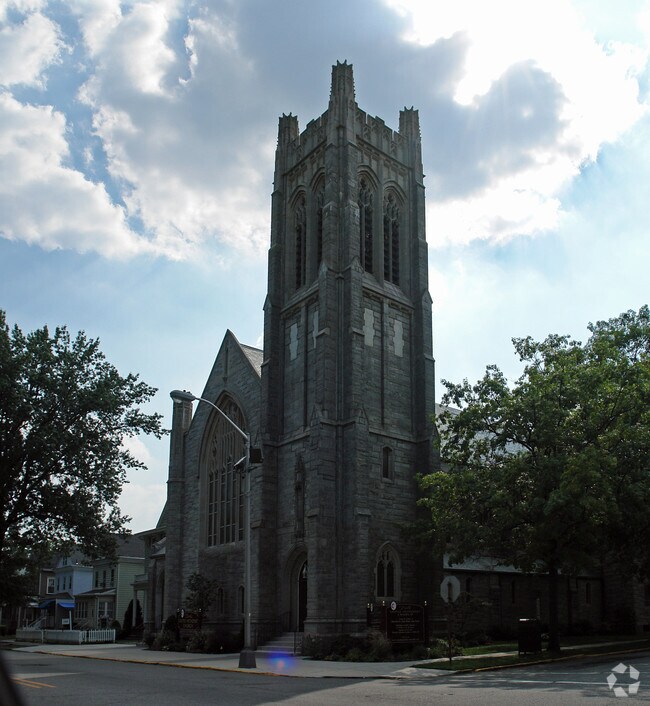

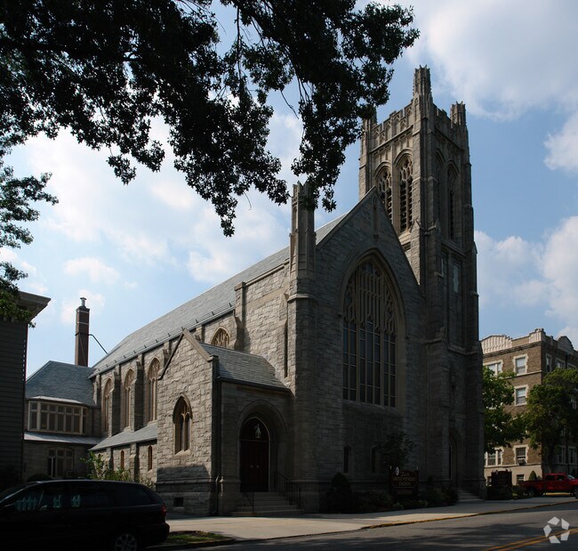
Property Detail
118 Broad St
Newark, NJ
87 X 206 CHURCH
02-00245-0000-00018
ESSEX
Religious
New Jersey
POR
18
B and X Area of moderate flood hazard, usually the area between the limits of the 100-year and 500-year floods.
0.41 AC
0
Bloomfield/GSP
2025
Northern New Jersey
015200
NEARBY LISTINGS FOR SALE OR LEASE
DEMOGRAPHICS near 118 Broad St
1 mile
3 mile
5 mile
2025 Total Population
33,708
325,961
746,187
2030 Population
35,046
338,821
773,989
Pop Growth 2025-2030
+ 3.97%
+ 3.95%
+ 3.73%
Average Age
39
39
39
2025 Total Households
13,728
124,852
278,808
HH Growth 2025-2030
+ 4.15%
+ 4.18%
+ 4.03%
Median Household Inc
$100,913
$81,525
$82,696
Avg Household Size
2.40
2.50
2.60
2025 Avg HH Vehicles
1.00
1.00
1.00
Median Home Value
$512,723
$461,596
$482,188
Median Year Built
1949
1954
1956
Nearby Places
Map Layers
Map Styles
 Street
 Aerial
Transit
 Traffic
 Biking
Places
Listings with unknown addresses are not visible on the map
- Restaurants
- Banks
- Shops
- Fitness
- Groceries
PUBLIC TRANSPORTATION
COMMUTER RAIL
Glen Ridge (Montclair-Boonton Line - NJ Transit Commuter Rail (NJ Transit))
Drive
Walk
Distance
Glen Ridge (Montclair-Boonton Line - NJ Transit Commuter Rail (NJ Transit))
1 min
9 min
0.5 mi
Bloomfield (Montclair-Boonton Line - NJ Transit Commuter Rail (NJ Transit))
Drive
Walk
Distance
Bloomfield (Montclair-Boonton Line - NJ Transit Commuter Rail (NJ Transit))
1 min
11 min
0.5 mi
AIRPORT
Newark Liberty International
Drive
Walk
Distance
Newark Liberty International
17 min
10.2 mi
LaGuardia
Drive
Walk
Distance
LaGuardia
43 min
25.3 mi
John F Kennedy International
Drive
Walk
Distance
John F Kennedy International
52 min
33.3 mi
Freight Ports
Port Newark Container Terminal
Drive
Walk
Distance
Port Newark Container Terminal
20 min
10.0 mi
Nearby Properties
Address
Land Use
TOTAL SIZE
Lot Size
Zoning
Address
Land Use
TOTAL SIZE
Lot Size
Zoning
5 AC
H
Address
Land Use
TOTAL SIZE
Lot Size
Zoning
17.97 AC
Address
Land Use
TOTAL SIZE
Lot Size
Zoning
Address
Land Use
TOTAL SIZE
Lot Size
Zoning
16,084 SF
7.23 AC
Address
Land Use
TOTAL SIZE
Lot Size
Zoning
1,589 SF
0.22 AC
R4
Address
Land Use
TOTAL SIZE
Lot Size
Zoning
12.54 AC
OPRP
Address
Land Use
TOTAL SIZE
Lot Size
Zoning
3.31 AC
Address
Land Use
TOTAL SIZE
Lot Size
Zoning
0.24 AC
R4
Address
Land Use
TOTAL SIZE
Lot Size
Zoning
2.64 AC
Address
Land Use
TOTAL SIZE
Lot Size
Zoning
4.92 AC
Address
Land Use
TOTAL SIZE
Lot Size
Zoning
11.49 AC
M-1
Address
Land Use
TOTAL SIZE
Lot Size
Zoning
298,272 SF
31.36 AC
P-6
Address
Land Use
TOTAL SIZE
Lot Size
Zoning
306,414 SF
4.62 AC
Address
Land Use
TOTAL SIZE
Lot Size
Zoning
3.26 AC
PR
Address
Land Use
TOTAL SIZE
Lot Size
Zoning
0.17 AC
BCR1
Address
Land Use
TOTAL SIZE
Lot Size
Zoning
2.22 AC
OB-2
Address
Land Use
TOTAL SIZE
Lot Size
Zoning
1.67 AC
BCR1
Address
Land Use
TOTAL SIZE
Lot Size
Zoning
3.20 AC
BSRD
Address
Land Use
TOTAL SIZE
Lot Size
Zoning
224 SF
0.94 AC
BCR1
Address
Land Use
TOTAL SIZE
Lot Size
Zoning
1.50 AC
RA
Address
Land Use
TOTAL SIZE
Lot Size
Zoning
1.95 AC
RA
Address
Land Use
TOTAL SIZE
Lot Size
Zoning
3.64 AC
R-M
Address
Land Use
TOTAL SIZE
Lot Size
Zoning
11,296 SF
17.50 AC
R-G
Address
Land Use
TOTAL SIZE
Lot Size
Zoning
9.98 AC
R-1
Address
Land Use
TOTAL SIZE
Lot Size
Zoning
364.34 AC
R-1
Address
Land Use
TOTAL SIZE
Lot Size
Zoning
3.04 AC
Address
Land Use
TOTAL SIZE
Lot Size
Zoning
228,736 SF
48.25 AC
Address
Land Use
TOTAL SIZE
Lot Size
Zoning
10.40 AC
Address
Land Use
TOTAL SIZE
Lot Size
Zoning
5,527 SF
8.47 AC
Address
Land Use
TOTAL SIZE
Lot Size
Zoning
17.90 AC
R-G
The World's #1 Commercial Real Estate Marketplace
Connect with us
© 2026 CoStar Group
The information above has been obtained from sources believed reliable. While we do not doubt its accuracy we have not verified it and make no guarantee, warranty or representation about it. It is your responsibility to independently confirm its accuracy and completeness. Any projections, opinions, assumptions, or estimates used are for example only and do not represent the current or future performance of the property. The value of this transaction to you depends on tax and other factors which should be evaluated by your tax, financial, and legal advisors. You and your advisors should conduct a careful, independent investigation of the property to determine to your satisfaction the suitability of the property for your needs.