Property Record
118 Broad St, Plainville, CT 06062
NEARBY LISTINGS FOR SALE OR LEASE
-
-
View all Plainville listings for sale on LoopNet.com
Property Detail
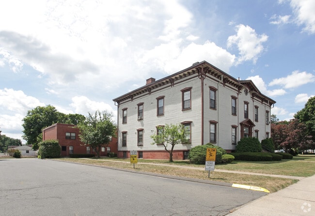
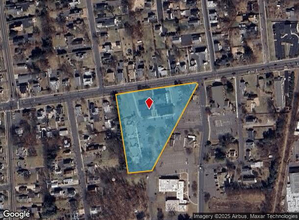
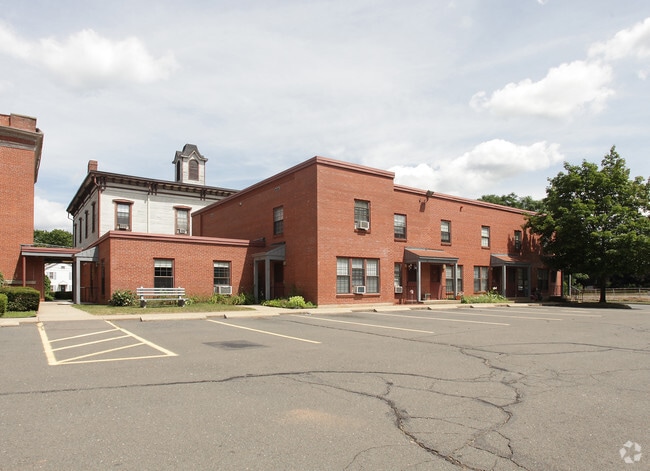
118 Broad St
Hartford-West Hartford-East Hartford, CT
Sheltered Ponds
PLAI-000028-K000000-000004
Hartford
Apartmenthouse5plusunits
Connecticut
X
4
09003C0486G
3.40 AC
2025
Bristol/Plainville
2025
Hartford
420500
DEMOGRAPHICS near 118 Broad St
1 mile
3 mile
5 mile
2024 Total Population
9,035
49,849
153,607
2029 Population
8,979
49,786
153,108
Pop Growth 2024-2029
(0.62%)
(0.13%)
(0.32%)
Average Age
43
43
41
2024 Total Households
4,141
21,854
63,940
HH Growth 2024-2029
(0.65%)
(0.16%)
(0.33%)
Median Household Inc
$66,057
$73,617
$69,498
Avg Household Size
2.10
2.20
2.30
2024 Avg HH Vehicles
2.00
2.00
2.00
Median Home Value
$227,401
$230,711
$243,407
Median Year Built
1965
1970
1964
Nearby Places
Map Layers
Map Styles
 Street
 Aerial
Transit
 Traffic
 Biking
Places
Listings with unknown addresses are not visible on the map
- Restaurants
- Banks
- Shops
- Fitness
- Groceries
PUBLIC TRANSPORTATION
COMMUTER RAIL
Drive
Walk
Distance
14 min
7.4 mi
Drive
Walk
Distance
14 min
7.4 mi
AIRPORT
Bradley International
Drive
Walk
Distance
Bradley International
46 min
29.7 mi
Tweed/New Haven
Drive
Walk
Distance
Tweed/New Haven
47 min
30.6 mi
Freight Ports
Port of New Haven
Drive
Walk
Distance
Port of New Haven
42 min
28.0 mi
Nearby Properties
Address
Land Use
TOTAL SIZE
Lot Size
Zoning
Address
Land Use
TOTAL SIZE
Lot Size
Zoning
268,369 SF
13.32 AC
B1
Address
Land Use
TOTAL SIZE
Lot Size
Zoning
77,001 SF
54.59 AC
IP-1
Address
Land Use
TOTAL SIZE
Lot Size
Zoning
100,304 SF
28.80 AC
IP-1
Address
Land Use
TOTAL SIZE
Lot Size
Zoning
134,488 SF
63.26 AC
GC
Address
Land Use
TOTAL SIZE
Lot Size
Zoning
64,822 SF
9.47 AC
TP
Address
Land Use
TOTAL SIZE
Lot Size
Zoning
58,473 SF
18.20 AC
IP-1
Address
Land Use
TOTAL SIZE
Lot Size
Zoning
145,719 SF
17.90 AC
R-15
Address
Land Use
TOTAL SIZE
Lot Size
Zoning
114,375 SF
12.72 AC
IP-1
Address
Land Use
TOTAL SIZE
Lot Size
Zoning
330,400 SF
36.90 AC
IP-1
Address
Land Use
TOTAL SIZE
Lot Size
Zoning
182,930 SF
15.70 AC
SA
Address
Land Use
TOTAL SIZE
Lot Size
Zoning
28.47 AC
R-10
Address
Land Use
TOTAL SIZE
Lot Size
Zoning
48.09 AC
CR
Address
Land Use
TOTAL SIZE
Lot Size
Zoning
288,827 SF
24.01 AC
RI
Address
Land Use
TOTAL SIZE
Lot Size
Zoning
103,886 SF
10.47 AC
BR
Address
Land Use
TOTAL SIZE
Lot Size
Zoning
199,744 SF
44.70 AC
R-15
Address
Land Use
TOTAL SIZE
Lot Size
Zoning
54,904 SF
7.01 AC
A
Address
Land Use
TOTAL SIZE
Lot Size
Zoning
502,440 SF
27.87 AC
I-2
Address
Land Use
TOTAL SIZE
Lot Size
Zoning
17.62 AC
B
Address
Land Use
TOTAL SIZE
Lot Size
Zoning
29.05 AC
R-20
Address
Land Use
TOTAL SIZE
Lot Size
Zoning
149,912 SF
13.66 AC
B
Address
Land Use
TOTAL SIZE
Lot Size
Zoning
143,315 SF
4.50 AC
A
Address
Land Use
TOTAL SIZE
Lot Size
Zoning
3,084 SF
14.90 AC
BG
Address
Land Use
TOTAL SIZE
Lot Size
Zoning
133,720 SF
7.34 AC
IP-1
Address
Land Use
TOTAL SIZE
Lot Size
Zoning
19 AC
GI
Address
Land Use
TOTAL SIZE
Lot Size
Zoning
42,516 SF
10.40 AC
BG
Address
Land Use
TOTAL SIZE
Lot Size
Zoning
168,296 SF
17.94 AC
C1
Address
Land Use
TOTAL SIZE
Lot Size
Zoning
41,011 SF
8.50 AC
BG
Address
Land Use
TOTAL SIZE
Lot Size
Zoning
118,573 SF
9.75 AC
BG
Address
Land Use
TOTAL SIZE
Lot Size
Zoning
99,576 SF
6.22 AC
CR
Address
Land Use
TOTAL SIZE
Lot Size
Zoning
147,132 SF
12.50 AC
BG
The World's #1 Commercial Real Estate Marketplace
Connect with us
© 2026 CoStar Group
The information above has been obtained from sources believed reliable. While we do not doubt its accuracy we have not verified it and make no guarantee, warranty or representation about it. It is your responsibility to independently confirm its accuracy and completeness. Any projections, opinions, assumptions, or estimates used are for example only and do not represent the current or future performance of the property. The value of this transaction to you depends on tax and other factors which should be evaluated by your tax, financial, and legal advisors. You and your advisors should conduct a careful, independent investigation of the property to determine to your satisfaction the suitability of the property for your needs.