Property Record
118 E Main St, Plainfield, IN 46168


Property Detail
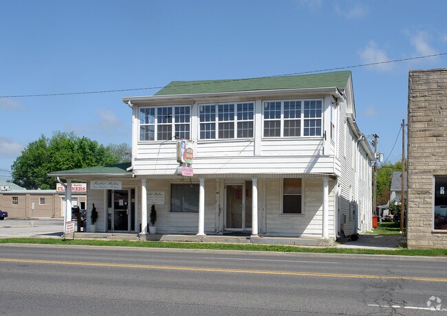
118 E Main St
Indianapolis-Carmel-Greenwood, IN
ORIG TOWN OF PLAINFIELD BLK 1 LOT 7 0.1512AC LOT SIZE 56 X 132 = 0.1512AC SEE ALSO 230-008 DBA:
32-10-34-230-007.000-012
Hendricks
Apartment
Indiana
B and X Area of moderate flood hazard, usually the area between the limits of the 100-year and 500-year floods.
7
2025
0.15 AC
2025
Hendricks County
210900
Indianapolis
5,396 SF
NEARBY LISTINGS FOR SALE OR LEASE
DEMOGRAPHICS near 118 E Main St
1 mile
3 mile
5 mile
2025 Total Population
7,007
47,196
75,722
2030 Population
7,502
50,690
80,920
Pop Growth 2025-2030
+ 7.06%
+ 7.40%
+ 6.86%
Average Age
41
40
40
2025 Total Households
3,055
17,375
27,875
HH Growth 2025-2030
+ 7.40%
+ 7.82%
+ 7.23%
Median Household Inc
$65,981
$89,633
$90,406
Avg Household Size
2.20
2.50
2.60
2025 Avg HH Vehicles
2.00
2.00
2.00
Median Home Value
$246,588
$292,689
$295,296
Median Year Built
1966
1996
1997
Nearby Places
Map Layers
Map Styles
 Street
 Aerial
Layers
 Traffic
 Biking
Places
Listings with unknown addresses are not visible on the map
- Restaurants
- Banks
- Shops
- Fitness
- Groceries
PUBLIC TRANSPORTATION
AIRPORT
Indianapolis International
Drive
Walk
Distance
Indianapolis International
18 min
8.7 mi
SALE & LEASE HISTORY
LISTING DATE
SALE/LEASE

Sep 23, 2021
For Lease
Nearby Properties
Address
Land Use
TOTAL SIZE
Lot Size
Zoning
Address
Land Use
TOTAL SIZE
Lot Size
Zoning
796,988 SF
48.51 AC
Address
Land Use
TOTAL SIZE
Lot Size
Zoning
Address
Land Use
TOTAL SIZE
Lot Size
Zoning
923,980 SF
60.08 AC
Address
Land Use
TOTAL SIZE
Lot Size
Zoning
9,728 SF
23.10 AC
Address
Land Use
TOTAL SIZE
Lot Size
Zoning
799,264 SF
43.44 AC
Address
Land Use
TOTAL SIZE
Lot Size
Zoning
750,820 SF
64.15 AC
Address
Land Use
TOTAL SIZE
Lot Size
Zoning
37.04 AC
Address
Land Use
TOTAL SIZE
Lot Size
Zoning
720,000 SF
39.03 AC
Address
Land Use
TOTAL SIZE
Lot Size
Zoning
5,064 SF
25.50 AC
Address
Land Use
TOTAL SIZE
Lot Size
Zoning
51,884 SF
14.73 AC
Address
Land Use
TOTAL SIZE
Lot Size
Zoning
24.62 AC
Address
Land Use
TOTAL SIZE
Lot Size
Zoning
651,610 SF
63.52 AC
Address
Land Use
TOTAL SIZE
Lot Size
Zoning
650,960 SF
31.95 AC
Address
Land Use
TOTAL SIZE
Lot Size
Zoning
635,585 SF
28.37 AC
Address
Land Use
TOTAL SIZE
Lot Size
Zoning
10,953 SF
18.52 AC
Address
Land Use
TOTAL SIZE
Lot Size
Zoning
551,424 SF
31.39 AC
Address
Land Use
TOTAL SIZE
Lot Size
Zoning
518,536 SF
25.66 AC
Address
Land Use
TOTAL SIZE
Lot Size
Zoning
599,744 SF
34.65 AC
Address
Land Use
TOTAL SIZE
Lot Size
Zoning
4,514 SF
18.08 AC
Address
Land Use
TOTAL SIZE
Lot Size
Zoning
3,443 SF
15.82 AC
Address
Land Use
TOTAL SIZE
Lot Size
Zoning
426,088 SF
23.11 AC
Address
Land Use
TOTAL SIZE
Lot Size
Zoning
500,000 SF
28.58 AC
Address
Land Use
TOTAL SIZE
Lot Size
Zoning
357,000 SF
27.34 AC
Address
Land Use
TOTAL SIZE
Lot Size
Zoning
476,720 SF
28.97 AC
Address
Land Use
TOTAL SIZE
Lot Size
Zoning
475,277 SF
29.61 AC
Address
Land Use
TOTAL SIZE
Lot Size
Zoning
448,625 SF
23.82 AC
Address
Land Use
TOTAL SIZE
Lot Size
Zoning
454,260 SF
29.55 AC
Address
Land Use
TOTAL SIZE
Lot Size
Zoning
371,601 SF
20.96 AC
Address
Land Use
TOTAL SIZE
Lot Size
Zoning
445,166 SF
24 AC
Address
Land Use
TOTAL SIZE
Lot Size
Zoning
401,751 SF
24.05 AC
The World's #1 Commercial Real Estate Marketplace
Connect with us
© 2026 CoStar Group
The information above has been obtained from sources believed reliable. While we do not doubt its accuracy we have not verified it and make no guarantee, warranty or representation about it. It is your responsibility to independently confirm its accuracy and completeness. Any projections, opinions, assumptions, or estimates used are for example only and do not represent the current or future performance of the property. The value of this transaction to you depends on tax and other factors which should be evaluated by your tax, financial, and legal advisors. You and your advisors should conduct a careful, independent investigation of the property to determine to your satisfaction the suitability of the property for your needs.