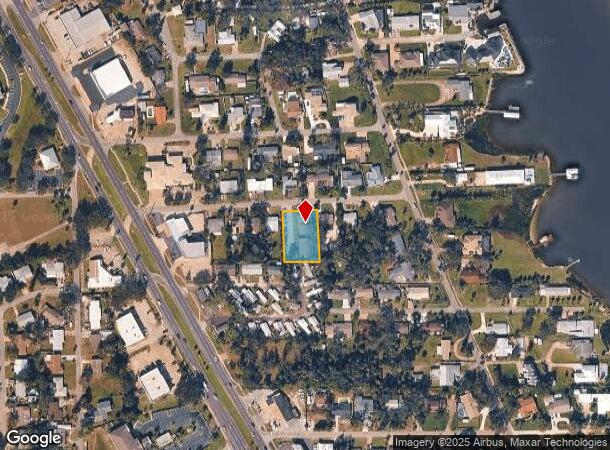
Property Record
118 Hardin Pl, Edgewater, FL 32132

NEARBY LISTINGS FOR SALE OR LEASE
-
-
View all Edgewater listings for sale on LoopNet.com
Property Detail
118 Hardin Pl
Deltona-Daytona Beach-Ormond Beach, FL
Hardin Sub Mb
8402-33-00-0070
02-18-34 LOTS 7 & 8 HARDIN SUB MB 8 PG 257 PER OR 4914 PG 3286 PER OR 6793 PG 1415 PER OR 7542 PG 2758 PER OR 8742 PG 4096
Multifamilydwelling
Volusia
X
Florida
12127C0685J
7,8
2025
0.50 AC
2025
Outer SE Volusia County
083008
Deltona/Daytona Beach
8,312 SF
DEMOGRAPHICS near 118 Hardin Pl
1 Mile
3 Mile
5 Mile
2024 Total Population
5,126
35,683
58,722
2029 Population
5,515
39,212
64,608
Pop Growth 2024-2029
+ 7.59%
+ 9.89%
+ 10.02%
Average Age
49
50
51
2024 Total Households
2,409
16,015
27,173
HH Growth 2024-2029
+ 7.47%
+ 10.37%
+ 10.37%
Median Household Inc
$54,427
$63,709
$67,436
Avg Household Size
2.10
2.10
2.10
2024 Avg HH Vehicles
2.00
2.00
2.00
Median Home Value
$289,021
$352,761
$369,969
Median Year Built
1982
1985
1986
Nearby Places
Map Layers
Map Styles
 Street
 Aerial
- Restaurants
- Banks
- Shops
- Fitness
- Groceries
PUBLIC TRANSPORTATION
AIRPORT
Daytona Beach International
DRIVE
WALK
Distance
Daytona Beach International
32 min
23.4 mi
Orlando Sanford International
DRIVE
WALK
Distance
Orlando Sanford International
53 min
37.2 mi
Freight Ports
Port Canaveral
DRIVE
WALK
Distance
Port Canaveral
68 min
56.1 mi
Nearby Properties
Address
Land Use
TOTAL SIZE
Lot Size
Zoning
Address
Land Use
TOTAL SIZE
Lot Size
Zoning
360,394 SF
65.63 AC
01R4
Address
Land Use
TOTAL SIZE
Lot Size
Zoning
209,027 SF
29.13 AC
10R2A
Address
Land Use
TOTAL SIZE
Lot Size
Zoning
68,493 SF
1.89 AC
10B6
Address
Land Use
TOTAL SIZE
Lot Size
Zoning
107,718 SF
24.20 AC
R3
Address
Land Use
TOTAL SIZE
Lot Size
Zoning
5,249 SF
0.42 AC
01MH5
Address
Land Use
TOTAL SIZE
Lot Size
Zoning
94,251 SF
18.51 AC
Address
Land Use
TOTAL SIZE
Lot Size
Zoning
111,686 SF
10.03 AC
10B5
Address
Land Use
TOTAL SIZE
Lot Size
Zoning
55,587 SF
85.39 AC
R4
Address
Land Use
TOTAL SIZE
Lot Size
Zoning
229,941 SF
0.57 AC
10R2A
Address
Land Use
TOTAL SIZE
Lot Size
Zoning
2,628 SF
3.04 AC
Address
Land Use
TOTAL SIZE
Lot Size
Zoning
98,105 SF
8.03 AC
07B3
Address
Land Use
TOTAL SIZE
Lot Size
Zoning
64,123 SF
6.94 AC
07B5
Address
Land Use
TOTAL SIZE
Lot Size
Zoning
108,762 SF
11.60 AC
RA
Address
Land Use
TOTAL SIZE
Lot Size
Zoning
79,634 SF
9.29 AC
07B5
Address
Land Use
TOTAL SIZE
Lot Size
Zoning
73,711 SF
7.06 AC
R2
Address
Land Use
TOTAL SIZE
Lot Size
Zoning
89,757 SF
12.19 AC
07B5
Address
Land Use
TOTAL SIZE
Lot Size
Zoning
11,516 SF
3.67 AC
10R5
Address
Land Use
TOTAL SIZE
Lot Size
Zoning
53,729 SF
12.70 AC
10R1
Address
Land Use
TOTAL SIZE
Lot Size
Zoning
96,923 SF
10 AC
BPUDW
Address
Land Use
TOTAL SIZE
Lot Size
Zoning
71,824 SF
2.01 AC
10R5
Address
Land Use
TOTAL SIZE
Lot Size
Zoning
31,765 SF
27.25 AC
Address
Land Use
TOTAL SIZE
Lot Size
Zoning
73,473 SF
6.66 AC
B5
Address
Land Use
TOTAL SIZE
Lot Size
Zoning
86,492 SF
6.15 AC
07I2
Address
Land Use
TOTAL SIZE
Lot Size
Zoning
1,530 SF
3.02 AC
10R6
Address
Land Use
TOTAL SIZE
Lot Size
Zoning
55,708 SF
6.71 AC
Address
Land Use
TOTAL SIZE
Lot Size
Zoning
1,816 SF
8.40 AC
07R3
Address
Land Use
TOTAL SIZE
Lot Size
Zoning
76,119 SF
4.07 AC
07I2
Address
Land Use
TOTAL SIZE
Lot Size
Zoning
10,477 SF
39.98 AC
R3W
Address
Land Use
TOTAL SIZE
Lot Size
Zoning
12,986 SF
3.80 AC
10B7
Address
Land Use
TOTAL SIZE
Lot Size
Zoning
14,710 SF
0.84 AC
10B4
The World's #1 Commercial Real Estate Marketplace
Connect with us
© 2025 CoStar Group
The information above has been obtained from sources believed reliable. While we do not doubt its accuracy we have not verified it and make no guarantee, warranty or representation about it. It is your responsibility to independently confirm its accuracy and completeness. Any projections, opinions, assumptions, or estimates used are for example only and do not represent the current or future performance of the property. The value of this transaction to you depends on tax and other factors which should be evaluated by your tax, financial, and legal advisors. You and your advisors should conduct a careful, independent investigation of the property to determine to your satisfaction the suitability of the property for your needs.