No Photo
Property Record
118-122 S Hill St, Griffin, GA 30223

NEARBY LISTINGS FOR SALE OR LEASE
-
-
View all Griffin listings for sale on LoopNet.com
Property Detail
118-122 S Hill St
Atlanta-Sandy Springs-Roswell, GA
Cumberland S/D
244-01-011-A
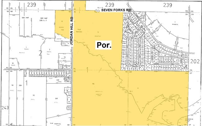
JORDAN HILL RD
Commercialnec
Spalding
AE
Georgia
13255C0090E
185
2025
337.38 AC
2025
Spalding County
160402
Atlanta
DEMOGRAPHICS near 118-122 S Hill St
1 Mile
3 Mile
5 Mile
2024 Total Population
2,987
9,819
41,999
2029 Population
3,184
10,455
45,017
Pop Growth 2024-2029
+ 6.60%
+ 6.48%
+ 7.19%
Average Age
56
47
40
2024 Total Households
1,431
3,974
15,436
HH Growth 2024-2029
+ 6.57%
+ 6.42%
+ 7.05%
Median Household Inc
$77,755
$74,419
$59,092
Avg Household Size
2.10
2.40
2.70
2024 Avg HH Vehicles
2.00
2.00
2.00
Median Home Value
$255,317
$233,422
$197,557
Median Year Built
2009
2002
1993
Nearby Places
Map Layers
Map Styles
 Street
 Aerial
- Restaurants
- Banks
- Shops
- Fitness
- Groceries
PUBLIC TRANSPORTATION
AIRPORT
Hartsfield - Jackson Atlanta International
DRIVE
WALK
Distance
Hartsfield - Jackson Atlanta International
57 min
30.3 mi
Freight Ports
Georgia Ports - Savannah
DRIVE
WALK
Distance
Georgia Ports - Savannah
256 min
219.3 mi
Nearby Properties
Address
Land Use
TOTAL SIZE
Lot Size
Zoning
Address
Land Use
TOTAL SIZE
Lot Size
Zoning
115,608 SF
20.92 AC
R3
Address
Land Use
TOTAL SIZE
Lot Size
Zoning
99,469 SF
28.98 AC
R-2
Address
Land Use
TOTAL SIZE
Lot Size
Zoning
8,934 SF
14.21 AC
R3
Address
Land Use
TOTAL SIZE
Lot Size
Zoning
11,520 SF
8.77 AC
C-1B
Address
Land Use
TOTAL SIZE
Lot Size
Zoning
304,000 SF
11.92 AC
Address
Land Use
TOTAL SIZE
Lot Size
Zoning
2,976 SF
11.30 AC
R3
Address
Land Use
TOTAL SIZE
Lot Size
Zoning
4,118 SF
14.40 AC
PID
Address
Land Use
TOTAL SIZE
Lot Size
Zoning
72,870 SF
30 AC
Address
Land Use
TOTAL SIZE
Lot Size
Zoning
72,252 SF
7.14 AC
HDRA
Address
Land Use
TOTAL SIZE
Lot Size
Zoning
41,830 SF
6.41 AC
INST
Address
Land Use
TOTAL SIZE
Lot Size
Zoning
312 SF
258.57 AC
AAR
Address
Land Use
TOTAL SIZE
Lot Size
Zoning
14.73 AC
INST
Address
Land Use
TOTAL SIZE
Lot Size
Zoning
50,382 SF
3.32 AC
C1
Address
Land Use
TOTAL SIZE
Lot Size
Zoning
2,640 SF
5.98 AC
HDR-B
Address
Land Use
TOTAL SIZE
Lot Size
Zoning
46,310 SF
24.68 AC
R3
Address
Land Use
TOTAL SIZE
Lot Size
Zoning
22,520 SF
1.01 AC
C1
Address
Land Use
TOTAL SIZE
Lot Size
Zoning
109.46 AC
Address
Land Use
TOTAL SIZE
Lot Size
Zoning
21,542 SF
7.53 AC
C-1B
Address
Land Use
TOTAL SIZE
Lot Size
Zoning
2,160 SF
6.90 AC
C-1B
Address
Land Use
TOTAL SIZE
Lot Size
Zoning
5,751 SF
16.49 AC
C1
Address
Land Use
TOTAL SIZE
Lot Size
Zoning
26.20 AC
PDD
Address
Land Use
TOTAL SIZE
Lot Size
Zoning
594 SF
4.08 AC
C-1B
Address
Land Use
TOTAL SIZE
Lot Size
Zoning
22,464 SF
1.55 AC
C1
Address
Land Use
TOTAL SIZE
Lot Size
Zoning
279.69 AC
R1
Address
Land Use
TOTAL SIZE
Lot Size
Zoning
19,236 SF
3.95 AC
MDR
Address
Land Use
TOTAL SIZE
Lot Size
Zoning
9,374 SF
168.36 AC
AAR
Address
Land Use
TOTAL SIZE
Lot Size
Zoning
10,640 SF
1.48 AC
C2
Address
Land Use
TOTAL SIZE
Lot Size
Zoning
22,116 SF
0.99 AC
PCD
Address
Land Use
TOTAL SIZE
Lot Size
Zoning
3,270 SF
2.85 AC
C1
Address
Land Use
TOTAL SIZE
Lot Size
Zoning
25,925 SF
8.25 AC
The World's #1 Commercial Real Estate Marketplace
Connect with us
© 2026 CoStar Group
The information above has been obtained from sources believed reliable. While we do not doubt its accuracy we have not verified it and make no guarantee, warranty or representation about it. It is your responsibility to independently confirm its accuracy and completeness. Any projections, opinions, assumptions, or estimates used are for example only and do not represent the current or future performance of the property. The value of this transaction to you depends on tax and other factors which should be evaluated by your tax, financial, and legal advisors. You and your advisors should conduct a careful, independent investigation of the property to determine to your satisfaction the suitability of the property for your needs.