Property Record
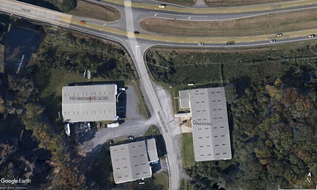
118 Maddox Mill Rd Se, Dalton, GA 30721

Property Detail
118 Maddox Mill Rd Se
12-208-16-000
2.77A MOSS,LOWELL&MADDOX,STARR
Industrialgeneral
WHITFIELD
M-2
Georgia
AE The base floodplain where base flood elevations are provided. AE Zones are now used on new format FIRMs instead of A1-A30 Zones.
2.77 AC
2025
Georgia Northwest
2025
Other Market Areas
001100
Dalton, GA
15,000 SF
NEARBY LISTINGS FOR SALE OR LEASE
DEMOGRAPHICS near 118 Maddox Mill Rd Se
1 mile
3 mile
5 mile
2025 Total Population
1,309
16,281
52,276
2030 Population
1,346
16,786
53,708
Pop Growth 2025-2030
+ 2.83%
+ 3.10%
+ 2.74%
Average Age
39
38
37
2025 Total Households
448
5,487
17,782
HH Growth 2025-2030
+ 2.90%
+ 3.15%
+ 2.81%
Median Household Inc
$49,399
$54,756
$57,985
Avg Household Size
2.90
2.90
2.90
2025 Avg HH Vehicles
2.00
2.00
2.00
Median Home Value
$217,308
$202,467
$210,144
Median Year Built
1982
1984
1985
Nearby Places
Map Layers
Map Styles
 Street
 Aerial
Layers
 Traffic
 Biking
Places
Listings with unknown addresses are not visible on the map
- Restaurants
- Banks
- Shops
- Fitness
- Groceries
PUBLIC TRANSPORTATION
AIRPORT
Lovell Field
Drive
Walk
Distance
Lovell Field
44 min
32.1 mi
Nearby Properties
Address
Land Use
TOTAL SIZE
Lot Size
Zoning
Address
Land Use
TOTAL SIZE
Lot Size
Zoning
199,398 SF
37.16 AC
Address
Land Use
TOTAL SIZE
Lot Size
Zoning
784,920 SF
56.60 AC
M-2
Address
Land Use
TOTAL SIZE
Lot Size
Zoning
346,476 SF
31.41 AC
Address
Land Use
TOTAL SIZE
Lot Size
Zoning
195,990 SF
60.25 AC
Address
Land Use
TOTAL SIZE
Lot Size
Zoning
664,020 SF
28.75 AC
M-2
Address
Land Use
TOTAL SIZE
Lot Size
Zoning
29,434 SF
6.36 AC
Address
Land Use
TOTAL SIZE
Lot Size
Zoning
84,200 SF
22.70 AC
Address
Land Use
TOTAL SIZE
Lot Size
Zoning
127,376 SF
5.64 AC
Address
Land Use
TOTAL SIZE
Lot Size
Zoning
211,512 SF
3.60 AC
M2
Address
Land Use
TOTAL SIZE
Lot Size
Zoning
3,638 SF
117.55 AC
Address
Land Use
TOTAL SIZE
Lot Size
Zoning
200,586 SF
18.37 AC
C2
Address
Land Use
TOTAL SIZE
Lot Size
Zoning
234,696 SF
41.91 AC
Address
Land Use
TOTAL SIZE
Lot Size
Zoning
48,360 SF
31.57 AC
Address
Land Use
TOTAL SIZE
Lot Size
Zoning
329,676 SF
12.21 AC
M-2
Address
Land Use
TOTAL SIZE
Lot Size
Zoning
20,561 SF
3.35 AC
Address
Land Use
TOTAL SIZE
Lot Size
Zoning
56,163 SF
11.66 AC
Address
Land Use
TOTAL SIZE
Lot Size
Zoning
55,187 SF
38.56 AC
Address
Land Use
TOTAL SIZE
Lot Size
Zoning
62,300 SF
4.45 AC
Address
Land Use
TOTAL SIZE
Lot Size
Zoning
40,645 SF
107.60 AC
Address
Land Use
TOTAL SIZE
Lot Size
Zoning
71,091 SF
44.70 AC
Address
Land Use
TOTAL SIZE
Lot Size
Zoning
28,656 SF
3.95 AC
C-2
Address
Land Use
TOTAL SIZE
Lot Size
Zoning
85,620 SF
7.77 AC
C2
Address
Land Use
TOTAL SIZE
Lot Size
Zoning
153,082 SF
10.27 AC
M-2
Address
Land Use
TOTAL SIZE
Lot Size
Zoning
42,472 SF
17.10 AC
Address
Land Use
TOTAL SIZE
Lot Size
Zoning
46,600 SF
6.12 AC
C2
Address
Land Use
TOTAL SIZE
Lot Size
Zoning
68,558 SF
17.18 AC
Address
Land Use
TOTAL SIZE
Lot Size
Zoning
155,957 SF
10.49 AC
M-2
Address
Land Use
TOTAL SIZE
Lot Size
Zoning
23,290 SF
5.85 AC
Address
Land Use
TOTAL SIZE
Lot Size
Zoning
46,900 SF
4.96 AC
C2
Address
Land Use
TOTAL SIZE
Lot Size
Zoning
55,670 SF
55.38 AC
M-2
The World's #1 Commercial Real Estate Marketplace
Connect with us
© 2026 CoStar Group
The information above has been obtained from sources believed reliable. While we do not doubt its accuracy we have not verified it and make no guarantee, warranty or representation about it. It is your responsibility to independently confirm its accuracy and completeness. Any projections, opinions, assumptions, or estimates used are for example only and do not represent the current or future performance of the property. The value of this transaction to you depends on tax and other factors which should be evaluated by your tax, financial, and legal advisors. You and your advisors should conduct a careful, independent investigation of the property to determine to your satisfaction the suitability of the property for your needs.