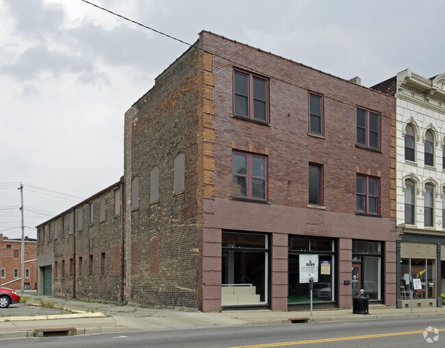
Property Record
118 Main St, Hamilton, OH 45013

NEARBY LISTINGS FOR SALE OR LEASE
Property Detail
118 Main St
Cincinnati, OH-KY-IN
Hamilton
P6411-001-000-035
1532 N 41 1/2
Storebuilding
Butler
X
Ohio
39017C0189F
1532
2024
0.16 AC
2025
Butler County
014700
Cincinnati/Dayton
2,824 SF
DEMOGRAPHICS near 118 Main St
1 Mile
3 Mile
5 Mile
2024 Total Population
15,996
69,547
114,951
2029 Population
16,297
70,728
116,519
Pop Growth 2024-2029
+ 1.88%
+ 1.70%
+ 1.36%
Average Age
36
39
40
2024 Total Households
6,283
27,234
44,422
HH Growth 2024-2029
+ 1.97%
+ 1.79%
+ 1.40%
Median Household Inc
$45,705
$52,871
$61,661
Avg Household Size
2.40
2.40
2.50
2024 Avg HH Vehicles
2.00
2.00
2.00
Median Home Value
$105,958
$147,764
$174,002
Median Year Built
1947
1956
1966
Nearby Places
Map Layers
Map Styles
 Street
 Aerial
- Restaurants
- Banks
- Shops
- Fitness
- Groceries
PUBLIC TRANSPORTATION
AIRPORT
Cincinnati/Northern Kentucky International
DRIVE
WALK
Distance
Cincinnati/Northern Kentucky International
63 min
39.4 mi
SALE & LEASE HISTORY
LISTING DATE
SALE/LEASE

Jul 27, 2017
For Lease
Jan 04, 2021
For Lease
Nearby Properties
Address
Land Use
TOTAL SIZE
Lot Size
Zoning
Address
Land Use
TOTAL SIZE
Lot Size
Zoning
659,723 SF
27.80 AC
Address
Land Use
TOTAL SIZE
Lot Size
Zoning
336,010 SF
5.56 AC
ADV
Address
Land Use
TOTAL SIZE
Lot Size
Zoning
34,129 SF
13.88 AC
Address
Land Use
TOTAL SIZE
Lot Size
Zoning
14.65 AC
Address
Land Use
TOTAL SIZE
Lot Size
Zoning
14,559 SF
27.50 AC
Address
Land Use
TOTAL SIZE
Lot Size
Zoning
112,027 SF
0.78 AC
Address
Land Use
TOTAL SIZE
Lot Size
Zoning
28.47 AC
Address
Land Use
TOTAL SIZE
Lot Size
Zoning
2.75 AC
Address
Land Use
TOTAL SIZE
Lot Size
Zoning
34.58 AC
Address
Land Use
TOTAL SIZE
Lot Size
Zoning
0.37 AC
Address
Land Use
TOTAL SIZE
Lot Size
Zoning
178,152 SF
63.48 AC
Address
Land Use
TOTAL SIZE
Lot Size
Zoning
32,000 SF
10.24 AC
Address
Land Use
TOTAL SIZE
Lot Size
Zoning
220,612 SF
1.79 AC
Address
Land Use
TOTAL SIZE
Lot Size
Zoning
259,203 SF
22.23 AC
Address
Land Use
TOTAL SIZE
Lot Size
Zoning
85,353 SF
7.85 AC
Address
Land Use
TOTAL SIZE
Lot Size
Zoning
75,402 SF
0.45 AC
Address
Land Use
TOTAL SIZE
Lot Size
Zoning
85,926 SF
35.50 AC
Address
Land Use
TOTAL SIZE
Lot Size
Zoning
166,169 SF
12.19 AC
Address
Land Use
TOTAL SIZE
Lot Size
Zoning
53,048 SF
27.49 AC
Address
Land Use
TOTAL SIZE
Lot Size
Zoning
Address
Land Use
TOTAL SIZE
Lot Size
Zoning
Address
Land Use
TOTAL SIZE
Lot Size
Zoning
216,812 SF
26.35 AC
Address
Land Use
TOTAL SIZE
Lot Size
Zoning
111,174 SF
17.78 AC
Address
Land Use
TOTAL SIZE
Lot Size
Zoning
51,906 SF
0.81 AC
Address
Land Use
TOTAL SIZE
Lot Size
Zoning
234,327 SF
20.57 AC
Address
Land Use
TOTAL SIZE
Lot Size
Zoning
408,194 SF
47.14 AC
Address
Land Use
TOTAL SIZE
Lot Size
Zoning
172,092 SF
17.49 AC
Address
Land Use
TOTAL SIZE
Lot Size
Zoning
15.61 AC
Address
Land Use
TOTAL SIZE
Lot Size
Zoning
44.10 AC
Address
Land Use
TOTAL SIZE
Lot Size
Zoning
21.31 AC
The World's #1 Commercial Real Estate Marketplace
Connect with us
© 2026 CoStar Group
The information above has been obtained from sources believed reliable. While we do not doubt its accuracy we have not verified it and make no guarantee, warranty or representation about it. It is your responsibility to independently confirm its accuracy and completeness. Any projections, opinions, assumptions, or estimates used are for example only and do not represent the current or future performance of the property. The value of this transaction to you depends on tax and other factors which should be evaluated by your tax, financial, and legal advisors. You and your advisors should conduct a careful, independent investigation of the property to determine to your satisfaction the suitability of the property for your needs.