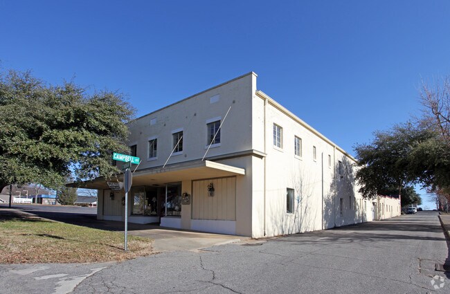
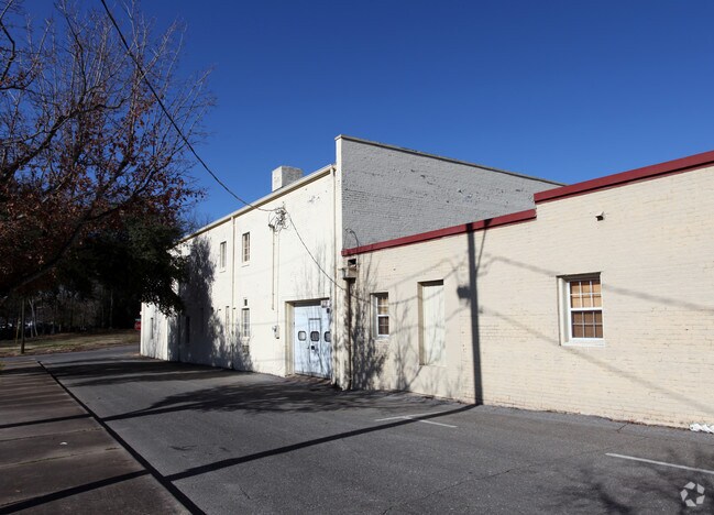
Property Record
118 N Morgan St, Shelby, NC 28150
NEARBY LISTINGS FOR SALE OR LEASE
-
-
-
-
-
-
No Photo
-
-
View all Shelby listings for lease on LoopNet.com
Property Detail
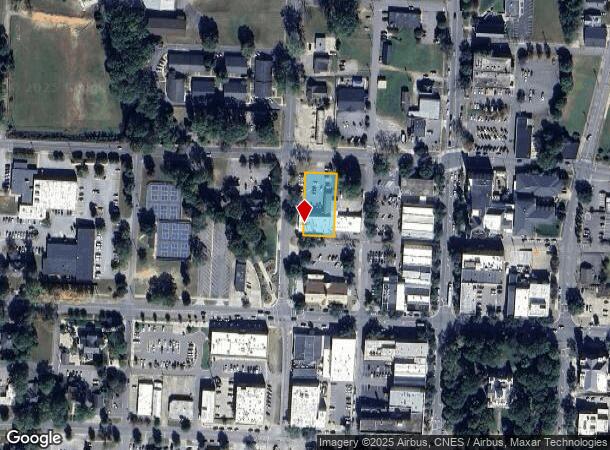
118 N Morgan St
Shelby, NC
Uptown
17820
118 N MORGAN ST
Officebuilding
Cleveland
X
North Carolina
3710254700J
1
2025
0.46 AC
2025
Cleveland County
951100
Charlotte
9,250 SF
DEMOGRAPHICS near 118 N Morgan St
1 Mile
3 Mile
5 Mile
2024 Total Population
7,442
23,399
37,365
2029 Population
7,889
24,553
39,113
Pop Growth 2024-2029
+ 6.01%
+ 4.93%
+ 4.68%
Average Age
40
41
41
2024 Total Households
3,032
9,741
15,573
HH Growth 2024-2029
+ 6.07%
+ 4.93%
+ 4.69%
Median Household Inc
$32,347
$39,554
$43,385
Avg Household Size
2.20
2.30
2.30
2024 Avg HH Vehicles
1.00
2.00
2.00
Median Home Value
$139,066
$136,733
$139,163
Median Year Built
1963
1971
1975
Nearby Places
Map Layers
Map Styles
 Street
 Aerial
- Restaurants
- Banks
- Shops
- Fitness
- Groceries
SALE & LEASE HISTORY
LISTING DATE
SALE/LEASE

Mar 22, 2023
For Lease
Nearby Properties
Address
Land Use
TOTAL SIZE
Lot Size
Zoning
Address
Land Use
TOTAL SIZE
Lot Size
Zoning
99,594 SF
247.03 AC
LI
Address
Land Use
TOTAL SIZE
Lot Size
Zoning
15.70 AC
RO
Address
Land Use
TOTAL SIZE
Lot Size
Zoning
5,036 SF
29.46 AC
CPD
Address
Land Use
TOTAL SIZE
Lot Size
Zoning
92,278 SF
41.63 AC
R10
Address
Land Use
TOTAL SIZE
Lot Size
Zoning
139,067 SF
25 AC
R20
Address
Land Use
TOTAL SIZE
Lot Size
Zoning
29,747 SF
21.06 AC
RO
Address
Land Use
TOTAL SIZE
Lot Size
Zoning
224,162 SF
15 AC
GBCU
Address
Land Use
TOTAL SIZE
Lot Size
Zoning
59,708 SF
10 AC
R10
Address
Land Use
TOTAL SIZE
Lot Size
Zoning
8,880 SF
8.28 AC
CPD
Address
Land Use
TOTAL SIZE
Lot Size
Zoning
27,337 SF
19.10 AC
LI
Address
Land Use
TOTAL SIZE
Lot Size
Zoning
18,864 SF
10.65 AC
ROCU
Address
Land Use
TOTAL SIZE
Lot Size
Zoning
1,436 SF
8.02 AC
RO
Address
Land Use
TOTAL SIZE
Lot Size
Zoning
40,956 SF
30.63 AC
LI
Address
Land Use
TOTAL SIZE
Lot Size
Zoning
4,040 SF
22.83 AC
GB
Address
Land Use
TOTAL SIZE
Lot Size
Zoning
24,652 SF
3.72 AC
R10
Address
Land Use
TOTAL SIZE
Lot Size
Zoning
44,684 SF
4.44 AC
RO
Address
Land Use
TOTAL SIZE
Lot Size
Zoning
52.33 AC
R8
Address
Land Use
TOTAL SIZE
Lot Size
Zoning
63,543 SF
24.07 AC
R20
Address
Land Use
TOTAL SIZE
Lot Size
Zoning
46,948 SF
2.06 AC
GB
Address
Land Use
TOTAL SIZE
Lot Size
Zoning
78,165 SF
8.02 AC
GB
Address
Land Use
TOTAL SIZE
Lot Size
Zoning
134,978 SF
14.50 AC
GB2CU
Address
Land Use
TOTAL SIZE
Lot Size
Zoning
37,580 SF
2 AC
GB
Address
Land Use
TOTAL SIZE
Lot Size
Zoning
43,540 SF
2.96 AC
GI
Address
Land Use
TOTAL SIZE
Lot Size
Zoning
36,511 SF
11.57 AC
GB2
Address
Land Use
TOTAL SIZE
Lot Size
Zoning
93.55 AC
R10
Address
Land Use
TOTAL SIZE
Lot Size
Zoning
40,074 SF
16 AC
R20
Address
Land Use
TOTAL SIZE
Lot Size
Zoning
63,281 SF
11.80 AC
NB
Address
Land Use
TOTAL SIZE
Lot Size
Zoning
36,758 SF
6.37 AC
R20CU
Address
Land Use
TOTAL SIZE
Lot Size
Zoning
24,255 SF
8.28 AC
GB2
Address
Land Use
TOTAL SIZE
Lot Size
Zoning
130 SF
6.14 AC
CB
The World's #1 Commercial Real Estate Marketplace
Connect with us
© 2025 CoStar Group
The information above has been obtained from sources believed reliable. While we do not doubt its accuracy we have not verified it and make no guarantee, warranty or representation about it. It is your responsibility to independently confirm its accuracy and completeness. Any projections, opinions, assumptions, or estimates used are for example only and do not represent the current or future performance of the property. The value of this transaction to you depends on tax and other factors which should be evaluated by your tax, financial, and legal advisors. You and your advisors should conduct a careful, independent investigation of the property to determine to your satisfaction the suitability of the property for your needs.