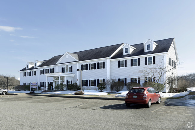
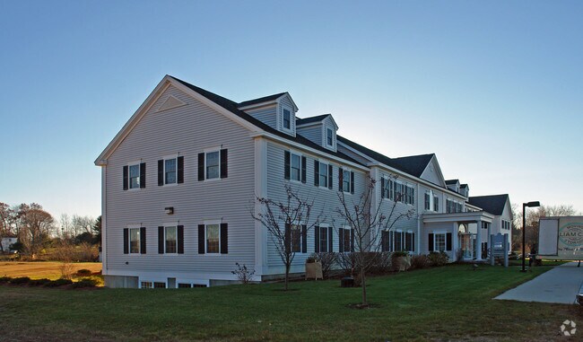
Property Record
118 Portsmouth Ave, Stratham, NH 03885

NEARBY LISTINGS FOR SALE OR LEASE
Property Detail
118 Portsmouth Ave
Commercialnec
Rockingham
X
New Hampshire
33015C0245F
8.96 AC
2024
Rockingham
2024
Boston
067000
Boston-Cambridge-Newton, MA-NH
11,396 SF
STRH-000013-000069
DEMOGRAPHICS near 118 Portsmouth Ave
1 Mile
3 Mile
5 Mile
2024 Total Population
1,542
13,459
41,714
2029 Population
1,595
13,979
43,449
Pop Growth 2024-2029
+ 3.44%
+ 3.86%
+ 4.16%
Average Age
43
44
44
2024 Total Households
588
5,345
17,434
HH Growth 2024-2029
+ 3.40%
+ 3.82%
+ 4.11%
Median Household Inc
$137,980
$125,699
$105,476
Avg Household Size
2.60
2.50
2.30
2024 Avg HH Vehicles
2.00
2.00
2.00
Median Home Value
$634,782
$544,980
$478,263
Median Year Built
1985
1985
1983
Nearby Places
Map Layers
Map Styles
 Street
 Aerial
- Restaurants
- Banks
- Shops
- Fitness
- Groceries
PUBLIC TRANSPORTATION
COMMUTER RAIL
DRIVE
WALK
Distance
12 min
4.9 mi
DRIVE
WALK
Distance
23 min
9.9 mi
AIRPORT
Portsmouth International at Pease
DRIVE
WALK
Distance
Portsmouth International at Pease
21 min
10.0 mi
Manchester Boston Regional
DRIVE
WALK
Distance
Manchester Boston Regional
54 min
37.1 mi
Nearby Properties
Address
Land Use
TOTAL SIZE
Lot Size
Zoning
Address
Land Use
TOTAL SIZE
Lot Size
Zoning
19,956 SF
14.55 AC
H
Address
Land Use
TOTAL SIZE
Lot Size
Zoning
177,803 SF
49.86 AC
IND
Address
Land Use
TOTAL SIZE
Lot Size
Zoning
12,487 SF
7.01 AC
R-5
Address
Land Use
TOTAL SIZE
Lot Size
Zoning
1.20 AC
H
Address
Land Use
TOTAL SIZE
Lot Size
Zoning
48,348 SF
8.60 AC
R-5
Address
Land Use
TOTAL SIZE
Lot Size
Zoning
87,917 SF
29.26 AC
RA
Address
Land Use
TOTAL SIZE
Lot Size
Zoning
64,221 SF
11.70 AC
H
Address
Land Use
TOTAL SIZE
Lot Size
Zoning
72,932 SF
43.83 AC
GCBD
Address
Land Use
TOTAL SIZE
Lot Size
Zoning
160,616 SF
9.03 AC
C-2
Address
Land Use
TOTAL SIZE
Lot Size
Zoning
50,370 SF
10.97 AC
NP
Address
Land Use
TOTAL SIZE
Lot Size
Zoning
46,512 SF
1 AC
H
Address
Land Use
TOTAL SIZE
Lot Size
Zoning
69,700 SF
2.46 AC
C-2
Address
Land Use
TOTAL SIZE
Lot Size
Zoning
73,282 SF
15.79 AC
GCBD
Address
Land Use
TOTAL SIZE
Lot Size
Zoning
65,131 SF
8.96 AC
C-2
Address
Land Use
TOTAL SIZE
Lot Size
Zoning
245,000 SF
6.35 AC
H
Address
Land Use
TOTAL SIZE
Lot Size
Zoning
26,991 SF
5.32 AC
NP
Address
Land Use
TOTAL SIZE
Lot Size
Zoning
25,679 SF
10.25 AC
GCBD
Address
Land Use
TOTAL SIZE
Lot Size
Zoning
329,504 SF
30 AC
I - IN
Address
Land Use
TOTAL SIZE
Lot Size
Zoning
71,247 SF
7.54 AC
C-2
Address
Land Use
TOTAL SIZE
Lot Size
Zoning
111,093 SF
21.27 AC
GCBD
Address
Land Use
TOTAL SIZE
Lot Size
Zoning
35,733 SF
1.56 AC
R-5
Address
Land Use
TOTAL SIZE
Lot Size
Zoning
40,095 SF
6.55 AC
H
Address
Land Use
TOTAL SIZE
Lot Size
Zoning
65,764 SF
10.20 AC
I
Address
Land Use
TOTAL SIZE
Lot Size
Zoning
36,386 SF
1.36 AC
C-2
Address
Land Use
TOTAL SIZE
Lot Size
Zoning
27,177 SF
6.61 AC
GCBD
Address
Land Use
TOTAL SIZE
Lot Size
Zoning
22,142 SF
2.47 AC
TC T
Address
Land Use
TOTAL SIZE
Lot Size
Zoning
14,400 SF
55 AC
R-1
Address
Land Use
TOTAL SIZE
Lot Size
Zoning
16.94 AC
CT
Address
Land Use
TOTAL SIZE
Lot Size
Zoning
3,393 SF
6 AC
RA - R
The World's #1 Commercial Real Estate Marketplace
Connect with us
© 2026 CoStar Group
The information above has been obtained from sources believed reliable. While we do not doubt its accuracy we have not verified it and make no guarantee, warranty or representation about it. It is your responsibility to independently confirm its accuracy and completeness. Any projections, opinions, assumptions, or estimates used are for example only and do not represent the current or future performance of the property. The value of this transaction to you depends on tax and other factors which should be evaluated by your tax, financial, and legal advisors. You and your advisors should conduct a careful, independent investigation of the property to determine to your satisfaction the suitability of the property for your needs.