Property Record
118 S Main Street Usa, Marceline, MO 64658


NEARBY LISTINGS FOR SALE OR LEASE
-
-
View all Marceline listings for sale on LoopNet.com
Property Detail
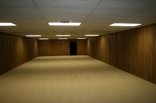
118 S Main Street Usa
20-09-31-001-007-008.00
City Marceline
Restaurantbuilding
31-57-18 LOT 1 THRU 3 BLK 125 ORIGINAL TOWN MARC
X
Linn
29041C0100D
Missouri
2024
1-3
2025
0.22 AC
490500
Missouri North Area
7,882 SF
Other Market Areas
DEMOGRAPHICS near 118 S Main Street Usa
1 Mile
3 Mile
5 Mile
2024 Total Population
2,107
2,536
2,970
2029 Population
2,090
2,512
2,936
Pop Growth 2024-2029
(0.81%)
(0.95%)
(1.14%)
Average Age
41
41
42
2024 Total Households
904
1,080
1,257
HH Growth 2024-2029
(0.77%)
(0.93%)
(1.11%)
Median Household Inc
$51,428
$55,263
$58,653
Avg Household Size
2.30
2.30
2.40
2024 Avg HH Vehicles
2.00
2.00
2.00
Median Home Value
$94,703
$105,634
$118,269
Median Year Built
1967
1968
1969
Nearby Places
Map Layers
Map Styles
 Street
 Aerial
- Restaurants
- Banks
- Shops
- Fitness
- Groceries
SALE & LEASE HISTORY
LISTING DATE
SALE/LEASE

Sep 23, 2016
For Sale
Nearby Properties
Address
Land Use
TOTAL SIZE
Lot Size
Zoning
Address
Land Use
TOTAL SIZE
Lot Size
Zoning
115,110 SF
23.30 AC
Address
Land Use
TOTAL SIZE
Lot Size
Zoning
13,320 SF
0.37 AC
Address
Land Use
TOTAL SIZE
Lot Size
Zoning
2,800 SF
31.30 AC
Address
Land Use
TOTAL SIZE
Lot Size
Zoning
5,845 SF
0.24 AC
Address
Land Use
TOTAL SIZE
Lot Size
Zoning
5,588 SF
0.32 AC
Address
Land Use
TOTAL SIZE
Lot Size
Zoning
7,916 SF
2 AC
Address
Land Use
TOTAL SIZE
Lot Size
Zoning
3,060 SF
7.10 AC
Address
Land Use
TOTAL SIZE
Lot Size
Zoning
4,306 SF
0.56 AC
Address
Land Use
TOTAL SIZE
Lot Size
Zoning
49.86 AC
Address
Land Use
TOTAL SIZE
Lot Size
Zoning
15,600 SF
7.87 AC
Address
Land Use
TOTAL SIZE
Lot Size
Zoning
12,000 SF
1.48 AC
Address
Land Use
TOTAL SIZE
Lot Size
Zoning
10,000 SF
0.15 AC
Address
Land Use
TOTAL SIZE
Lot Size
Zoning
10,000 SF
1.18 AC
Address
Land Use
TOTAL SIZE
Lot Size
Zoning
3,200 SF
0.56 AC
Address
Land Use
TOTAL SIZE
Lot Size
Zoning
Address
Land Use
TOTAL SIZE
Lot Size
Zoning
4,814 SF
0.37 AC
Address
Land Use
TOTAL SIZE
Lot Size
Zoning
13,950 SF
0.15 AC
Address
Land Use
TOTAL SIZE
Lot Size
Zoning
5,400 SF
5.66 AC
Address
Land Use
TOTAL SIZE
Lot Size
Zoning
5,046 SF
0.96 AC
Address
Land Use
TOTAL SIZE
Lot Size
Zoning
4,100 SF
1.70 AC
Address
Land Use
TOTAL SIZE
Lot Size
Zoning
7,038 SF
0.99 AC
Address
Land Use
TOTAL SIZE
Lot Size
Zoning
3,162 SF
0.16 AC
Address
Land Use
TOTAL SIZE
Lot Size
Zoning
10,600 SF
0.15 AC
Address
Land Use
TOTAL SIZE
Lot Size
Zoning
3,138 SF
1.49 AC
Address
Land Use
TOTAL SIZE
Lot Size
Zoning
2,720 SF
0.65 AC
Address
Land Use
TOTAL SIZE
Lot Size
Zoning
Address
Land Use
TOTAL SIZE
Lot Size
Zoning
4,230 SF
1.38 AC
Address
Land Use
TOTAL SIZE
Lot Size
Zoning
7,275 SF
21.30 AC
Address
Land Use
TOTAL SIZE
Lot Size
Zoning
2,105 SF
0.08 AC
Address
Land Use
TOTAL SIZE
Lot Size
Zoning
11,772 SF
1.60 AC
The World's #1 Commercial Real Estate Marketplace
Connect with us
© 2026 CoStar Group
The information above has been obtained from sources believed reliable. While we do not doubt its accuracy we have not verified it and make no guarantee, warranty or representation about it. It is your responsibility to independently confirm its accuracy and completeness. Any projections, opinions, assumptions, or estimates used are for example only and do not represent the current or future performance of the property. The value of this transaction to you depends on tax and other factors which should be evaluated by your tax, financial, and legal advisors. You and your advisors should conduct a careful, independent investigation of the property to determine to your satisfaction the suitability of the property for your needs.