Property Record
118 Scofieldtown Rd, Stamford, CT 06903
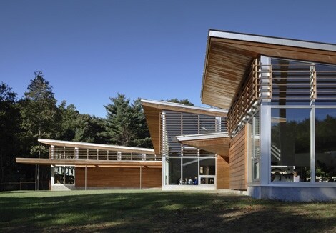

Property Detail
118 Scofieldtown Rd
STAM-000004-000000-004408
Western Ct
Publicschool
Connecticut
RA1
8.90 AC
B and X Area of moderate flood hazard, usually the area between the limits of the 100-year and 500-year floods.
Stamford
2025
Westchester/So Connecticut
2025
Bridgeport-Stamford-Danbury, CT
020400
NEARBY LISTINGS FOR SALE OR LEASE
DEMOGRAPHICS near 118 Scofieldtown Rd
1 mile
3 mile
5 mile
2025 Total Population
2,884
42,316
144,152
2030 Population
2,934
43,343
148,268
Pop Growth 2025-2030
+ 1.73%
+ 2.43%
+ 2.86%
Average Age
45
43
41
2025 Total Households
1,017
14,934
54,513
HH Growth 2025-2030
+ 1.77%
+ 2.39%
+ 2.98%
Median Household Inc
$181,168
$166,577
$131,079
Avg Household Size
2.70
2.80
2.60
2025 Avg HH Vehicles
2.00
2.00
2.00
Median Home Value
$808,164
$829,769
$853,464
Median Year Built
1960
1963
1968
Nearby Places
Map Layers
Map Styles
 Street
 Aerial
Layers
 Traffic
 Biking
Places
Listings with unknown addresses are not visible on the map
- Restaurants
- Banks
- Shops
- Fitness
- Groceries
PUBLIC TRANSPORTATION
COMMUTER RAIL
Talmadge Hill Station (New Haven Line - Metro-North Commuter Railroad Company (Metro-North))
Drive
Walk
Distance
Talmadge Hill Station (New Haven Line - Metro-North Commuter Railroad Company (Metro-North))
6 min
3.9 mi
Springdale Station (New Haven Line - Metro-North Commuter Railroad Company (Metro-North))
Drive
Walk
Distance
Springdale Station (New Haven Line - Metro-North Commuter Railroad Company (Metro-North))
8 min
4.3 mi
AIRPORT
Westchester County
Drive
Walk
Distance
Westchester County
25 min
15.4 mi
LaGuardia
Drive
Walk
Distance
LaGuardia
60 min
38.2 mi
Freight Ports
Port of New Haven
Drive
Walk
Distance
Port of New Haven
58 min
41.3 mi
Nearby Properties
Address
Land Use
TOTAL SIZE
Lot Size
Zoning
Address
Land Use
TOTAL SIZE
Lot Size
Zoning
32.43 AC
RA1
Address
Land Use
TOTAL SIZE
Lot Size
Zoning
25.91 AC
MZN
Address
Land Use
TOTAL SIZE
Lot Size
Zoning
29.87 AC
R10
Address
Land Use
TOTAL SIZE
Lot Size
Zoning
76.36 AC
2AC
Address
Land Use
TOTAL SIZE
Lot Size
Zoning
75,531 SF
6.85 AC
MZN
Address
Land Use
TOTAL SIZE
Lot Size
Zoning
34.05 AC
RA1
Address
Land Use
TOTAL SIZE
Lot Size
Zoning
16.99 AC
CD
Address
Land Use
TOTAL SIZE
Lot Size
Zoning
28.54 AC
R20
Address
Land Use
TOTAL SIZE
Lot Size
Zoning
23.84 AC
CD
Address
Land Use
TOTAL SIZE
Lot Size
Zoning
40.46 AC
RA2
Address
Land Use
TOTAL SIZE
Lot Size
Zoning
12.13 AC
WAVE
Address
Land Use
TOTAL SIZE
Lot Size
Zoning
83,095 SF
47.47 AC
2AC
Address
Land Use
TOTAL SIZE
Lot Size
Zoning
36.58 AC
CD
Address
Land Use
TOTAL SIZE
Lot Size
Zoning
3.50 AC
CN
Address
Land Use
TOTAL SIZE
Lot Size
Zoning
12.22 AC
RA1
Address
Land Use
TOTAL SIZE
Lot Size
Zoning
8,337 SF
132.50 AC
P
Address
Land Use
TOTAL SIZE
Lot Size
Zoning
87,525 SF
16.87 AC
RA1
Address
Land Use
TOTAL SIZE
Lot Size
Zoning
69,558 SF
10 AC
RD
Address
Land Use
TOTAL SIZE
Lot Size
Zoning
0.94 AC
VC
Address
Land Use
TOTAL SIZE
Lot Size
Zoning
90,532 SF
14.79 AC
RA1
Address
Land Use
TOTAL SIZE
Lot Size
Zoning
49,135 SF
6.58 AC
ML
Address
Land Use
TOTAL SIZE
Lot Size
Zoning
12.07 AC
RA1
Address
Land Use
TOTAL SIZE
Lot Size
Zoning
84.37 AC
RA2
Address
Land Use
TOTAL SIZE
Lot Size
Zoning
9.73 AC
R20
Address
Land Use
TOTAL SIZE
Lot Size
Zoning
2.04 AC
900
Address
Land Use
TOTAL SIZE
Lot Size
Zoning
33.51 AC
RA2
Address
Land Use
TOTAL SIZE
Lot Size
Zoning
96,643 SF
73.90 AC
RA3
Address
Land Use
TOTAL SIZE
Lot Size
Zoning
3.52 AC
MZN
Address
Land Use
TOTAL SIZE
Lot Size
Zoning
239,499 SF
CD
Address
Land Use
TOTAL SIZE
Lot Size
Zoning
25.30 AC
CD
The World's #1 Commercial Real Estate Marketplace
Connect with us
© 2026 CoStar Group
The information above has been obtained from sources believed reliable. While we do not doubt its accuracy we have not verified it and make no guarantee, warranty or representation about it. It is your responsibility to independently confirm its accuracy and completeness. Any projections, opinions, assumptions, or estimates used are for example only and do not represent the current or future performance of the property. The value of this transaction to you depends on tax and other factors which should be evaluated by your tax, financial, and legal advisors. You and your advisors should conduct a careful, independent investigation of the property to determine to your satisfaction the suitability of the property for your needs.