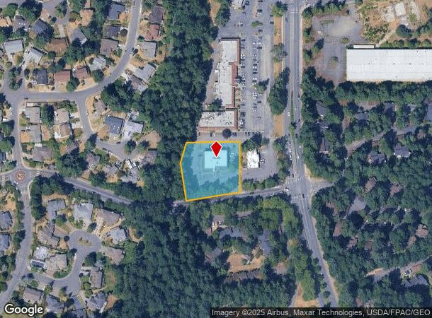
Property Record
118 Sw 330Th St, Federal Way, WA 98023


NEARBY LISTINGS FOR SALE OR LEASE
Property Detail
118 Sw 330Th St
Seattle-Tacoma-Bellevue, WA
Sp #378139
182104-9045
LOT 2 KCSP 378139 AF #7808240802 SD PLAT DAF-POR OF E 1/2 OF E 1/2 DAF BAAP WCH BEARS S 01-02-38 W 2388.29 FT & N 88-57-22 W 42 FT FR NE COR OF SD STR TH S 01-02-38 W 565 FT TO POC TO LFT RAD 2142 FT THRU C/A OF 07-00-41 ARC DIST 262.12 FT TO PRC TO
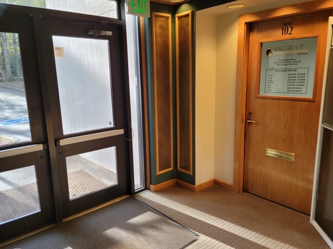
Medicalbuilding
King
X
Washington
53033C1250G
2
2025
1.01 AC
2024
Federal Way/Auburn
030309
Seattle/Puget Sound
17,556 SF
DEMOGRAPHICS near 118 Sw 330Th St
1 Mile
3 Mile
5 Mile
2024 Total Population
17,962
106,480
189,507
2029 Population
18,087
106,988
191,019
Pop Growth 2024-2029
+ 0.70%
+ 0.48%
+ 0.80%
Average Age
40
40
40
2024 Total Households
6,941
37,612
66,937
HH Growth 2024-2029
+ 0.55%
+ 0.33%
+ 0.73%
Median Household Inc
$70,839
$83,757
$88,263
Avg Household Size
2.50
2.70
2.70
2024 Avg HH Vehicles
2.00
2.00
2.00
Median Home Value
$426,180
$455,770
$476,035
Median Year Built
1986
1983
1984
Nearby Places
Map Layers
Map Styles
 Street
 Aerial
- Restaurants
- Banks
- Shops
- Fitness
- Groceries
PUBLIC TRANSPORTATION
COMMUTER RAIL
Auburn Station (Sounder South Line - Central Puget Sound Regional Transit Authority Rail (Link Light Rail/Sounder))
DRIVE
WALK
Distance
Auburn Station (Sounder South Line - Central Puget Sound Regional Transit Authority Rail (Link Light Rail/Sounder))
12 min
6.6 mi
Kent Station (Sounder South Line - Central Puget Sound Regional Transit Authority Rail (Link Light Rail/Sounder))
DRIVE
WALK
Distance
Kent Station (Sounder South Line - Central Puget Sound Regional Transit Authority Rail (Link Light Rail/Sounder))
20 min
9.8 mi
AIRPORT
Seattle-Tacoma International
DRIVE
WALK
Distance
Seattle-Tacoma International
26 min
12.2 mi
Freight Ports
Port of Tacoma
DRIVE
WALK
Distance
Port of Tacoma
19 min
10.7 mi
SALE & LEASE HISTORY
LISTING DATE
SALE/LEASE

May 20, 2019
For Sale
May 18, 2021
For Lease
May 15, 2018
For Lease
Jul 20, 2017
For Lease
Feb 07, 2023
For Lease
Nearby Properties
Address
Land Use
TOTAL SIZE
Lot Size
Zoning
Address
Land Use
TOTAL SIZE
Lot Size
Zoning
235,855 SF
38.17 AC
BC
Address
Land Use
TOTAL SIZE
Lot Size
Zoning
347,266 SF
39.15 AC
RM2400
Address
Land Use
TOTAL SIZE
Lot Size
Zoning
1,038,000 SF
51.55 AC
OP
Address
Land Use
TOTAL SIZE
Lot Size
Zoning
334,593 SF
19.39 AC
RM2400
Address
Land Use
TOTAL SIZE
Lot Size
Zoning
220,608 SF
5.41 AC
OP
Address
Land Use
TOTAL SIZE
Lot Size
Zoning
308,142 SF
18.09 AC
RM2400
Address
Land Use
TOTAL SIZE
Lot Size
Zoning
331,874 SF
4.80 AC
CC-C
Address
Land Use
TOTAL SIZE
Lot Size
Zoning
471,032 SF
48.12 AC
CP-1
Address
Land Use
TOTAL SIZE
Lot Size
Zoning
267,250 SF
16.82 AC
RM2400
Address
Land Use
TOTAL SIZE
Lot Size
Zoning
259,560 SF
16.20 AC
RM2400
Address
Land Use
TOTAL SIZE
Lot Size
Zoning
249,777 SF
14.76 AC
RM2400
Address
Land Use
TOTAL SIZE
Lot Size
Zoning
253,164 SF
6.70 AC
RM3600
Address
Land Use
TOTAL SIZE
Lot Size
Zoning
242,351 SF
14.96 AC
RM2400
Address
Land Use
TOTAL SIZE
Lot Size
Zoning
212,164 SF
13.28 AC
RM2400
Address
Land Use
TOTAL SIZE
Lot Size
Zoning
242,462 SF
16.05 AC
RM2400
Address
Land Use
TOTAL SIZE
Lot Size
Zoning
204,620 SF
17.89 AC
RM2400
Address
Land Use
TOTAL SIZE
Lot Size
Zoning
210,196 SF
12.75 AC
R2
Address
Land Use
TOTAL SIZE
Lot Size
Zoning
212,544 SF
9.48 AC
R24
Address
Land Use
TOTAL SIZE
Lot Size
Zoning
116,613 SF
1.29 AC
BC
Address
Land Use
TOTAL SIZE
Lot Size
Zoning
116,613 SF
1.69 AC
BC
Address
Land Use
TOTAL SIZE
Lot Size
Zoning
15.16 AC
CP-1
Address
Land Use
TOTAL SIZE
Lot Size
Zoning
16.85 AC
CP-1
Address
Land Use
TOTAL SIZE
Lot Size
Zoning
229,500 SF
24.53 AC
CE
Address
Land Use
TOTAL SIZE
Lot Size
Zoning
329,386 SF
31.58 AC
CC-C
Address
Land Use
TOTAL SIZE
Lot Size
Zoning
171,200 SF
10.31 AC
RM2400
Address
Land Use
TOTAL SIZE
Lot Size
Zoning
145,728 SF
19.49 AC
R4
Address
Land Use
TOTAL SIZE
Lot Size
Zoning
148,108 SF
7.89 AC
RM1800
Address
Land Use
TOTAL SIZE
Lot Size
Zoning
302,083 SF
16.56 AC
RM2400
Address
Land Use
TOTAL SIZE
Lot Size
Zoning
250,393 SF
15.79 AC
R18P
Address
Land Use
TOTAL SIZE
Lot Size
Zoning
160,517 SF
19.14 AC
RS35.0
The World's #1 Commercial Real Estate Marketplace
Connect with us
© 2025 CoStar Group
The information above has been obtained from sources believed reliable. While we do not doubt its accuracy we have not verified it and make no guarantee, warranty or representation about it. It is your responsibility to independently confirm its accuracy and completeness. Any projections, opinions, assumptions, or estimates used are for example only and do not represent the current or future performance of the property. The value of this transaction to you depends on tax and other factors which should be evaluated by your tax, financial, and legal advisors. You and your advisors should conduct a careful, independent investigation of the property to determine to your satisfaction the suitability of the property for your needs.