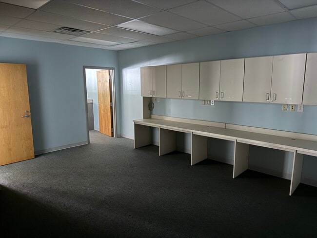
Property Record
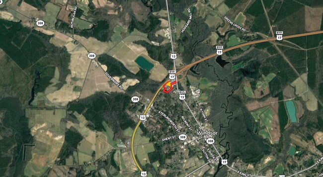
118 Us 17 N, Windsor, NC 27983

NEARBY LISTINGS FOR SALE OR LEASE
Property Detail
118 Us 17 N
6801-48-1379
HOME LOT
Residentialacreage
Bertie
X
North Carolina
3720680100J
1.86 AC
2025
North Carolina Northeast Area
2025
Other Market Areas
960401
DEMOGRAPHICS near 118 Us 17 N
1 Mile
3 Mile
5 Mile
2024 Total Population
560
3,169
4,826
2029 Population
548
3,077
4,691
Pop Growth 2024-2029
(2.14%)
(2.90%)
(2.80%)
Average Age
45
46
46
2024 Total Households
227
1,375
2,104
HH Growth 2024-2029
(1.76%)
(2.69%)
(2.61%)
Median Household Inc
$37,200
$36,091
$35,476
Avg Household Size
2.30
2.20
2.20
2024 Avg HH Vehicles
2.00
2.00
2.00
Median Home Value
$100,833
$112,719
$107,036
Median Year Built
1979
1977
1978
Nearby Places
Map Layers
Map Styles
 Street
 Aerial
- Restaurants
- Banks
- Shops
- Fitness
- Groceries
SALE & LEASE HISTORY
LISTING DATE
SALE/LEASE

Aug 22, 2025
For Lease
Apr 05, 2023
For Lease
Nearby Properties
Address
Land Use
TOTAL SIZE
Lot Size
Zoning
Address
Land Use
TOTAL SIZE
Lot Size
Zoning
400,006 SF
130.31 AC
RA-20 SING
Address
Land Use
TOTAL SIZE
Lot Size
Zoning
6.86 AC
HIGHWAY CO
Address
Land Use
TOTAL SIZE
Lot Size
Zoning
45,619 SF
7.37 AC
R-5MH SING
Address
Land Use
TOTAL SIZE
Lot Size
Zoning
9,464 SF
1.92 AC
CENTRAL BU
Address
Land Use
TOTAL SIZE
Lot Size
Zoning
10,964 SF
2.61 AC
MANUFACTUR
Address
Land Use
TOTAL SIZE
Lot Size
Zoning
696 SF
7.15 AC
HIGHWAY CO
Address
Land Use
TOTAL SIZE
Lot Size
Zoning
6.33 AC
R-5MH SING
Address
Land Use
TOTAL SIZE
Lot Size
Zoning
21,622 SF
13.79 AC
HIGHWAY CO
Address
Land Use
TOTAL SIZE
Lot Size
Zoning
1,800 SF
3.94 AC
R-5MH SING
Address
Land Use
TOTAL SIZE
Lot Size
Zoning
25,710 SF
5.56 AC
RA-20 SING
Address
Land Use
TOTAL SIZE
Lot Size
Zoning
1,427 SF
4.47 AC
HIGHWAY CO
Address
Land Use
TOTAL SIZE
Lot Size
Zoning
1,698 SF
10 AC
RA-20 SING
Address
Land Use
TOTAL SIZE
Lot Size
Zoning
900 SF
6.76 AC
R-5 SINGLE
Address
Land Use
TOTAL SIZE
Lot Size
Zoning
132 SF
1.50 AC
R-5 SINGLE
Address
Land Use
TOTAL SIZE
Lot Size
Zoning
210 SF
1.34 AC
HIGHWAY CO
Address
Land Use
TOTAL SIZE
Lot Size
Zoning
6,000 SF
15.73 AC
MANUFACTUR
Address
Land Use
TOTAL SIZE
Lot Size
Zoning
2.63 AC
HIGHWAY CO
Address
Land Use
TOTAL SIZE
Lot Size
Zoning
9,171 SF
1.96 AC
R-10 SINGL
Address
Land Use
TOTAL SIZE
Lot Size
Zoning
9,085 SF
0.76 AC
HIGHWAY CO
Address
Land Use
TOTAL SIZE
Lot Size
Zoning
5.43 AC
OFFICE & I
Address
Land Use
TOTAL SIZE
Lot Size
Zoning
1.41 AC
HIGHWAY CO
Address
Land Use
TOTAL SIZE
Lot Size
Zoning
6,666 SF
3.59 AC
OFFICE & I
Address
Land Use
TOTAL SIZE
Lot Size
Zoning
200 SF
1.12 AC
CENTRAL BU
Address
Land Use
TOTAL SIZE
Lot Size
Zoning
6,149 SF
4.54 AC
HIGHWAY CO
Address
Land Use
TOTAL SIZE
Lot Size
Zoning
4,216 SF
1.56 AC
HIGHWAY CO
Address
Land Use
TOTAL SIZE
Lot Size
Zoning
712 SF
1,314.81 AC
R-75 RESID
Address
Land Use
TOTAL SIZE
Lot Size
Zoning
1,176 SF
17.83 AC
MANUFACTUR
Address
Land Use
TOTAL SIZE
Lot Size
Zoning
147.58 AC
MANUFACTUR
Address
Land Use
TOTAL SIZE
Lot Size
Zoning
6,698 SF
0.69 AC
HIGHWAY CO
Address
Land Use
TOTAL SIZE
Lot Size
Zoning
462 SF
1.20 AC
HIGHWAY CO
The World's #1 Commercial Real Estate Marketplace
Connect with us
© 2026 CoStar Group
The information above has been obtained from sources believed reliable. While we do not doubt its accuracy we have not verified it and make no guarantee, warranty or representation about it. It is your responsibility to independently confirm its accuracy and completeness. Any projections, opinions, assumptions, or estimates used are for example only and do not represent the current or future performance of the property. The value of this transaction to you depends on tax and other factors which should be evaluated by your tax, financial, and legal advisors. You and your advisors should conduct a careful, independent investigation of the property to determine to your satisfaction the suitability of the property for your needs.