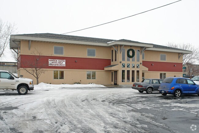
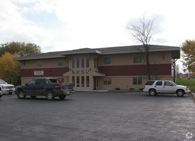
Property Record
118 W 6Th St, Monticello, MN 55362
NEARBY LISTINGS FOR SALE OR LEASE
Property Detail
118 W 6Th St
Minneapolis/St Paul
Original Plat Monticello
Minneapolis-St. Paul-Bloomington, MN-WI
SECT-11 TWP-121 RANGE-025 ORIGINAL PLAT MONTICELLO LOT-009 BLOCK-005 LTS 9&10 BLK 5 LOCK-005 LTS 9&10 BLK 5
155-010-005090
Wright
Officebuilding
Minnesota
0
9
2025
0.49 AC
100203
Wright County
2,912 SF
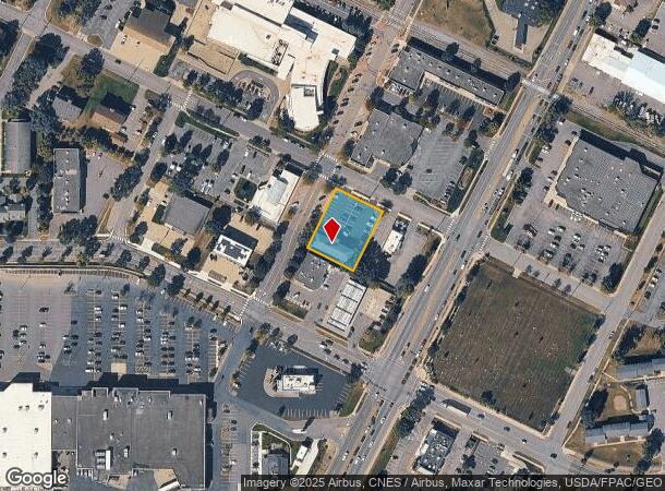
DEMOGRAPHICS near 118 W 6Th St
1 Mile
3 Mile
5 Mile
2024 Total Population
4,521
20,207
33,833
2029 Population
5,017
22,415
37,369
Pop Growth 2024-2029
+ 10.97%
+ 10.93%
+ 10.45%
Average Age
38
37
36
2024 Total Households
1,892
7,490
12,163
HH Growth 2024-2029
+ 11.15%
+ 11.03%
+ 10.56%
Median Household Inc
$60,209
$86,544
$91,710
Avg Household Size
2.30
2.60
2.70
2024 Avg HH Vehicles
2.00
2.00
2.00
Median Home Value
$251,049
$264,226
$266,277
Median Year Built
1987
1994
1994
Nearby Places
Map Layers
Map Styles
 Street
 Aerial
- Restaurants
- Banks
- Shops
- Fitness
- Groceries
PUBLIC TRANSPORTATION
COMMUTER RAIL
Big Lake Station (Northstar Corridor - Northstar Commuter Rail)
DRIVE
WALK
Distance
Big Lake Station (Northstar Corridor - Northstar Commuter Rail)
12 min
4.5 mi
Nearby Properties
Address
Land Use
TOTAL SIZE
Lot Size
Zoning
Address
Land Use
TOTAL SIZE
Lot Size
Zoning
284,950 SF
110.02 AC
Address
Land Use
TOTAL SIZE
Lot Size
Zoning
143,300 SF
10.73 AC
Address
Land Use
TOTAL SIZE
Lot Size
Zoning
259,284 SF
12.70 AC
Address
Land Use
TOTAL SIZE
Lot Size
Zoning
83,437 SF
6.40 AC
Address
Land Use
TOTAL SIZE
Lot Size
Zoning
30,281 SF
27.77 AC
Address
Land Use
TOTAL SIZE
Lot Size
Zoning
207,895 SF
26.76 AC
Address
Land Use
TOTAL SIZE
Lot Size
Zoning
88,227 SF
2.95 AC
Address
Land Use
TOTAL SIZE
Lot Size
Zoning
141,593 SF
18.15 AC
Address
Land Use
TOTAL SIZE
Lot Size
Zoning
119,837 SF
5.04 AC
Address
Land Use
TOTAL SIZE
Lot Size
Zoning
174,200 SF
14.09 AC
Address
Land Use
TOTAL SIZE
Lot Size
Zoning
165,248 SF
28.59 AC
Address
Land Use
TOTAL SIZE
Lot Size
Zoning
214,571 SF
26.90 AC
Address
Land Use
TOTAL SIZE
Lot Size
Zoning
15,300 SF
0.55 AC
Address
Land Use
TOTAL SIZE
Lot Size
Zoning
69,747 SF
2.08 AC
Address
Land Use
TOTAL SIZE
Lot Size
Zoning
50,900 SF
17.86 AC
Address
Land Use
TOTAL SIZE
Lot Size
Zoning
1,800 SF
1.33 AC
Address
Land Use
TOTAL SIZE
Lot Size
Zoning
88,970 SF
12.79 AC
Address
Land Use
TOTAL SIZE
Lot Size
Zoning
69,500 SF
3.50 AC
Address
Land Use
TOTAL SIZE
Lot Size
Zoning
58,898 SF
0.78 AC
Address
Land Use
TOTAL SIZE
Lot Size
Zoning
1.22 AC
Address
Land Use
TOTAL SIZE
Lot Size
Zoning
105,255 SF
10.39 AC
Address
Land Use
TOTAL SIZE
Lot Size
Zoning
720 SF
52.42 AC
Address
Land Use
TOTAL SIZE
Lot Size
Zoning
60,432 SF
0.76 AC
Address
Land Use
TOTAL SIZE
Lot Size
Zoning
12,960 SF
3.81 AC
Address
Land Use
TOTAL SIZE
Lot Size
Zoning
13,200 SF
57.14 AC
I
Address
Land Use
TOTAL SIZE
Lot Size
Zoning
4.50 AC
Address
Land Use
TOTAL SIZE
Lot Size
Zoning
10.35 AC
Address
Land Use
TOTAL SIZE
Lot Size
Zoning
108,986 SF
9.39 AC
Address
Land Use
TOTAL SIZE
Lot Size
Zoning
65,671 SF
4.68 AC
Address
Land Use
TOTAL SIZE
Lot Size
Zoning
76,164 SF
6.28 AC
The World's #1 Commercial Real Estate Marketplace
Connect with us
© 2025 CoStar Group
The information above has been obtained from sources believed reliable. While we do not doubt its accuracy we have not verified it and make no guarantee, warranty or representation about it. It is your responsibility to independently confirm its accuracy and completeness. Any projections, opinions, assumptions, or estimates used are for example only and do not represent the current or future performance of the property. The value of this transaction to you depends on tax and other factors which should be evaluated by your tax, financial, and legal advisors. You and your advisors should conduct a careful, independent investigation of the property to determine to your satisfaction the suitability of the property for your needs.