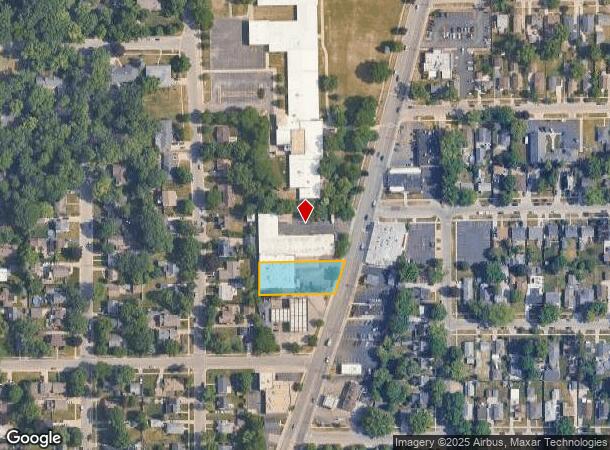
Property Record
1170 Dundee Ave, Elgin, IL 60120

NEARBY LISTINGS FOR SALE OR LEASE
Property Detail
1170 Dundee Ave
Chicago-Naperville-Elgin, IL-IN
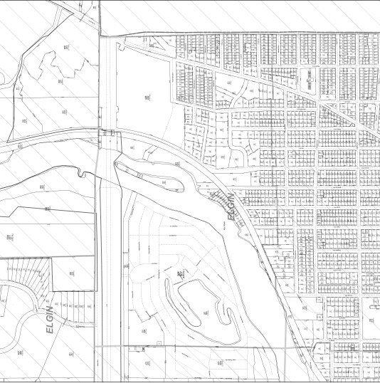
Riverside Park Addn
06-01-479-016
RIVERSIDE PARK ADDN LOT 4 (EXCEPT SOUTH 36.46 FT)
Commercialnec
Kane
X
Illinois
17089C0167H
4
2024
0.53 AC
2024
Far Northwest
850800
Chicago
19,584 SF
DEMOGRAPHICS near 1170 Dundee Ave
1 Mile
3 Mile
5 Mile
2024 Total Population
14,890
91,889
174,256
2029 Population
14,653
90,862
172,207
Pop Growth 2024-2029
(1.59%)
(1.12%)
(1.18%)
Average Age
38
38
39
2024 Total Households
4,947
31,263
59,406
HH Growth 2024-2029
(1.78%)
(1.22%)
(1.31%)
Median Household Inc
$76,970
$76,210
$83,780
Avg Household Size
2.80
2.80
2.80
2024 Avg HH Vehicles
2.00
2.00
2.00
Median Home Value
$198,653
$214,218
$240,734
Median Year Built
1964
1970
1978
Nearby Places
Map Layers
Map Styles
 Street
 Aerial
- Restaurants
- Banks
- Shops
- Fitness
- Groceries
PUBLIC TRANSPORTATION
COMMUTER RAIL
Elgin Station (Milwaukee District West Line - Northeast Illinois Regional Commuter Railroad (Metra))
DRIVE
WALK
Distance
Elgin Station (Milwaukee District West Line - Northeast Illinois Regional Commuter Railroad (Metra))
4 min
2.2 mi
National Street Station (Milwaukee District West Line - Northeast Illinois Regional Commuter Railroad (Metra))
DRIVE
WALK
Distance
National Street Station (Milwaukee District West Line - Northeast Illinois Regional Commuter Railroad (Metra))
7 min
2.9 mi
AIRPORT
Chicago O'Hare International
DRIVE
WALK
Distance
Chicago O'Hare International
30 min
24.8 mi
Freight Ports
Port Milwaukee
DRIVE
WALK
Distance
Port Milwaukee
109 min
81.1 mi
Nearby Properties
Address
Land Use
TOTAL SIZE
Lot Size
Zoning
Address
Land Use
TOTAL SIZE
Lot Size
Zoning
551,248 SF
28.94 AC
Address
Land Use
TOTAL SIZE
Lot Size
Zoning
23.54 AC
Address
Land Use
TOTAL SIZE
Lot Size
Zoning
27.33 AC
Address
Land Use
TOTAL SIZE
Lot Size
Zoning
108.60 AC
Address
Land Use
TOTAL SIZE
Lot Size
Zoning
51,091 SF
3.52 AC
Address
Land Use
TOTAL SIZE
Lot Size
Zoning
431,318 SF
20 AC
Address
Land Use
TOTAL SIZE
Lot Size
Zoning
Address
Land Use
TOTAL SIZE
Lot Size
Zoning
Address
Land Use
TOTAL SIZE
Lot Size
Zoning
35,808 SF
11.40 AC
Address
Land Use
TOTAL SIZE
Lot Size
Zoning
Address
Land Use
TOTAL SIZE
Lot Size
Zoning
176,799 SF
10 AC
Address
Land Use
TOTAL SIZE
Lot Size
Zoning
193,288 SF
16.24 AC
Address
Land Use
TOTAL SIZE
Lot Size
Zoning
38,550 SF
0.60 AC
Address
Land Use
TOTAL SIZE
Lot Size
Zoning
93,341 SF
3.67 AC
Address
Land Use
TOTAL SIZE
Lot Size
Zoning
71,725 SF
49.30 AC
Address
Land Use
TOTAL SIZE
Lot Size
Zoning
10.03 AC
Address
Land Use
TOTAL SIZE
Lot Size
Zoning
130,050 SF
12.64 AC
Address
Land Use
TOTAL SIZE
Lot Size
Zoning
Address
Land Use
TOTAL SIZE
Lot Size
Zoning
154,483 SF
10 AC
Address
Land Use
TOTAL SIZE
Lot Size
Zoning
Address
Land Use
TOTAL SIZE
Lot Size
Zoning
Address
Land Use
TOTAL SIZE
Lot Size
Zoning
126,314 SF
11.58 AC
Address
Land Use
TOTAL SIZE
Lot Size
Zoning
137,500 SF
12.51 AC
Address
Land Use
TOTAL SIZE
Lot Size
Zoning
123,844 SF
11.51 AC
Address
Land Use
TOTAL SIZE
Lot Size
Zoning
151,977 SF
7 AC
Address
Land Use
TOTAL SIZE
Lot Size
Zoning
227,125 SF
2.79 AC
Address
Land Use
TOTAL SIZE
Lot Size
Zoning
193,530 SF
0.57 AC
Address
Land Use
TOTAL SIZE
Lot Size
Zoning
120,075 SF
10.70 AC
The World's #1 Commercial Real Estate Marketplace
Connect with us
© 2026 CoStar Group
The information above has been obtained from sources believed reliable. While we do not doubt its accuracy we have not verified it and make no guarantee, warranty or representation about it. It is your responsibility to independently confirm its accuracy and completeness. Any projections, opinions, assumptions, or estimates used are for example only and do not represent the current or future performance of the property. The value of this transaction to you depends on tax and other factors which should be evaluated by your tax, financial, and legal advisors. You and your advisors should conduct a careful, independent investigation of the property to determine to your satisfaction the suitability of the property for your needs.