Property Record
1180 Keane Ave, Naples, FL 34117

Property Detail
1180 Keane Ave
00330160005
29 49 27 N 30FT OF SW 1/4 OF NW 1/4 OF NE 1/4 AND NW 1/4 OF NW 1/4 OF NE 1/4
Livestock
Collier
A
Florida
AH Areas with a 1% annual chance of shallow flooding, usually in the form of a pond, withan average depth ranging from 1 to 3 feet. These areas have a 26% chance of flooding over the life of a 30-year mortgage.
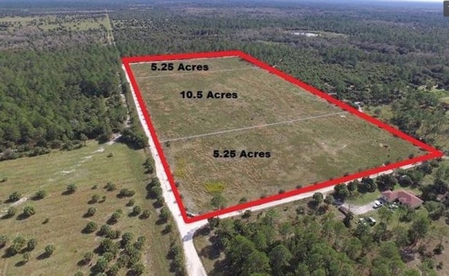
10.45 AC
2024
Outlying Collier County
2025
Southwest Florida
010428
Naples-Marco Island, FL
26,132 SF
NEARBY LISTINGS FOR SALE OR LEASE
DEMOGRAPHICS near 1180 Keane Ave
1 mile
3 mile
5 mile
2025 Total Population
116
4,760
35,234
2030 Population
123
4,936
36,689
Pop Growth 2025-2030
+ 6.03%
+ 3.70%
+ 4.13%
Average Age
40
40
41
2025 Total Households
39
1,514
11,789
HH Growth 2025-2030
+ 5.13%
+ 2.58%
+ 3.58%
Median Household Inc
$45,714
$115,379
$84,067
Avg Household Size
2.70
2.90
2.80
2025 Avg HH Vehicles
2.00
2.00
2.00
Median Home Value
$333,333
$456,902
$462,126
Median Year Built
2000
1996
1994
Nearby Places
Map Layers
Map Styles
 Street
 Aerial
Layers
 Traffic
 Biking
Places
Listings with unknown addresses are not visible on the map
- Restaurants
- Banks
- Shops
- Fitness
- Groceries
PUBLIC TRANSPORTATION
AIRPORT
Southwest Florida International
Drive
Walk
Distance
Southwest Florida International
54 min
35.5 mi
Freight Ports
Port Everglades
Drive
Walk
Distance
Port Everglades
131 min
105.9 mi
SALE & LEASE HISTORY
LISTING DATE
SALE/LEASE

Jan 25, 2018
For Sale
Nearby Properties
Address
Land Use
TOTAL SIZE
Lot Size
Zoning
Address
Land Use
TOTAL SIZE
Lot Size
Zoning
40,869 SF
67.93 AC
Address
Land Use
TOTAL SIZE
Lot Size
Zoning
18,044 SF
310.97 AC
A
Address
Land Use
TOTAL SIZE
Lot Size
Zoning
128.05 AC
Address
Land Use
TOTAL SIZE
Lot Size
Zoning
5,751 SF
0.24 AC
NAPLES
Address
Land Use
TOTAL SIZE
Lot Size
Zoning
199.51 AC
A
Address
Land Use
TOTAL SIZE
Lot Size
Zoning
260 AC
A
Address
Land Use
TOTAL SIZE
Lot Size
Zoning
120 SF
344 AC
A
Address
Land Use
TOTAL SIZE
Lot Size
Zoning
10,897 SF
105 AC
A
Address
Land Use
TOTAL SIZE
Lot Size
Zoning
12,492 SF
391.96 AC
PUD
Address
Land Use
TOTAL SIZE
Lot Size
Zoning
9,200 SF
27.72 AC
A
Address
Land Use
TOTAL SIZE
Lot Size
Zoning
9,929 SF
5 AC
A
Address
Land Use
TOTAL SIZE
Lot Size
Zoning
40,784 SF
8.26 AC
A
Address
Land Use
TOTAL SIZE
Lot Size
Zoning
11,240 SF
85 AC
A
Address
Land Use
TOTAL SIZE
Lot Size
Zoning
20.03 AC
Address
Land Use
TOTAL SIZE
Lot Size
Zoning
70 AC
A
Address
Land Use
TOTAL SIZE
Lot Size
Zoning
5,950 SF
5 AC
A
Address
Land Use
TOTAL SIZE
Lot Size
Zoning
852 SF
14.55 AC
A
Address
Land Use
TOTAL SIZE
Lot Size
Zoning
5,532 SF
2.48 AC
A
Address
Land Use
TOTAL SIZE
Lot Size
Zoning
3,272 SF
20 AC
A
Address
Land Use
TOTAL SIZE
Lot Size
Zoning
4,990 SF
5.23 AC
E
Address
Land Use
TOTAL SIZE
Lot Size
Zoning
3,871 SF
7.63 AC
A
Address
Land Use
TOTAL SIZE
Lot Size
Zoning
Address
Land Use
TOTAL SIZE
Lot Size
Zoning
3,408 SF
5 AC
A
Address
Land Use
TOTAL SIZE
Lot Size
Zoning
5,834 SF
6.85 AC
E
Address
Land Use
TOTAL SIZE
Lot Size
Zoning
4,901 SF
30 AC
A
Address
Land Use
TOTAL SIZE
Lot Size
Zoning
13,432 SF
9.55 AC
A
The World's #1 Commercial Real Estate Marketplace
Connect with us
© 2026 CoStar Group
The information above has been obtained from sources believed reliable. While we do not doubt its accuracy we have not verified it and make no guarantee, warranty or representation about it. It is your responsibility to independently confirm its accuracy and completeness. Any projections, opinions, assumptions, or estimates used are for example only and do not represent the current or future performance of the property. The value of this transaction to you depends on tax and other factors which should be evaluated by your tax, financial, and legal advisors. You and your advisors should conduct a careful, independent investigation of the property to determine to your satisfaction the suitability of the property for your needs.