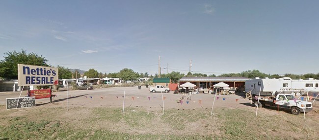
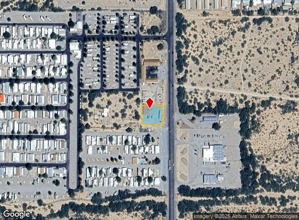
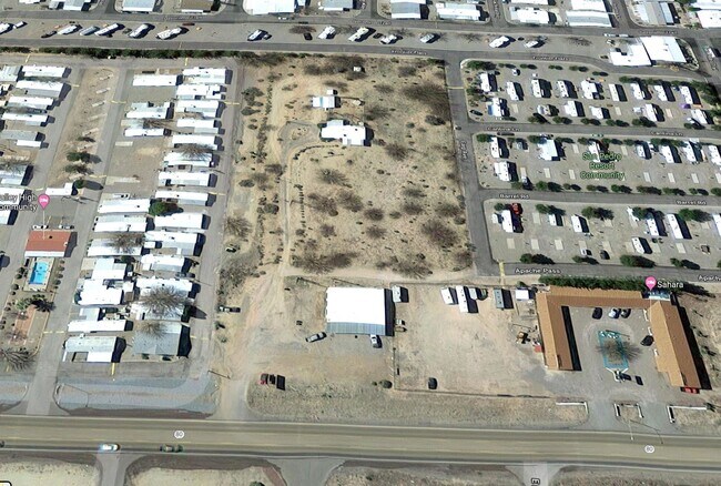
Property Record
1180 S Highway 80, Benson, AZ 85602
NEARBY LISTINGS FOR SALE OR LEASE
Property Detail
1180 S Highway 80
124-17-013
E BEG 1176.8E & 635S OF NW COR OF NE4 S100 RT CURVER & TAN 25 FOR 39.27 W125 N125 E150 TO BEG SEC 22 17 20 LESS .026AC TO STATE SEC 22-17-20 .404AC AFFIXED/2006 - 1985 48X60 SPACEMAST ER 95160A&B&C&D
Storemultistory
Cochise
X
Arizona
04003C1233F
0.40 AC
2024
Arizona SE & Sierra Vista Area
2025
Other Market Areas
000301
Sierra Vista-Douglas, AZ
2,880 SF
DEMOGRAPHICS near 1180 S Highway 80
1 Mile
3 Mile
5 Mile
2024 Total Population
1,506
5,833
8,806
2029 Population
1,590
6,075
9,062
Pop Growth 2024-2029
+ 5.58%
+ 4.15%
+ 2.91%
Average Age
53
50
49
2024 Total Households
717
2,777
4,022
HH Growth 2024-2029
+ 5.44%
+ 4.07%
+ 2.96%
Median Household Inc
$67,164
$51,603
$52,555
Avg Household Size
2.10
2.10
2.10
2024 Avg HH Vehicles
2.00
2.00
2.00
Median Home Value
$169,743
$137,939
$157,446
Median Year Built
1991
1987
1989
Nearby Places
Map Layers
Map Styles
 Street
 Aerial
- Restaurants
- Banks
- Shops
- Fitness
- Groceries
PUBLIC TRANSPORTATION
COMMUTER RAIL
Benson Amtrak (Sunset Limited - Amtrak, Texas Eagle - Amtrak)
DRIVE
WALK
Distance
Benson Amtrak (Sunset Limited - Amtrak, Texas Eagle - Amtrak)
3 min
1.9 mi
Freight Ports
Port of San Diego
DRIVE
WALK
Distance
Port of San Diego
486 min
457.0 mi
SALE & LEASE HISTORY
LISTING DATE
SALE/LEASE

May 03, 2021
For Sale
Jun 25, 2019
For Sale
Nearby Properties
Address
Land Use
TOTAL SIZE
Lot Size
Zoning
Address
Land Use
TOTAL SIZE
Lot Size
Zoning
98,040 SF
10.11 AC
Address
Land Use
TOTAL SIZE
Lot Size
Zoning
92,124 SF
8.87 AC
Address
Land Use
TOTAL SIZE
Lot Size
Zoning
13,260 SF
7.08 AC
Address
Land Use
TOTAL SIZE
Lot Size
Zoning
20,000 SF
8 AC
Address
Land Use
TOTAL SIZE
Lot Size
Zoning
7,395 SF
13.76 AC
Address
Land Use
TOTAL SIZE
Lot Size
Zoning
51,349 SF
6.58 AC
Address
Land Use
TOTAL SIZE
Lot Size
Zoning
19,143 SF
128.10 AC
Address
Land Use
TOTAL SIZE
Lot Size
Zoning
36,165 SF
2.20 AC
Address
Land Use
TOTAL SIZE
Lot Size
Zoning
42,726 SF
5.07 AC
Address
Land Use
TOTAL SIZE
Lot Size
Zoning
24,894 SF
20.05 AC
Address
Land Use
TOTAL SIZE
Lot Size
Zoning
22,060 SF
15.60 AC
Address
Land Use
TOTAL SIZE
Lot Size
Zoning
33,645 SF
3.21 AC
Address
Land Use
TOTAL SIZE
Lot Size
Zoning
41,677 SF
3.51 AC
Address
Land Use
TOTAL SIZE
Lot Size
Zoning
24,990 SF
3 AC
TR36
Address
Land Use
TOTAL SIZE
Lot Size
Zoning
28,583 SF
2.51 AC
Address
Land Use
TOTAL SIZE
Lot Size
Zoning
0.96 AC
Address
Land Use
TOTAL SIZE
Lot Size
Zoning
12,000 SF
1.38 AC
Address
Land Use
TOTAL SIZE
Lot Size
Zoning
3,802 SF
0.60 AC
Address
Land Use
TOTAL SIZE
Lot Size
Zoning
3,551 SF
0.10 AC
Address
Land Use
TOTAL SIZE
Lot Size
Zoning
2,601 SF
27.50 AC
Address
Land Use
TOTAL SIZE
Lot Size
Zoning
13,034 SF
1.48 AC
Address
Land Use
TOTAL SIZE
Lot Size
Zoning
8,907 SF
0.71 AC
Address
Land Use
TOTAL SIZE
Lot Size
Zoning
10,120 SF
Address
Land Use
TOTAL SIZE
Lot Size
Zoning
20,271 SF
2.20 AC
Address
Land Use
TOTAL SIZE
Lot Size
Zoning
45,160 SF
2.59 AC
Address
Land Use
TOTAL SIZE
Lot Size
Zoning
14,109 SF
10 AC
Address
Land Use
TOTAL SIZE
Lot Size
Zoning
8,568 SF
2.01 AC
Address
Land Use
TOTAL SIZE
Lot Size
Zoning
6,969 SF
5 AC
Address
Land Use
TOTAL SIZE
Lot Size
Zoning
15,383 SF
1.42 AC
Address
Land Use
TOTAL SIZE
Lot Size
Zoning
3,543 SF
0.87 AC
The World's #1 Commercial Real Estate Marketplace
Connect with us
© 2025 CoStar Group
The information above has been obtained from sources believed reliable. While we do not doubt its accuracy we have not verified it and make no guarantee, warranty or representation about it. It is your responsibility to independently confirm its accuracy and completeness. Any projections, opinions, assumptions, or estimates used are for example only and do not represent the current or future performance of the property. The value of this transaction to you depends on tax and other factors which should be evaluated by your tax, financial, and legal advisors. You and your advisors should conduct a careful, independent investigation of the property to determine to your satisfaction the suitability of the property for your needs.