Property Record
11810 E Washington St, Indianapolis, IN 46229


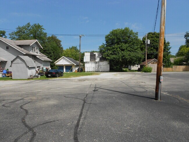
Property Detail
11810 E Washington St
49-09-03-129-010.000-724
FULLERS EAST ADD TO CUMBERLAND L6 B1 EX 21FTE SIDE
Storebuilding
Marion
ZO01
Indiana
B and X Area of moderate flood hazard, usually the area between the limits of the 100-year and 500-year floods.
6
2024
0.09 AC
2025
Lawrence/East County
360501
Indianapolis
1,000 SF
Indianapolis-Carmel-Greenwood, IN
NEARBY LISTINGS FOR SALE OR LEASE
DEMOGRAPHICS near 11810 E Washington St
1 mile
3 mile
5 mile
2025 Total Population
6,282
41,873
110,223
2030 Population
6,486
43,085
113,128
Pop Growth 2025-2030
+ 3.25%
+ 2.89%
+ 2.64%
Average Age
38
39
37
2025 Total Households
2,439
15,804
41,334
HH Growth 2025-2030
+ 3.44%
+ 2.94%
+ 2.70%
Median Household Inc
$77,535
$75,847
$67,193
Avg Household Size
2.60
2.60
2.60
2025 Avg HH Vehicles
2.00
2.00
2.00
Median Home Value
$195,109
$242,439
$230,741
Median Year Built
1991
1989
1978
Nearby Places
Map Layers
Map Styles
 Street
 Aerial
Layers
 Traffic
 Biking
Places
Listings with unknown addresses are not visible on the map
- Restaurants
- Banks
- Shops
- Fitness
- Groceries
PUBLIC TRANSPORTATION
AIRPORT
Indianapolis International
Drive
Walk
Distance
Indianapolis International
44 min
25.4 mi
SALE & LEASE HISTORY
LISTING DATE
SALE/LEASE

May 03, 2019
For Sale
Aug 10, 2020
For Sale
Nearby Properties
Address
Land Use
TOTAL SIZE
Lot Size
Zoning
Address
Land Use
TOTAL SIZE
Lot Size
Zoning
540,000 SF
33.78 AC
Address
Land Use
TOTAL SIZE
Lot Size
Zoning
4,379 SF
11.48 AC
ZO01
Address
Land Use
TOTAL SIZE
Lot Size
Zoning
200,806 SF
26.29 AC
Address
Land Use
TOTAL SIZE
Lot Size
Zoning
7,284 SF
17.31 AC
Address
Land Use
TOTAL SIZE
Lot Size
Zoning
5,560 SF
10.88 AC
ZO01
Address
Land Use
TOTAL SIZE
Lot Size
Zoning
170,000 SF
11.29 AC
ZO01
Address
Land Use
TOTAL SIZE
Lot Size
Zoning
169,094 SF
10.43 AC
ZO01
Address
Land Use
TOTAL SIZE
Lot Size
Zoning
5,620 SF
36.95 AC
ZO01
Address
Land Use
TOTAL SIZE
Lot Size
Zoning
140,976 SF
15.46 AC
ZO01
Address
Land Use
TOTAL SIZE
Lot Size
Zoning
213,102 SF
14.51 AC
Address
Land Use
TOTAL SIZE
Lot Size
Zoning
48,510 SF
3.09 AC
Address
Land Use
TOTAL SIZE
Lot Size
Zoning
234,064 SF
29.49 AC
ZO01
Address
Land Use
TOTAL SIZE
Lot Size
Zoning
4,202 SF
19.62 AC
Address
Land Use
TOTAL SIZE
Lot Size
Zoning
76,456 SF
24.91 AC
Address
Land Use
TOTAL SIZE
Lot Size
Zoning
5,070 SF
13.62 AC
ZO01
Address
Land Use
TOTAL SIZE
Lot Size
Zoning
64,768 SF
7.08 AC
ZO01
Address
Land Use
TOTAL SIZE
Lot Size
Zoning
51,390 SF
40.43 AC
Address
Land Use
TOTAL SIZE
Lot Size
Zoning
103,032 SF
10.60 AC
Address
Land Use
TOTAL SIZE
Lot Size
Zoning
13,712 SF
26.10 AC
ZO01
Address
Land Use
TOTAL SIZE
Lot Size
Zoning
113,863 SF
13.60 AC
Address
Land Use
TOTAL SIZE
Lot Size
Zoning
107,656 SF
7.66 AC
Address
Land Use
TOTAL SIZE
Lot Size
Zoning
2,669 SF
16.29 AC
ZO01
Address
Land Use
TOTAL SIZE
Lot Size
Zoning
160,410 SF
13.71 AC
Address
Land Use
TOTAL SIZE
Lot Size
Zoning
76,663 SF
1.91 AC
ZO01
Address
Land Use
TOTAL SIZE
Lot Size
Zoning
15,008 SF
18.12 AC
ZO01
Address
Land Use
TOTAL SIZE
Lot Size
Zoning
121,697 SF
10.05 AC
ZO01
Address
Land Use
TOTAL SIZE
Lot Size
Zoning
2,784 SF
23 AC
ZO01
Address
Land Use
TOTAL SIZE
Lot Size
Zoning
36,501 SF
4.58 AC
Address
Land Use
TOTAL SIZE
Lot Size
Zoning
54,354 SF
5.11 AC
ZO01
Address
Land Use
TOTAL SIZE
Lot Size
Zoning
12,786 SF
24.78 AC
ZO01
The World's #1 Commercial Real Estate Marketplace
Connect with us
© 2026 CoStar Group
The information above has been obtained from sources believed reliable. While we do not doubt its accuracy we have not verified it and make no guarantee, warranty or representation about it. It is your responsibility to independently confirm its accuracy and completeness. Any projections, opinions, assumptions, or estimates used are for example only and do not represent the current or future performance of the property. The value of this transaction to you depends on tax and other factors which should be evaluated by your tax, financial, and legal advisors. You and your advisors should conduct a careful, independent investigation of the property to determine to your satisfaction the suitability of the property for your needs.