Property Record
11811 Peter Shane Way, Nokesville, VA 20181

NEARBY LISTINGS FOR SALE OR LEASE
-
-
View all Nokesville listings for sale on LoopNet.com
Property Detail
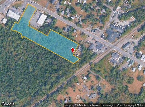
11811 Peter Shane Way
Washington-Arlington-Alexandria, DC-VA-MD-WV
PROPERTY OF JHG LLC LOT 2
7493-48-7881
Prince William
Vacantlandnec
Virginia
X
2
51061C0375D
0.95 AC
2024
Manassas
2025
Washington, DC
901417
DEMOGRAPHICS near 11811 Peter Shane Way
1 Mile
3 Mile
5 Mile
2024 Total Population
717
11,863
47,071
2029 Population
737
12,128
48,241
Pop Growth 2024-2029
+ 2.79%
+ 2.23%
+ 2.49%
Average Age
39
36
36
2024 Total Households
229
3,557
14,139
HH Growth 2024-2029
+ 3.06%
+ 2.28%
+ 2.56%
Median Household Inc
$140,530
$153,014
$149,985
Avg Household Size
3.10
3.30
3.20
2024 Avg HH Vehicles
3.00
2.00
2.00
Median Home Value
$707,516
$615,490
$570,173
Median Year Built
1986
2002
2003
Nearby Places
Map Layers
Map Styles
 Street
 Aerial
- Restaurants
- Banks
- Shops
- Fitness
- Groceries
PUBLIC TRANSPORTATION
COMMUTER RAIL
Lead (Manassas Line - Virginia Railway Express)
DRIVE
WALK
Distance
Lead (Manassas Line - Virginia Railway Express)
11 min
5.8 mi
Broad Run/Airport (Manassas Line - Virginia Railway Express)
DRIVE
WALK
Distance
Broad Run/Airport (Manassas Line - Virginia Railway Express)
11 min
5.8 mi
AIRPORT
Washington Dulles International
DRIVE
WALK
Distance
Washington Dulles International
45 min
27.9 mi
Freight Ports
Port of Baltimore
DRIVE
WALK
Distance
Port of Baltimore
104 min
78.3 mi
SALE & LEASE HISTORY
LISTING DATE
SALE/LEASE

Aug 23, 2018
For Sale
Nearby Properties
Address
Land Use
TOTAL SIZE
Lot Size
Zoning
Address
Land Use
TOTAL SIZE
Lot Size
Zoning
446,663 SF
92.79 AC
A1
Address
Land Use
TOTAL SIZE
Lot Size
Zoning
135,706 SF
18.91 AC
B1
Address
Land Use
TOTAL SIZE
Lot Size
Zoning
145,047 SF
48.16 AC
A1
Address
Land Use
TOTAL SIZE
Lot Size
Zoning
140,337 SF
36.42 AC
RPC
Address
Land Use
TOTAL SIZE
Lot Size
Zoning
174,634 SF
29.47 AC
A1
Address
Land Use
TOTAL SIZE
Lot Size
Zoning
85,852 SF
15.48 AC
RPC
Address
Land Use
TOTAL SIZE
Lot Size
Zoning
67 AC
PMR
Address
Land Use
TOTAL SIZE
Lot Size
Zoning
202.90 AC
M1
Address
Land Use
TOTAL SIZE
Lot Size
Zoning
168.68 AC
M1
Address
Land Use
TOTAL SIZE
Lot Size
Zoning
54,651 SF
25.05 AC
A1
Address
Land Use
TOTAL SIZE
Lot Size
Zoning
13,800 SF
10.48 AC
M1
Address
Land Use
TOTAL SIZE
Lot Size
Zoning
87.31 AC
M1
Address
Land Use
TOTAL SIZE
Lot Size
Zoning
11.70 AC
PMR
Address
Land Use
TOTAL SIZE
Lot Size
Zoning
20,834 SF
7.30 AC
A1
Address
Land Use
TOTAL SIZE
Lot Size
Zoning
10,340 SF
2.41 AC
B1
Address
Land Use
TOTAL SIZE
Lot Size
Zoning
5.73 AC
PMR
Address
Land Use
TOTAL SIZE
Lot Size
Zoning
10,000 SF
1.40 AC
RPC
Address
Land Use
TOTAL SIZE
Lot Size
Zoning
18.93 AC
B1
Address
Land Use
TOTAL SIZE
Lot Size
Zoning
12,578 SF
5.16 AC
PMR
Address
Land Use
TOTAL SIZE
Lot Size
Zoning
42,198 SF
10.13 AC
A1
Address
Land Use
TOTAL SIZE
Lot Size
Zoning
10,030 SF
1.48 AC
R4
Address
Land Use
TOTAL SIZE
Lot Size
Zoning
2,144 SF
46.26 AC
AGRICULTUR
Address
Land Use
TOTAL SIZE
Lot Size
Zoning
15,376 SF
10.47 AC
A1
Address
Land Use
TOTAL SIZE
Lot Size
Zoning
9,297 SF
125.63 AC
A1
Address
Land Use
TOTAL SIZE
Lot Size
Zoning
960 SF
128 AC
A1
Address
Land Use
TOTAL SIZE
Lot Size
Zoning
1,053 SF
97.07 AC
A1
Address
Land Use
TOTAL SIZE
Lot Size
Zoning
1,728 SF
91.06 AC
A1
Address
Land Use
TOTAL SIZE
Lot Size
Zoning
9,250 SF
1.06 AC
B1
Address
Land Use
TOTAL SIZE
Lot Size
Zoning
2,940 SF
1.62 AC
RPC
Address
Land Use
TOTAL SIZE
Lot Size
Zoning
5.32 AC
PMR
The World's #1 Commercial Real Estate Marketplace
Connect with us
© 2026 CoStar Group
The information above has been obtained from sources believed reliable. While we do not doubt its accuracy we have not verified it and make no guarantee, warranty or representation about it. It is your responsibility to independently confirm its accuracy and completeness. Any projections, opinions, assumptions, or estimates used are for example only and do not represent the current or future performance of the property. The value of this transaction to you depends on tax and other factors which should be evaluated by your tax, financial, and legal advisors. You and your advisors should conduct a careful, independent investigation of the property to determine to your satisfaction the suitability of the property for your needs.