Property Record
11815 N Tryon St, Charlotte, NC 28262


NEARBY LISTINGS FOR SALE OR LEASE
Property Detail
11815 N Tryon St
Charlotte
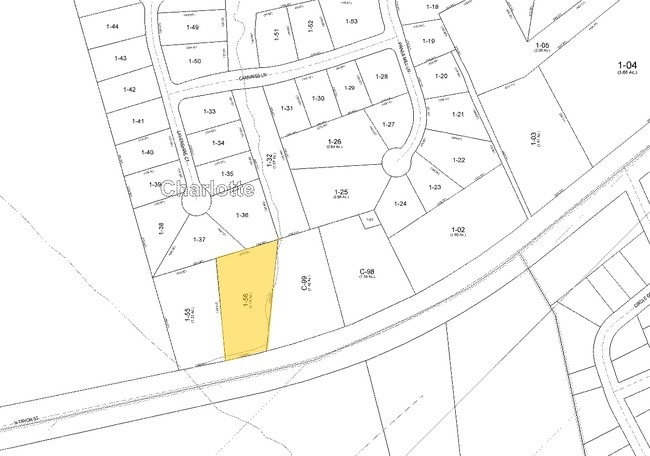
Hwy 29 Bus Park Map 01
Charlotte-Concord-Gastonia, NC-SC
Mecklenburg
029-371-55
North Carolina
Sfr
2.37 AC
X
University
3710458800K
DEMOGRAPHICS near 11815 N Tryon St
1 Mile
3 Mile
5 Mile
2024 Total Population
8,434
58,991
161,224
2029 Population
9,043
63,011
174,005
Pop Growth 2024-2029
+ 7.22%
+ 6.81%
+ 7.93%
Average Age
33
33
36
2024 Total Households
3,355
23,592
62,051
HH Growth 2024-2029
+ 7.30%
+ 6.74%
+ 7.45%
Median Household Inc
$64,592
$61,021
$77,089
Avg Household Size
2.50
2.40
2.50
2024 Avg HH Vehicles
2.00
2.00
2.00
Median Home Value
$279,061
$267,482
$288,388
Median Year Built
2004
2002
2001
Nearby Places
Map Layers
Map Styles
 Street
 Aerial
- Restaurants
- Banks
- Shops
- Fitness
- Groceries
PUBLIC TRANSPORTATION
AIRPORT
Concord-Padgett Regional
DRIVE
WALK
Distance
Concord-Padgett Regional
10 min
6.0 mi
Charlotte/Douglas International
DRIVE
WALK
Distance
Charlotte/Douglas International
32 min
20.9 mi
Freight Ports
North Charleston Terminal
DRIVE
WALK
Distance
North Charleston Terminal
245 min
213.1 mi
SALE & LEASE HISTORY
LISTING DATE
SALE/LEASE

Sep 24, 2016
For Sale
Mar 05, 2025
For Lease
Mar 05, 2025
For Sale
Jan 16, 2023
For Sale
Nearby Properties
Address
Land Use
TOTAL SIZE
Lot Size
Zoning
Address
Land Use
TOTAL SIZE
Lot Size
Zoning
701,530 SF
143.45 AC
C-2
Address
Land Use
TOTAL SIZE
Lot Size
Zoning
2,022,784 SF
654.80 AC
INST
Address
Land Use
TOTAL SIZE
Lot Size
Zoning
154,304 SF
857.72 AC
PID
Address
Land Use
TOTAL SIZE
Lot Size
Zoning
381,490 SF
29.24 AC
C-2
Address
Land Use
TOTAL SIZE
Lot Size
Zoning
1,532,477 SF
92.30 AC
RE1
Address
Land Use
TOTAL SIZE
Lot Size
Zoning
727,169 SF
6.07 AC
INST
Address
Land Use
TOTAL SIZE
Lot Size
Zoning
389,720 SF
33.83 AC
R12MFCD
Address
Land Use
TOTAL SIZE
Lot Size
Zoning
471,271 SF
24.30 AC
MUDD-O
Address
Land Use
TOTAL SIZE
Lot Size
Zoning
374,697 SF
12.46 AC
Address
Land Use
TOTAL SIZE
Lot Size
Zoning
324,349 SF
4.69 AC
C-2
Address
Land Use
TOTAL SIZE
Lot Size
Zoning
375,242 SF
25.64 AC
CC
Address
Land Use
TOTAL SIZE
Lot Size
Zoning
412,078 SF
27.46 AC
R17MFCD
Address
Land Use
TOTAL SIZE
Lot Size
Zoning
16,601 SF
7.42 AC
R-12MF(CD)
Address
Land Use
TOTAL SIZE
Lot Size
Zoning
26,733 SF
48.78 AC
C-2
Address
Land Use
TOTAL SIZE
Lot Size
Zoning
346,666 SF
26.53 AC
R17MFCD
Address
Land Use
TOTAL SIZE
Lot Size
Zoning
30,586 SF
54.10 AC
C-2
Address
Land Use
TOTAL SIZE
Lot Size
Zoning
347,856 SF
21.16 AC
R17MFCD
Address
Land Use
TOTAL SIZE
Lot Size
Zoning
284,360 SF
21.68 AC
R12MFCD
Address
Land Use
TOTAL SIZE
Lot Size
Zoning
57,268 SF
25.88 AC
C-2
Address
Land Use
TOTAL SIZE
Lot Size
Zoning
549,120 SF
5.29 AC
NS
Address
Land Use
TOTAL SIZE
Lot Size
Zoning
300,275 SF
20.78 AC
MX2
Address
Land Use
TOTAL SIZE
Lot Size
Zoning
497,811 SF
49.75 AC
RE2
Address
Land Use
TOTAL SIZE
Lot Size
Zoning
306,269 SF
9.44 AC
MUDD-O
Address
Land Use
TOTAL SIZE
Lot Size
Zoning
31,248 SF
21.72 AC
C-2
Address
Land Use
TOTAL SIZE
Lot Size
Zoning
333,498 SF
17.66 AC
R3
Address
Land Use
TOTAL SIZE
Lot Size
Zoning
306,583 SF
24.15 AC
Address
Land Use
TOTAL SIZE
Lot Size
Zoning
357,469 SF
49.75 AC
Address
Land Use
TOTAL SIZE
Lot Size
Zoning
276,596 SF
41.26 AC
Address
Land Use
TOTAL SIZE
Lot Size
Zoning
330,598 SF
20.29 AC
Address
Land Use
TOTAL SIZE
Lot Size
Zoning
260,820 SF
14.72 AC
R3
The World's #1 Commercial Real Estate Marketplace
Connect with us
© 2026 CoStar Group
The information above has been obtained from sources believed reliable. While we do not doubt its accuracy we have not verified it and make no guarantee, warranty or representation about it. It is your responsibility to independently confirm its accuracy and completeness. Any projections, opinions, assumptions, or estimates used are for example only and do not represent the current or future performance of the property. The value of this transaction to you depends on tax and other factors which should be evaluated by your tax, financial, and legal advisors. You and your advisors should conduct a careful, independent investigation of the property to determine to your satisfaction the suitability of the property for your needs.