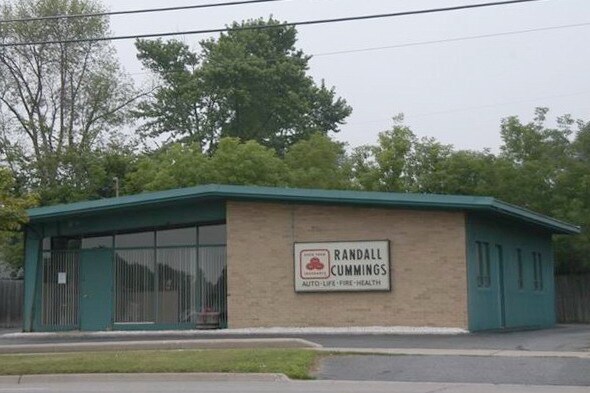
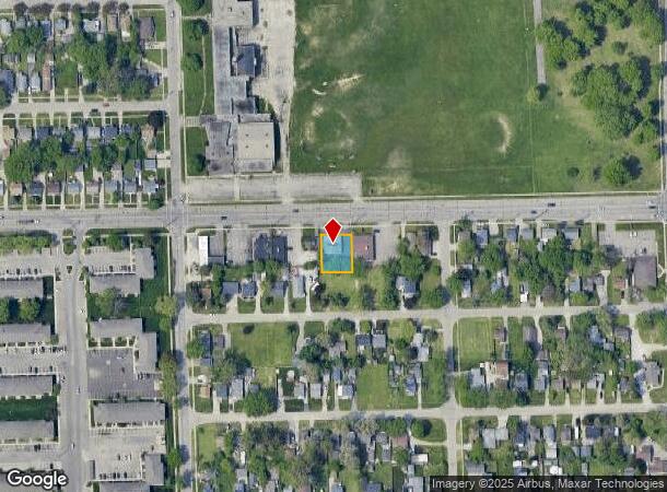
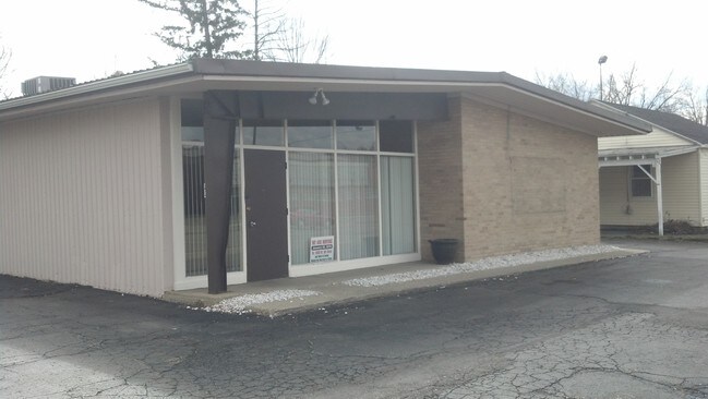
Property Record
1182 E Hemphill Rd, Burton, MI 48529
NEARBY LISTINGS FOR SALE OR LEASE
Property Detail
1182 E Hemphill Rd
Flint, MI
Baker Park
59-30-577-048
LOTS 581 AND 582 BAKER PARK
Commercialnec
Genesee
X
Michigan
26049C0306D
581-582
2024
0.19 AC
2025
Flint
011302
Detroit
1,620 SF
DEMOGRAPHICS near 1182 E Hemphill Rd
1 mile
3 mile
5 mile
2024 Total Population
6,887
56,459
140,757
2029 Population
6,793
55,633
140,077
Pop Growth 2024-2029
(1.36%)
(1.46%)
(0.48%)
Average Age
37
39
39
2024 Total Households
2,738
23,653
58,874
HH Growth 2024-2029
(1.46%)
(1.50%)
(0.56%)
Median Household Inc
$40,038
$40,435
$44,093
Avg Household Size
2.40
2.30
2.30
2024 Avg HH Vehicles
2.00
2.00
2.00
Median Home Value
$60,941
$90,697
$110,394
Median Year Built
1955
1960
1963
Nearby Places
Map Layers
Map Styles
 Street
 Aerial
Transit
 Traffic
 Biking
Places
Listings with unknown addresses are not visible on the map
- Restaurants
- Banks
- Shops
- Fitness
- Groceries
PUBLIC TRANSPORTATION
COMMUTER RAIL
Drive
Walk
Distance
8 min
4.0 mi
AIRPORT
Bishop International
Drive
Walk
Distance
Bishop International
21 min
8.1 mi
SALE & LEASE HISTORY
LISTING DATE
SALE/LEASE

Sep 24, 2016
For Sale
Nearby Properties
Address
Land Use
TOTAL SIZE
Lot Size
Zoning
Address
Land Use
TOTAL SIZE
Lot Size
Zoning
381,509 SF
371.45 AC
PC
Address
Land Use
TOTAL SIZE
Lot Size
Zoning
340,418 SF
45.65 AC
GC
Address
Land Use
TOTAL SIZE
Lot Size
Zoning
Address
Land Use
TOTAL SIZE
Lot Size
Zoning
247,329 SF
31.10 AC
MDM
Address
Land Use
TOTAL SIZE
Lot Size
Zoning
51.26 AC
HDM
Address
Land Use
TOTAL SIZE
Lot Size
Zoning
911,140 SF
Address
Land Use
TOTAL SIZE
Lot Size
Zoning
120,487 SF
5.81 AC
PRC
Address
Land Use
TOTAL SIZE
Lot Size
Zoning
45,095 SF
6.42 AC
GC
Address
Land Use
TOTAL SIZE
Lot Size
Zoning
130,291 SF
Address
Land Use
TOTAL SIZE
Lot Size
Zoning
227,755 SF
32.27 AC
C-2
Address
Land Use
TOTAL SIZE
Lot Size
Zoning
70,994 SF
8.89 AC
GC
Address
Land Use
TOTAL SIZE
Lot Size
Zoning
112,232 SF
196 AC
Address
Land Use
TOTAL SIZE
Lot Size
Zoning
144,896 SF
0.23 AC
DC
Address
Land Use
TOTAL SIZE
Lot Size
Zoning
115,556 SF
2.50 AC
DE
Address
Land Use
TOTAL SIZE
Lot Size
Zoning
100,000 SF
Address
Land Use
TOTAL SIZE
Lot Size
Zoning
58,648 SF
5.80 AC
OS
Address
Land Use
TOTAL SIZE
Lot Size
Zoning
60,613 SF
12.91 AC
RO
Address
Land Use
TOTAL SIZE
Lot Size
Zoning
100,750 SF
Address
Land Use
TOTAL SIZE
Lot Size
Zoning
9.88 AC
HDM
Address
Land Use
TOTAL SIZE
Lot Size
Zoning
68,571 SF
0.81 AC
DC
Address
Land Use
TOTAL SIZE
Lot Size
Zoning
118,750 SF
21.26 AC
C-3A
Address
Land Use
TOTAL SIZE
Lot Size
Zoning
246,759 SF
19.03 AC
CC
Address
Land Use
TOTAL SIZE
Lot Size
Zoning
24.38 AC
RM
Address
Land Use
TOTAL SIZE
Lot Size
Zoning
48,557 SF
2.99 AC
Address
Land Use
TOTAL SIZE
Lot Size
Zoning
225,506 SF
31.13 AC
CE
Address
Land Use
TOTAL SIZE
Lot Size
Zoning
364,289 SF
24.80 AC
GN-1
Address
Land Use
TOTAL SIZE
Lot Size
Zoning
41,508 SF
5.27 AC
OS
Address
Land Use
TOTAL SIZE
Lot Size
Zoning
236,340 SF
25.17 AC
CE
Address
Land Use
TOTAL SIZE
Lot Size
Zoning
11.22 AC
RM
Address
Land Use
TOTAL SIZE
Lot Size
Zoning
10,212 SF
2.60 AC
UC
The World's #1 Commercial Real Estate Marketplace
Connect with us
© 2026 CoStar Group
The information above has been obtained from sources believed reliable. While we do not doubt its accuracy we have not verified it and make no guarantee, warranty or representation about it. It is your responsibility to independently confirm its accuracy and completeness. Any projections, opinions, assumptions, or estimates used are for example only and do not represent the current or future performance of the property. The value of this transaction to you depends on tax and other factors which should be evaluated by your tax, financial, and legal advisors. You and your advisors should conduct a careful, independent investigation of the property to determine to your satisfaction the suitability of the property for your needs.