Property Record
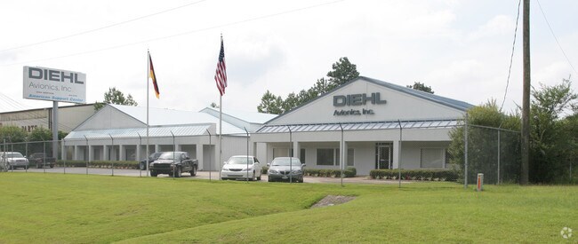
11825 Highway 280 E, Sterrett, AL 35147


Property Detail
11825 Highway 280 E
08-8-28-0-001-034-005
301.74'X492'IRR COMM NE COR NW1/4 SE1/4 SW ALG SAME 1361.89 FT TO POB E 301.74' S 492'(S) W 300' N 461'(S) TO POB LESS RD ROW
Autorepair
SHELBY
B and X Area of moderate flood hazard, usually the area between the limits of the 100-year and 500-year floods.
Alabama
2025
3.27 AC
2025
Chelsea/Harpersville
030219
Birmingham
5,000 SF
Birmingham, AL
NEARBY LISTINGS FOR SALE OR LEASE
DEMOGRAPHICS near 11825 Highway 280 E
1 mile
3 mile
5 mile
2025 Total Population
740
6,577
12,497
2030 Population
787
7,003
13,290
Pop Growth 2025-2030
+ 6.35%
+ 6.48%
+ 6.35%
Average Age
41
40
40
2025 Total Households
278
2,436
4,622
HH Growth 2025-2030
+ 6.47%
+ 6.53%
+ 6.38%
Median Household Inc
$95,246
$97,890
$94,607
Avg Household Size
2.60
2.70
2.70
2025 Avg HH Vehicles
2.00
2.00
2.00
Median Home Value
$349,074
$360,504
$344,991
Median Year Built
2005
2006
2006
Nearby Places
Map Layers
Map Styles
 Street
 Aerial
Layers
 Traffic
 Biking
Places
Listings with unknown addresses are not visible on the map
- Restaurants
- Banks
- Shops
- Fitness
- Groceries
PUBLIC TRANSPORTATION
AIRPORT
Birmingham-Shuttlesworth International
Drive
Walk
Distance
Birmingham-Shuttlesworth International
39 min
27.5 mi
Freight Ports
Port of Mobile
Drive
Walk
Distance
Port of Mobile
285 min
255.2 mi
Nearby Properties
Address
Land Use
TOTAL SIZE
Lot Size
Zoning
Address
Land Use
TOTAL SIZE
Lot Size
Zoning
134,494 SF
16 AC
Address
Land Use
TOTAL SIZE
Lot Size
Zoning
15,366 SF
15 AC
Address
Land Use
TOTAL SIZE
Lot Size
Zoning
17,199 SF
10 AC
Address
Land Use
TOTAL SIZE
Lot Size
Zoning
6,930 SF
2.42 AC
Address
Land Use
TOTAL SIZE
Lot Size
Zoning
4,961 SF
21 AC
Address
Land Use
TOTAL SIZE
Lot Size
Zoning
720 SF
88 AC
Address
Land Use
TOTAL SIZE
Lot Size
Zoning
14,216 SF
4.60 AC
Address
Land Use
TOTAL SIZE
Lot Size
Zoning
4,000 SF
5.03 AC
Address
Land Use
TOTAL SIZE
Lot Size
Zoning
10,500 SF
4.70 AC
Address
Land Use
TOTAL SIZE
Lot Size
Zoning
16,450 SF
10 AC
Address
Land Use
TOTAL SIZE
Lot Size
Zoning
Address
Land Use
TOTAL SIZE
Lot Size
Zoning
13,759 SF
1.70 AC
Address
Land Use
TOTAL SIZE
Lot Size
Zoning
3,120 SF
2.97 AC
Address
Land Use
TOTAL SIZE
Lot Size
Zoning
9,037 SF
1.21 AC
Address
Land Use
TOTAL SIZE
Lot Size
Zoning
12,100 SF
2.50 AC
Address
Land Use
TOTAL SIZE
Lot Size
Zoning
Address
Land Use
TOTAL SIZE
Lot Size
Zoning
2,254 SF
8.60 AC
Address
Land Use
TOTAL SIZE
Lot Size
Zoning
2,475 SF
1.82 AC
Address
Land Use
TOTAL SIZE
Lot Size
Zoning
7,000 SF
5.10 AC
Address
Land Use
TOTAL SIZE
Lot Size
Zoning
2,500 SF
2.40 AC
Address
Land Use
TOTAL SIZE
Lot Size
Zoning
1,988 SF
5 AC
Address
Land Use
TOTAL SIZE
Lot Size
Zoning
3,200 SF
1.96 AC
Address
Land Use
TOTAL SIZE
Lot Size
Zoning
5,440 SF
4.70 AC
Address
Land Use
TOTAL SIZE
Lot Size
Zoning
3,092 SF
3 AC
Address
Land Use
TOTAL SIZE
Lot Size
Zoning
Address
Land Use
TOTAL SIZE
Lot Size
Zoning
4,427 SF
5 AC
Address
Land Use
TOTAL SIZE
Lot Size
Zoning
6,000 SF
2.54 AC
The World's #1 Commercial Real Estate Marketplace
Connect with us
© 2026 CoStar Group
The information above has been obtained from sources believed reliable. While we do not doubt its accuracy we have not verified it and make no guarantee, warranty or representation about it. It is your responsibility to independently confirm its accuracy and completeness. Any projections, opinions, assumptions, or estimates used are for example only and do not represent the current or future performance of the property. The value of this transaction to you depends on tax and other factors which should be evaluated by your tax, financial, and legal advisors. You and your advisors should conduct a careful, independent investigation of the property to determine to your satisfaction the suitability of the property for your needs.