Property Record
11828 Us Highway 15-501, , NC


NEARBY LISTINGS FOR SALE OR LEASE
Property Detail
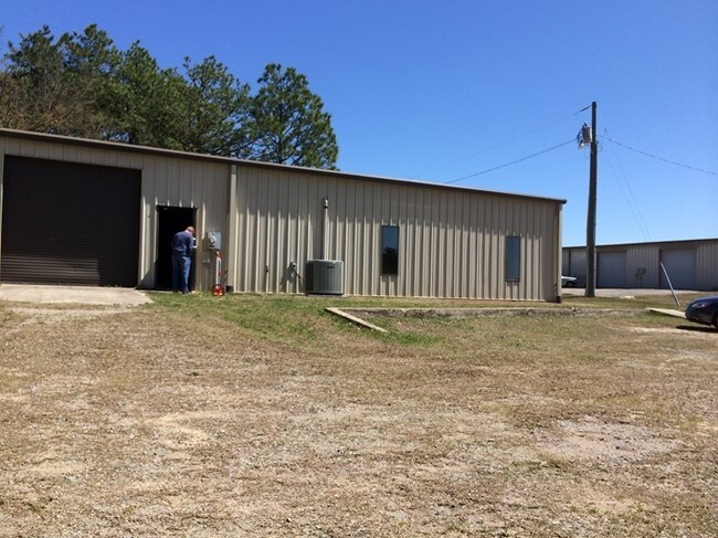
11828 Us Highway 15-501
Lightindustrial
RANSDELL LAND
X
Moore
3710847900J
North Carolina
2024
2.80 AC
2024
Other Market Areas
9511005078
Pinehurst-Southern Pines, NC
4,500 SF
8479-01-17-8487
DEMOGRAPHICS near 11828 Us Highway 15-501
1 Mile
3 Mile
5 Mile
2024 Total Population
1,721
13,924
32,956
2029 Population
2,025
16,059
38,048
Pop Growth 2024-2029
+ 17.66%
+ 15.33%
+ 15.45%
Average Age
38
39
42
2024 Total Households
624
5,667
14,344
HH Growth 2024-2029
+ 17.79%
+ 15.48%
+ 15.71%
Median Household Inc
$54,565
$60,210
$64,148
Avg Household Size
2.50
2.40
2.20
2024 Avg HH Vehicles
2.00
2.00
2.00
Median Home Value
$371,773
$257,403
$302,305
Median Year Built
1993
1997
1993
Nearby Places
Map Layers
Map Styles
 Street
 Aerial
- Restaurants
- Banks
- Shops
- Fitness
- Groceries
PUBLIC TRANSPORTATION
COMMUTER RAIL
DRIVE
WALK
Distance
9 min
5.3 mi
AIRPORT
Fayetteville Regional/Grannis Field
DRIVE
WALK
Distance
Fayetteville Regional/Grannis Field
59 min
40.1 mi
Nearby Properties
Address
Land Use
TOTAL SIZE
Lot Size
Zoning
Address
Land Use
TOTAL SIZE
Lot Size
Zoning
7,024 SF
9.05 AC
Address
Land Use
TOTAL SIZE
Lot Size
Zoning
22,772 SF
12.46 AC
HC
Address
Land Use
TOTAL SIZE
Lot Size
Zoning
83,896 SF
66.98 AC
R20
Address
Land Use
TOTAL SIZE
Lot Size
Zoning
8.15 AC
GC
Address
Land Use
TOTAL SIZE
Lot Size
Zoning
33,296 SF
11.23 AC
HC
Address
Land Use
TOTAL SIZE
Lot Size
Zoning
0.84 AC
GC
Address
Land Use
TOTAL SIZE
Lot Size
Zoning
9,690 SF
19.96 AC
HC
Address
Land Use
TOTAL SIZE
Lot Size
Zoning
23,472 SF
3.49 AC
GC
Address
Land Use
TOTAL SIZE
Lot Size
Zoning
Address
Land Use
TOTAL SIZE
Lot Size
Zoning
157,500 SF
10.01 AC
CI
Address
Land Use
TOTAL SIZE
Lot Size
Zoning
10,348 SF
6.14 AC
HC
Address
Land Use
TOTAL SIZE
Lot Size
Zoning
9,832 SF
1.71 AC
B3
Address
Land Use
TOTAL SIZE
Lot Size
Zoning
15,920 SF
18.06 AC
MULTI
Address
Land Use
TOTAL SIZE
Lot Size
Zoning
9,790 SF
40.16 AC
CI
Address
Land Use
TOTAL SIZE
Lot Size
Zoning
11,280 SF
6.91 AC
R6
Address
Land Use
TOTAL SIZE
Lot Size
Zoning
6,900 SF
21.62 AC
CI
Address
Land Use
TOTAL SIZE
Lot Size
Zoning
24,016 SF
8.61 AC
MULTI
Address
Land Use
TOTAL SIZE
Lot Size
Zoning
150,100 SF
11.98 AC
CI
Address
Land Use
TOTAL SIZE
Lot Size
Zoning
5,360 SF
67.09 AC
Address
Land Use
TOTAL SIZE
Lot Size
Zoning
1,428 SF
1.37 AC
HC
Address
Land Use
TOTAL SIZE
Lot Size
Zoning
14,399 SF
1.26 AC
HC
Address
Land Use
TOTAL SIZE
Lot Size
Zoning
2,400 SF
3.39 AC
MULTI
Address
Land Use
TOTAL SIZE
Lot Size
Zoning
936 SF
350.01 AC
RA
Address
Land Use
TOTAL SIZE
Lot Size
Zoning
Address
Land Use
TOTAL SIZE
Lot Size
Zoning
17,325 SF
2.72 AC
OI
Address
Land Use
TOTAL SIZE
Lot Size
Zoning
4,966 SF
215.74 AC
R20
Address
Land Use
TOTAL SIZE
Lot Size
Zoning
2,157 SF
6.79 AC
Address
Land Use
TOTAL SIZE
Lot Size
Zoning
3,400 SF
2.14 AC
HC
Address
Land Use
TOTAL SIZE
Lot Size
Zoning
1,476 SF
3.14 AC
HC
Address
Land Use
TOTAL SIZE
Lot Size
Zoning
36,452 SF
0.84 AC
GC
The World's #1 Commercial Real Estate Marketplace
Connect with us
© 2026 CoStar Group
The information above has been obtained from sources believed reliable. While we do not doubt its accuracy we have not verified it and make no guarantee, warranty or representation about it. It is your responsibility to independently confirm its accuracy and completeness. Any projections, opinions, assumptions, or estimates used are for example only and do not represent the current or future performance of the property. The value of this transaction to you depends on tax and other factors which should be evaluated by your tax, financial, and legal advisors. You and your advisors should conduct a careful, independent investigation of the property to determine to your satisfaction the suitability of the property for your needs.