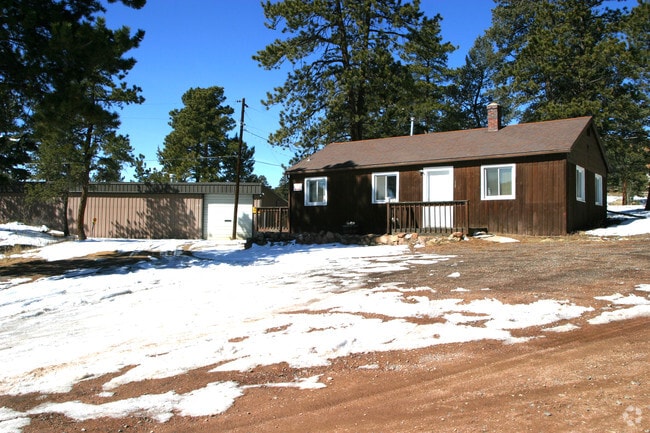
Property Record
11829 Us Highway 285, Conifer, CO 80433

Property Detail
11829 Us Highway 285
61-271-00-008
SECTION 27 TOWNSHIP 06 RANGE 71 QTR NE SIZE: 92826 VALUE: 2.131 KEY=018
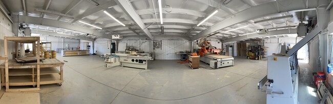
Commercialnec
Jefferson
C1
Colorado
B and X Area of moderate flood hazard, usually the area between the limits of the 100-year and 500-year floods.
2.13 AC
2023
West Denver
2025
Denver
012037
Denver-Aurora-Centennial, CO
4,760 SF
NEARBY LISTINGS FOR SALE OR LEASE
-
-
View all Conifer listings for sale on LoopNet.com
DEMOGRAPHICS near 11829 Us Highway 285
1 mile
3 mile
5 mile
2025 Total Population
775
5,344
12,125
2030 Population
772
5,333
12,177
Pop Growth 2025-2030
(0.39%)
(0.21%)
+ 0.43%
Average Age
46
47
46
2025 Total Households
311
2,166
4,931
HH Growth 2025-2030
(0.64%)
(0.28%)
+ 0.39%
Median Household Inc
$151,705
$131,976
$132,181
Avg Household Size
2.40
2.40
2.40
2025 Avg HH Vehicles
3.00
3.00
3.00
Median Home Value
$795,454
$773,298
$779,329
Median Year Built
1984
1983
1980
Nearby Places
Map Layers
Map Styles
 Street
 Aerial
Layers
 Traffic
 Biking
Places
Listings with unknown addresses are not visible on the map
- Restaurants
- Banks
- Shops
- Fitness
- Groceries
SALE & LEASE HISTORY
LISTING DATE
SALE/LEASE

Oct 07, 2021
For Sale
Dec 03, 2018
For Sale
Apr 13, 2022
For Sale
Nearby Properties
Address
Land Use
TOTAL SIZE
Lot Size
Zoning
Address
Land Use
TOTAL SIZE
Lot Size
Zoning
483.04 AC
A2
Address
Land Use
TOTAL SIZE
Lot Size
Zoning
159,469 SF
104.55 AC
A2
Address
Land Use
TOTAL SIZE
Lot Size
Zoning
205.11 AC
A2
Address
Land Use
TOTAL SIZE
Lot Size
Zoning
87,394 SF
7.32 AC
Address
Land Use
TOTAL SIZE
Lot Size
Zoning
173.19 AC
CO
Address
Land Use
TOTAL SIZE
Lot Size
Zoning
65,199 SF
1.78 AC
Address
Land Use
TOTAL SIZE
Lot Size
Zoning
55,436 SF
5.10 AC
PD
Address
Land Use
TOTAL SIZE
Lot Size
Zoning
12,076 SF
499.18 AC
A2
Address
Land Use
TOTAL SIZE
Lot Size
Zoning
50,801 SF
19.26 AC
R1
Address
Land Use
TOTAL SIZE
Lot Size
Zoning
14,822 SF
2.99 AC
PD
Address
Land Use
TOTAL SIZE
Lot Size
Zoning
52,794 SF
2.27 AC
PD
Address
Land Use
TOTAL SIZE
Lot Size
Zoning
17,509 SF
0.59 AC
Address
Land Use
TOTAL SIZE
Lot Size
Zoning
9,364 SF
9.44 AC
A1
Address
Land Use
TOTAL SIZE
Lot Size
Zoning
9,554 SF
1.50 AC
RC
Address
Land Use
TOTAL SIZE
Lot Size
Zoning
5,597 SF
1.61 AC
PD
Address
Land Use
TOTAL SIZE
Lot Size
Zoning
7,820 SF
0.33 AC
Address
Land Use
TOTAL SIZE
Lot Size
Zoning
5,926 SF
0.36 AC
Address
Land Use
TOTAL SIZE
Lot Size
Zoning
9,832 SF
1.61 AC
PD
Address
Land Use
TOTAL SIZE
Lot Size
Zoning
9,200 SF
1 AC
C1
Address
Land Use
TOTAL SIZE
Lot Size
Zoning
20,759 SF
5.82 AC
PD
Address
Land Use
TOTAL SIZE
Lot Size
Zoning
7,800 SF
3.11 AC
PD
Address
Land Use
TOTAL SIZE
Lot Size
Zoning
7,635 SF
1.16 AC
PD
Address
Land Use
TOTAL SIZE
Lot Size
Zoning
9,763 SF
0.97 AC
PD
Address
Land Use
TOTAL SIZE
Lot Size
Zoning
78.37 AC
A2
Address
Land Use
TOTAL SIZE
Lot Size
Zoning
9,256 SF
0.81 AC
PD
Address
Land Use
TOTAL SIZE
Lot Size
Zoning
4,728 SF
0.67 AC
C1
Address
Land Use
TOTAL SIZE
Lot Size
Zoning
13,436 SF
1.64 AC
C2
Address
Land Use
TOTAL SIZE
Lot Size
Zoning
8,097 SF
2.48 AC
RC
Address
Land Use
TOTAL SIZE
Lot Size
Zoning
10,511 SF
1 AC
Address
Land Use
TOTAL SIZE
Lot Size
Zoning
4,092 SF
0.98 AC
C1
The World's #1 Commercial Real Estate Marketplace
Connect with us
© 2026 CoStar Group
The information above has been obtained from sources believed reliable. While we do not doubt its accuracy we have not verified it and make no guarantee, warranty or representation about it. It is your responsibility to independently confirm its accuracy and completeness. Any projections, opinions, assumptions, or estimates used are for example only and do not represent the current or future performance of the property. The value of this transaction to you depends on tax and other factors which should be evaluated by your tax, financial, and legal advisors. You and your advisors should conduct a careful, independent investigation of the property to determine to your satisfaction the suitability of the property for your needs.