Property Record
11841 Us 64 Hwy E, Apex, NC 27523

NEARBY LISTINGS FOR SALE OR LEASE
Property Detail
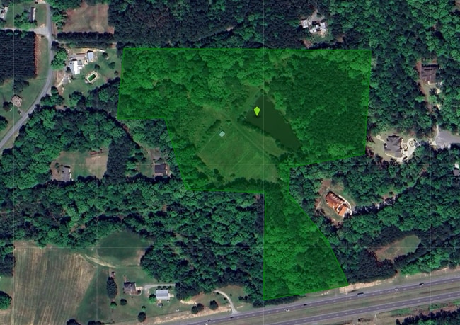
11841 Us 64 Hwy E
Durham-Chapel Hill, NC
South East New Hope
82304
Q5-59AB AC 18.41 BK 2015 PG 72
Realpropertynec
Chatham
X
North Carolina
3720070200K
18.41 AC
2025
Chatham County
2025
Raleigh/Durham
053426
DEMOGRAPHICS near 11841 Us 64 Hwy E
1 mile
3 mile
5 mile
2024 Total Population
320
3,071
34,685
2029 Population
362
3,531
39,239
Pop Growth 2024-2029
+ 13.13%
+ 14.98%
+ 13.13%
Average Age
46
40
37
2024 Total Households
132
1,123
11,687
HH Growth 2024-2029
+ 12.88%
+ 14.87%
+ 13.19%
Median Household Inc
$96,428
$132,717
$152,831
Avg Household Size
2.30
2.70
2.90
2024 Avg HH Vehicles
3.00
2.00
2.00
Median Home Value
$629,807
$604,969
$608,457
Median Year Built
1992
2008
2010
Nearby Places
Map Layers
Map Styles
 Street
 Aerial
Transit
 Traffic
 Biking
Places
Listings with unknown addresses are not visible on the map
- Restaurants
- Banks
- Shops
- Fitness
- Groceries
PUBLIC TRANSPORTATION
AIRPORT
Raleigh-Durham International
Drive
Walk
Distance
Raleigh-Durham International
29 min
19.9 mi
Freight Ports
Port of Wilmington
Drive
Walk
Distance
Port of Wilmington
178 min
152.3 mi
SALE & LEASE HISTORY
LISTING DATE
SALE/LEASE

Mar 05, 2024
For Lease
Dec 12, 2022
For Sale
Nearby Properties
Address
Land Use
TOTAL SIZE
Lot Size
Zoning
Address
Land Use
TOTAL SIZE
Lot Size
Zoning
1,704 SF
38,566.08 AC
R-5
Address
Land Use
TOTAL SIZE
Lot Size
Zoning
855.90 AC
R-80W
Address
Land Use
TOTAL SIZE
Lot Size
Zoning
174,645 SF
23.23 AC
LI-CZ
Address
Land Use
TOTAL SIZE
Lot Size
Zoning
189,429 SF
26.61 AC
PUD-C
Address
Land Use
TOTAL SIZE
Lot Size
Zoning
178,880 SF
55.35 AC
LI-CZ
Address
Land Use
TOTAL SIZE
Lot Size
Zoning
28,846 SF
10.20 AC
TF
Address
Land Use
TOTAL SIZE
Lot Size
Zoning
22,534 SF
20.01 AC
CD-RB
Address
Land Use
TOTAL SIZE
Lot Size
Zoning
39,040 SF
42.75 AC
CD-IL
Address
Land Use
TOTAL SIZE
Lot Size
Zoning
83.23 AC
M-1
Address
Land Use
TOTAL SIZE
Lot Size
Zoning
8,681 SF
31.68 AC
R-80W
Address
Land Use
TOTAL SIZE
Lot Size
Zoning
6,688 SF
19.51 AC
RR
Address
Land Use
TOTAL SIZE
Lot Size
Zoning
28,089 SF
16.40 AC
R-80W
Address
Land Use
TOTAL SIZE
Lot Size
Zoning
45.06 AC
PUD-C
Address
Land Use
TOTAL SIZE
Lot Size
Zoning
4,432 SF
41.02 AC
PUD-C
Address
Land Use
TOTAL SIZE
Lot Size
Zoning
10,756 SF
28.30 AC
R-1
Address
Land Use
TOTAL SIZE
Lot Size
Zoning
3,670 SF
58.97 AC
M-1
Address
Land Use
TOTAL SIZE
Lot Size
Zoning
1,705 SF
41.57 AC
R-80W
Address
Land Use
TOTAL SIZE
Lot Size
Zoning
39.71 AC
R-80W
Address
Land Use
TOTAL SIZE
Lot Size
Zoning
2,331 SF
56.57 AC
R-80W
Address
Land Use
TOTAL SIZE
Lot Size
Zoning
16,840 SF
25.72 AC
CD-RB
Address
Land Use
TOTAL SIZE
Lot Size
Zoning
11,539 SF
6.42 AC
R-1
Address
Land Use
TOTAL SIZE
Lot Size
Zoning
10,840 SF
3.91 AC
R-1
Address
Land Use
TOTAL SIZE
Lot Size
Zoning
2,014 SF
42.08 AC
R-80W
Address
Land Use
TOTAL SIZE
Lot Size
Zoning
16.42 AC
LI-CZ
Address
Land Use
TOTAL SIZE
Lot Size
Zoning
30.18 AC
R-80W
Address
Land Use
TOTAL SIZE
Lot Size
Zoning
3,680 SF
35.41 AC
R-80W
Address
Land Use
TOTAL SIZE
Lot Size
Zoning
2,343 SF
39.42 AC
RR
Address
Land Use
TOTAL SIZE
Lot Size
Zoning
40.60 AC
R-80W
Address
Land Use
TOTAL SIZE
Lot Size
Zoning
1,350 SF
38.11 AC
MH-NC
Address
Land Use
TOTAL SIZE
Lot Size
Zoning
1,104 SF
24.26 AC
PUD-C
The World's #1 Commercial Real Estate Marketplace
Connect with us
© 2026 CoStar Group
The information above has been obtained from sources believed reliable. While we do not doubt its accuracy we have not verified it and make no guarantee, warranty or representation about it. It is your responsibility to independently confirm its accuracy and completeness. Any projections, opinions, assumptions, or estimates used are for example only and do not represent the current or future performance of the property. The value of this transaction to you depends on tax and other factors which should be evaluated by your tax, financial, and legal advisors. You and your advisors should conduct a careful, independent investigation of the property to determine to your satisfaction the suitability of the property for your needs.