Property Record
11846 State Route 15, Montpelier, OH 43543

NEARBY LISTINGS FOR SALE OR LEASE
Property Detail
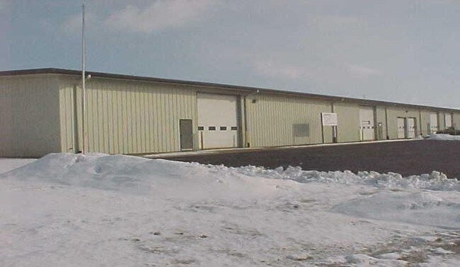
11846 State Route 15
073-080-00-013.000
R.3 T.7 S.8 TR.1 13.35AC EZ 12/18 $54,300 ABATED VAL ALLOCATED 065-01100-000
Truckterminal
Williams
2024
Ohio
2024
13.35 AC
950300
Ohio North Area
9,120 SF
Other Market Areas
DEMOGRAPHICS near 11846 State Route 15
1 Mile
3 Mile
5 Mile
2024 Total Population
263
4,556
6,897
2029 Population
258
4,534
6,834
Pop Growth 2024-2029
(1.90%)
(0.48%)
(0.91%)
Average Age
46
41
42
2024 Total Households
111
1,900
2,871
HH Growth 2024-2029
(2.70%)
(0.58%)
(0.98%)
Median Household Inc
$51,250
$44,177
$47,521
Avg Household Size
2.40
2.30
2.30
2024 Avg HH Vehicles
3.00
2.00
2.00
Median Home Value
$172,222
$97,993
$114,318
Median Year Built
1973
1956
1961
Nearby Places
Map Layers
Map Styles
 Street
 Aerial
- Restaurants
- Banks
- Shops
- Fitness
- Groceries
PUBLIC TRANSPORTATION
COMMUTER RAIL
Bryan Amtrak Station (Lake Shore Limited - Amtrak)
DRIVE
WALK
Distance
Bryan Amtrak Station (Lake Shore Limited - Amtrak)
11 min
7.4 mi
Freight Ports
Port of Toledo
DRIVE
WALK
Distance
Port of Toledo
82 min
63.5 mi
Nearby Properties
Address
Land Use
TOTAL SIZE
Lot Size
Zoning
Address
Land Use
TOTAL SIZE
Lot Size
Zoning
124,127 SF
38.02 AC
Address
Land Use
TOTAL SIZE
Lot Size
Zoning
34,300 SF
43.99 AC
Address
Land Use
TOTAL SIZE
Lot Size
Zoning
129,906 SF
54.48 AC
Address
Land Use
TOTAL SIZE
Lot Size
Zoning
168,613 SF
3.24 AC
Address
Land Use
TOTAL SIZE
Lot Size
Zoning
66,690 SF
6.75 AC
Address
Land Use
TOTAL SIZE
Lot Size
Zoning
49,647 SF
7.72 AC
Address
Land Use
TOTAL SIZE
Lot Size
Zoning
105,705 SF
28.42 AC
Address
Land Use
TOTAL SIZE
Lot Size
Zoning
49,812 SF
5 AC
Address
Land Use
TOTAL SIZE
Lot Size
Zoning
1,092 SF
52.35 AC
Address
Land Use
TOTAL SIZE
Lot Size
Zoning
60,000 SF
2.39 AC
Address
Land Use
TOTAL SIZE
Lot Size
Zoning
79,570 SF
23.32 AC
Address
Land Use
TOTAL SIZE
Lot Size
Zoning
100,000 SF
1.96 AC
Address
Land Use
TOTAL SIZE
Lot Size
Zoning
44.50 AC
Address
Land Use
TOTAL SIZE
Lot Size
Zoning
13,620 SF
3.46 AC
Address
Land Use
TOTAL SIZE
Lot Size
Zoning
29,277 SF
4.15 AC
Address
Land Use
TOTAL SIZE
Lot Size
Zoning
10,000 SF
19.87 AC
Address
Land Use
TOTAL SIZE
Lot Size
Zoning
17,840 SF
7.51 AC
Address
Land Use
TOTAL SIZE
Lot Size
Zoning
4,944 SF
2.71 AC
Address
Land Use
TOTAL SIZE
Lot Size
Zoning
25,960 SF
5.49 AC
Address
Land Use
TOTAL SIZE
Lot Size
Zoning
4,800 SF
1.52 AC
Address
Land Use
TOTAL SIZE
Lot Size
Zoning
38,200 SF
9.85 AC
Address
Land Use
TOTAL SIZE
Lot Size
Zoning
70,540 SF
15.58 AC
Address
Land Use
TOTAL SIZE
Lot Size
Zoning
31.75 AC
Address
Land Use
TOTAL SIZE
Lot Size
Zoning
12,400 SF
4.70 AC
Address
Land Use
TOTAL SIZE
Lot Size
Zoning
25,300 SF
3.97 AC
Address
Land Use
TOTAL SIZE
Lot Size
Zoning
1,498 SF
19.75 AC
Address
Land Use
TOTAL SIZE
Lot Size
Zoning
150.37 AC
Address
Land Use
TOTAL SIZE
Lot Size
Zoning
8,919 SF
0.90 AC
Address
Land Use
TOTAL SIZE
Lot Size
Zoning
164.53 AC
The World's #1 Commercial Real Estate Marketplace
Connect with us
© 2026 CoStar Group
The information above has been obtained from sources believed reliable. While we do not doubt its accuracy we have not verified it and make no guarantee, warranty or representation about it. It is your responsibility to independently confirm its accuracy and completeness. Any projections, opinions, assumptions, or estimates used are for example only and do not represent the current or future performance of the property. The value of this transaction to you depends on tax and other factors which should be evaluated by your tax, financial, and legal advisors. You and your advisors should conduct a careful, independent investigation of the property to determine to your satisfaction the suitability of the property for your needs.