Property Record
1185 Talbot Ave, Jacksonville, FL 32205


NEARBY LISTINGS FOR SALE OR LEASE
Property Detail
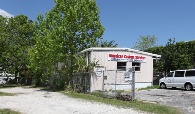
1185 Talbot Ave
Jacksonville, FL
Murray Hills Heights
061504-0010
5-86 20-2S-26E MURRAY HILL HEIGHTS LOT 10 BLK 46
Storebuilding
Duval
X
Florida
12031C0362J
10
2025
0.18 AC
2026
Riverside
002502
Jacksonville (Florida)
3,915 SF
DEMOGRAPHICS near 1185 Talbot Ave
1 Mile
3 Mile
5 Mile
2024 Total Population
14,974
73,241
197,904
2029 Population
15,674
77,153
209,202
Pop Growth 2024-2029
+ 4.67%
+ 5.34%
+ 5.71%
Average Age
40
39
39
2024 Total Households
7,374
32,231
82,525
HH Growth 2024-2029
+ 4.72%
+ 5.52%
+ 5.98%
Median Household Inc
$57,774
$48,878
$44,345
Avg Household Size
2.00
2.20
2.30
2024 Avg HH Vehicles
1.00
1.00
1.00
Median Home Value
$259,651
$214,539
$183,421
Median Year Built
1948
1955
1962
Nearby Places
Map Layers
Map Styles
 Street
 Aerial
- Restaurants
- Banks
- Shops
- Fitness
- Groceries
PUBLIC TRANSPORTATION
COMMUTER RAIL
DRIVE
WALK
Distance
12 min
5.4 mi
AIRPORT
Jacksonville International
DRIVE
WALK
Distance
Jacksonville International
27 min
17.7 mi
Freight Ports
Jacksonville Port
DRIVE
WALK
Distance
Jacksonville Port
14 min
8.1 mi
Nearby Properties
Address
Land Use
TOTAL SIZE
Lot Size
Zoning
Address
Land Use
TOTAL SIZE
Lot Size
Zoning
629,459 SF
10.33 AC
PUD
Address
Land Use
TOTAL SIZE
Lot Size
Zoning
187,278 SF
1.71 AC
CCBD
Address
Land Use
TOTAL SIZE
Lot Size
Zoning
744,280 SF
53.40 AC
RMD-D
Address
Land Use
TOTAL SIZE
Lot Size
Zoning
355,967 SF
8.98 AC
PUD
Address
Land Use
TOTAL SIZE
Lot Size
Zoning
700,443 SF
8 AC
CCBD
Address
Land Use
TOTAL SIZE
Lot Size
Zoning
264,277 SF
2.07 AC
CCBD
Address
Land Use
TOTAL SIZE
Lot Size
Zoning
299,055 SF
18.93 AC
CCBD
Address
Land Use
TOTAL SIZE
Lot Size
Zoning
290,975 SF
4.49 AC
PUD
Address
Land Use
TOTAL SIZE
Lot Size
Zoning
212,152 SF
8.17 AC
CCBD
Address
Land Use
TOTAL SIZE
Lot Size
Zoning
465,664 SF
21.27 AC
IL
Address
Land Use
TOTAL SIZE
Lot Size
Zoning
888,083 SF
46.65 AC
IL
Address
Land Use
TOTAL SIZE
Lot Size
Zoning
352,439 SF
3.40 AC
CCBD
Address
Land Use
TOTAL SIZE
Lot Size
Zoning
225,440 SF
4.68 AC
PUD
Address
Land Use
TOTAL SIZE
Lot Size
Zoning
222,138 SF
13.18 AC
IL
Address
Land Use
TOTAL SIZE
Lot Size
Zoning
184,092 SF
21.69 AC
CCG-1
Address
Land Use
TOTAL SIZE
Lot Size
Zoning
255,405 SF
1.91 AC
PUD
Address
Land Use
TOTAL SIZE
Lot Size
Zoning
594,573 SF
27.69 AC
IL
Address
Land Use
TOTAL SIZE
Lot Size
Zoning
290,599 SF
27.84 AC
RMD-D
Address
Land Use
TOTAL SIZE
Lot Size
Zoning
291,338 SF
37 AC
PBF-1
Address
Land Use
TOTAL SIZE
Lot Size
Zoning
147,066 SF
3.30 AC
PUD
Address
Land Use
TOTAL SIZE
Lot Size
Zoning
310,972 SF
19.91 AC
RMD-D
Address
Land Use
TOTAL SIZE
Lot Size
Zoning
233,363 SF
20.36 AC
PUD
Address
Land Use
TOTAL SIZE
Lot Size
Zoning
216,810 SF
4.24 AC
CCBD
Address
Land Use
TOTAL SIZE
Lot Size
Zoning
72,080 SF
4.19 AC
CCBD
Address
Land Use
TOTAL SIZE
Lot Size
Zoning
186,773 SF
9.77 AC
CCG-2
Address
Land Use
TOTAL SIZE
Lot Size
Zoning
100,600 SF
1.31 AC
PUD
Address
Land Use
TOTAL SIZE
Lot Size
Zoning
40,984 SF
2.33 AC
CCBD
Address
Land Use
TOTAL SIZE
Lot Size
Zoning
117,227 SF
14.32 AC
CCG-2
Address
Land Use
TOTAL SIZE
Lot Size
Zoning
129,506 SF
21.68 AC
CCG-2
Address
Land Use
TOTAL SIZE
Lot Size
Zoning
212,874 SF
3.38 AC
CCBD
The World's #1 Commercial Real Estate Marketplace
Connect with us
© 2026 CoStar Group
The information above has been obtained from sources believed reliable. While we do not doubt its accuracy we have not verified it and make no guarantee, warranty or representation about it. It is your responsibility to independently confirm its accuracy and completeness. Any projections, opinions, assumptions, or estimates used are for example only and do not represent the current or future performance of the property. The value of this transaction to you depends on tax and other factors which should be evaluated by your tax, financial, and legal advisors. You and your advisors should conduct a careful, independent investigation of the property to determine to your satisfaction the suitability of the property for your needs.