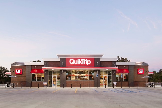
Property Record
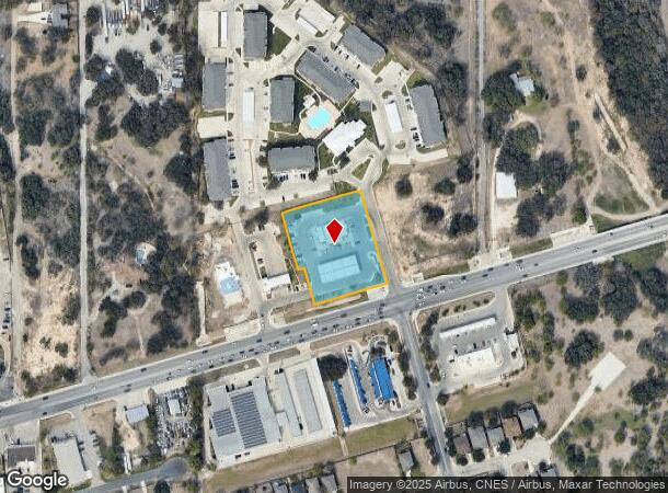
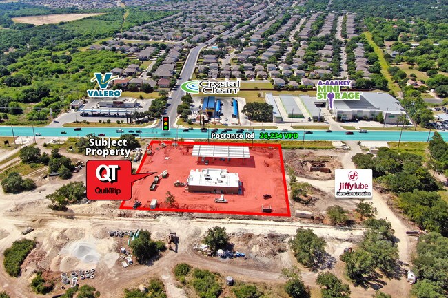
11873 Potranco Rd, San Antonio, TX 78253
NEARBY LISTINGS FOR SALE OR LEASE
Property Detail
11873 Potranco Rd
San Antonio-New Braunfels, TX
Cb 4363A ( 36.06 Acre Tract At Potranco/
04363-101-0050
CB 4363A ( 36.06 ACRE TRACT AT POTRANCO/AL ), BLOCK 1 LOT 5 2019-CREATED PER PLAT 20001/630-631 FILED 12-12-2018
Servicestation
Bexar
X
Texas
48325C0400D
5
2024
1.70 AC
2025
Far West
172003
San Antonio
44,840 SF
DEMOGRAPHICS near 11873 Potranco Rd
1 Mile
3 Mile
5 Mile
2024 Total Population
14,066
94,086
235,160
2029 Population
15,154
101,251
253,465
Pop Growth 2024-2029
+ 7.73%
+ 7.62%
+ 7.78%
Average Age
33
34
34
2024 Total Households
4,219
29,754
77,368
HH Growth 2024-2029
+ 7.92%
+ 7.66%
+ 7.97%
Median Household Inc
$105,580
$96,783
$83,492
Avg Household Size
3.30
3.10
3.00
2024 Avg HH Vehicles
2.00
2.00
2.00
Median Home Value
$241,346
$244,092
$236,389
Median Year Built
2006
2007
2007
Nearby Places
Map Layers
Map Styles
 Street
 Aerial
- Restaurants
- Banks
- Shops
- Fitness
- Groceries
PUBLIC TRANSPORTATION
AIRPORT
San Antonio International
DRIVE
WALK
Distance
San Antonio International
26 min
17.7 mi
Freight Ports
Port of Corpus Christi
DRIVE
WALK
Distance
Port of Corpus Christi
166 min
157.2 mi
SALE & LEASE HISTORY
LISTING DATE
SALE/LEASE

Jun 10, 2019
For Sale
Jun 03, 2019
For Sale
Jul 18, 2019
For Sale
Aug 07, 2019
For Sale
Nearby Properties
Address
Land Use
TOTAL SIZE
Lot Size
Zoning
Address
Land Use
TOTAL SIZE
Lot Size
Zoning
257,232 SF
66.01 AC
Address
Land Use
TOTAL SIZE
Lot Size
Zoning
304,232 SF
99.80 AC
Address
Land Use
TOTAL SIZE
Lot Size
Zoning
361,708 SF
17.83 AC
Address
Land Use
TOTAL SIZE
Lot Size
Zoning
50,135 SF
10.96 AC
Address
Land Use
TOTAL SIZE
Lot Size
Zoning
375,203 SF
15.99 AC
Address
Land Use
TOTAL SIZE
Lot Size
Zoning
360,108 SF
24 AC
Address
Land Use
TOTAL SIZE
Lot Size
Zoning
299,795 SF
16.13 AC
Address
Land Use
TOTAL SIZE
Lot Size
Zoning
302,851 SF
14.98 AC
Address
Land Use
TOTAL SIZE
Lot Size
Zoning
241,445 SF
15.86 AC
Address
Land Use
TOTAL SIZE
Lot Size
Zoning
238,098 SF
13.93 AC
Address
Land Use
TOTAL SIZE
Lot Size
Zoning
577,717 SF
418.25 AC
Address
Land Use
TOTAL SIZE
Lot Size
Zoning
276,312 SF
12 AC
Address
Land Use
TOTAL SIZE
Lot Size
Zoning
209,657 SF
26.97 AC
Address
Land Use
TOTAL SIZE
Lot Size
Zoning
263,976 SF
17.42 AC
Address
Land Use
TOTAL SIZE
Lot Size
Zoning
209,459 SF
18.25 AC
Address
Land Use
TOTAL SIZE
Lot Size
Zoning
319,143 SF
30.15 AC
Address
Land Use
TOTAL SIZE
Lot Size
Zoning
266,680 SF
30.19 AC
Address
Land Use
TOTAL SIZE
Lot Size
Zoning
228,847 SF
38.28 AC
Address
Land Use
TOTAL SIZE
Lot Size
Zoning
1,152 SF
133.72 AC
Address
Land Use
TOTAL SIZE
Lot Size
Zoning
221,920 SF
12.50 AC
Address
Land Use
TOTAL SIZE
Lot Size
Zoning
275,619 SF
32.92 AC
Address
Land Use
TOTAL SIZE
Lot Size
Zoning
93,480 SF
11.34 AC
Address
Land Use
TOTAL SIZE
Lot Size
Zoning
104,134 SF
0.87 AC
Address
Land Use
TOTAL SIZE
Lot Size
Zoning
198,717 SF
15.05 AC
Address
Land Use
TOTAL SIZE
Lot Size
Zoning
58,649 SF
20.01 AC
Address
Land Use
TOTAL SIZE
Lot Size
Zoning
60,490 SF
4.07 AC
Address
Land Use
TOTAL SIZE
Lot Size
Zoning
109,650 SF
13.53 AC
Address
Land Use
TOTAL SIZE
Lot Size
Zoning
71,940 SF
44 SF
Address
Land Use
TOTAL SIZE
Lot Size
Zoning
71,940 SF
44 SF
Address
Land Use
TOTAL SIZE
Lot Size
Zoning
102,996 SF
13.86 AC
The World's #1 Commercial Real Estate Marketplace
Connect with us
© 2025 CoStar Group
The information above has been obtained from sources believed reliable. While we do not doubt its accuracy we have not verified it and make no guarantee, warranty or representation about it. It is your responsibility to independently confirm its accuracy and completeness. Any projections, opinions, assumptions, or estimates used are for example only and do not represent the current or future performance of the property. The value of this transaction to you depends on tax and other factors which should be evaluated by your tax, financial, and legal advisors. You and your advisors should conduct a careful, independent investigation of the property to determine to your satisfaction the suitability of the property for your needs.