Property Record
11876 Darryl Dr, Baton Rouge, LA 70815


Property Detail
11876 Darryl Dr
Baton Rouge, LA
WARD: 1-4, SUBDIVISION: SHERWOOD FOREST COMMERCIAL PARK, LOT: 85.
01013300
East Baton Rouge
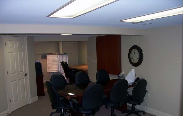
Storesoffices
Louisiana
2025
85
2025
0.25 AC
003604
East Baton Rouge Parish North
5,250 SF
Baton Rouge
NEARBY LISTINGS FOR SALE OR LEASE
DEMOGRAPHICS near 11876 Darryl Dr
1 mile
3 mile
5 mile
2025 Total Population
9,635
61,776
142,407
2030 Population
9,739
61,153
141,377
Pop Growth 2025-2030
+ 1.08%
(1.01%)
(0.72%)
Average Age
35
38
38
2025 Total Households
3,389
23,083
56,926
HH Growth 2025-2030
+ 1.00%
(1.16%)
(0.85%)
Median Household Inc
$38,678
$56,859
$59,485
Avg Household Size
2.70
2.60
2.40
2025 Avg HH Vehicles
1.00
2.00
2.00
Median Home Value
$168,081
$203,021
$234,845
Median Year Built
1976
1977
1980
Nearby Places
Map Layers
Map Styles
 Street
 Aerial
Layers
 Traffic
 Biking
Places
Listings with unknown addresses are not visible on the map
- Restaurants
- Banks
- Shops
- Fitness
- Groceries
PUBLIC TRANSPORTATION
AIRPORT
Baton Rouge Metro Ryan Field
Drive
Walk
Distance
Baton Rouge Metro Ryan Field
16 min
9.0 mi
Freight Ports
Port of Greater Baton Rouge
Drive
Walk
Distance
Port of Greater Baton Rouge
25 min
14.8 mi
SALE & LEASE HISTORY
LISTING DATE
SALE/LEASE

Sep 29, 2017
For Sale
Nearby Properties
Address
Land Use
TOTAL SIZE
Lot Size
Zoning
Address
Land Use
TOTAL SIZE
Lot Size
Zoning
97.03 AC
Address
Land Use
TOTAL SIZE
Lot Size
Zoning
365,566 SF
8.77 AC
Address
Land Use
TOTAL SIZE
Lot Size
Zoning
501,688 SF
11.17 AC
Address
Land Use
TOTAL SIZE
Lot Size
Zoning
30.26 AC
Address
Land Use
TOTAL SIZE
Lot Size
Zoning
481,760 SF
18.31 AC
Address
Land Use
TOTAL SIZE
Lot Size
Zoning
13.07 AC
Address
Land Use
TOTAL SIZE
Lot Size
Zoning
223,498 SF
20.34 AC
Address
Land Use
TOTAL SIZE
Lot Size
Zoning
145,622 SF
25.07 AC
Address
Land Use
TOTAL SIZE
Lot Size
Zoning
14.31 AC
Address
Land Use
TOTAL SIZE
Lot Size
Zoning
Address
Land Use
TOTAL SIZE
Lot Size
Zoning
288,746 SF
12.16 AC
Address
Land Use
TOTAL SIZE
Lot Size
Zoning
25.54 AC
Address
Land Use
TOTAL SIZE
Lot Size
Zoning
303,400 SF
25.16 AC
Address
Land Use
TOTAL SIZE
Lot Size
Zoning
15.16 AC
Address
Land Use
TOTAL SIZE
Lot Size
Zoning
Address
Land Use
TOTAL SIZE
Lot Size
Zoning
14.11 AC
Address
Land Use
TOTAL SIZE
Lot Size
Zoning
Address
Land Use
TOTAL SIZE
Lot Size
Zoning
Address
Land Use
TOTAL SIZE
Lot Size
Zoning
119,328 SF
10.72 AC
Address
Land Use
TOTAL SIZE
Lot Size
Zoning
16,146 SF
2.26 AC
Address
Land Use
TOTAL SIZE
Lot Size
Zoning
Address
Land Use
TOTAL SIZE
Lot Size
Zoning
135,445 SF
17.17 AC
Address
Land Use
TOTAL SIZE
Lot Size
Zoning
Address
Land Use
TOTAL SIZE
Lot Size
Zoning
Address
Land Use
TOTAL SIZE
Lot Size
Zoning
4,182 SF
4.54 AC
Address
Land Use
TOTAL SIZE
Lot Size
Zoning
40,574 SF
9.74 AC
Address
Land Use
TOTAL SIZE
Lot Size
Zoning
Address
Land Use
TOTAL SIZE
Lot Size
Zoning
123,730 SF
9.08 AC
Address
Land Use
TOTAL SIZE
Lot Size
Zoning
Address
Land Use
TOTAL SIZE
Lot Size
Zoning
156,046 SF
14.82 AC
The World's #1 Commercial Real Estate Marketplace
Connect with us
© 2026 CoStar Group
The information above has been obtained from sources believed reliable. While we do not doubt its accuracy we have not verified it and make no guarantee, warranty or representation about it. It is your responsibility to independently confirm its accuracy and completeness. Any projections, opinions, assumptions, or estimates used are for example only and do not represent the current or future performance of the property. The value of this transaction to you depends on tax and other factors which should be evaluated by your tax, financial, and legal advisors. You and your advisors should conduct a careful, independent investigation of the property to determine to your satisfaction the suitability of the property for your needs.