Property Record
119 Authority Dr, Fitchburg, MA 01420


NEARBY LISTINGS FOR SALE OR LEASE
Property Detail
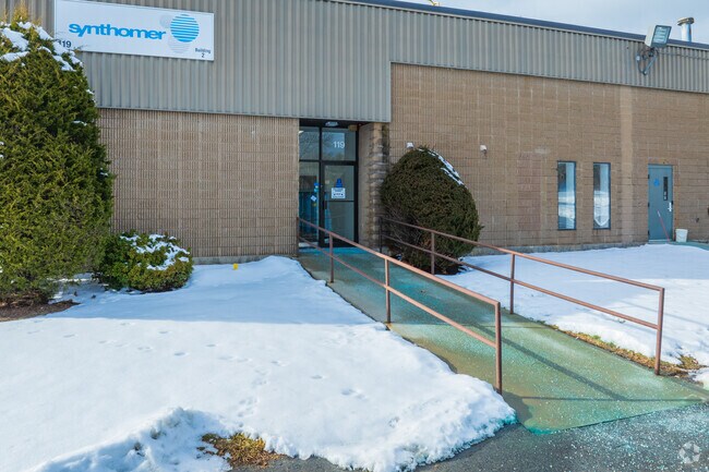
119 Authority Dr
FITC-000118R-000003-A000000
Fitchburg
Manufacturinglight
Worcester
X
Massachusetts
25027C0261F
a
2025
3.01 AC
2025
Fitchburg/Leominster
710300
Boston
23,556 SF
Worcester, MA
DEMOGRAPHICS near 119 Authority Dr
1 Mile
3 Mile
5 Mile
2024 Total Population
1,222
20,504
65,713
2029 Population
1,217
20,434
65,505
Pop Growth 2024-2029
(0.41%)
(0.34%)
(0.32%)
Average Age
41
41
40
2024 Total Households
497
8,017
25,838
HH Growth 2024-2029
(0.60%)
(0.40%)
(0.32%)
Median Household Inc
$86,764
$83,057
$70,494
Avg Household Size
2.50
2.50
2.40
2024 Avg HH Vehicles
2.00
2.00
2.00
Median Home Value
$265,697
$291,164
$302,981
Median Year Built
1958
1959
1957
Nearby Places
Map Layers
Map Styles
 Street
 Aerial
- Restaurants
- Banks
- Shops
- Fitness
- Groceries
PUBLIC TRANSPORTATION
COMMUTER RAIL
DRIVE
WALK
Distance
2 min
8 min
0.3 mi
Fitchburg (Fitchburg/South Acton Line - Massachusetts Bay Transportation Authority Commuter Rail (Purple Line))
DRIVE
WALK
Distance
Fitchburg (Fitchburg/South Acton Line - Massachusetts Bay Transportation Authority Commuter Rail (Purple Line))
12 min
4.9 mi
AIRPORT
Worcester Regional
DRIVE
WALK
Distance
Worcester Regional
44 min
27.0 mi
Manchester Boston Regional
DRIVE
WALK
Distance
Manchester Boston Regional
76 min
41.0 mi
Freight Ports
Port of Boston
DRIVE
WALK
Distance
Port of Boston
77 min
51.0 mi
SALE & LEASE HISTORY
LISTING DATE
SALE/LEASE

Jun 20, 2025
For Lease
Nearby Properties
Address
Land Use
TOTAL SIZE
Lot Size
Zoning
Address
Land Use
TOTAL SIZE
Lot Size
Zoning
39.19 AC
CR
Address
Land Use
TOTAL SIZE
Lot Size
Zoning
276,822 SF
26.98 AC
I
Address
Land Use
TOTAL SIZE
Lot Size
Zoning
12.11 AC
RA
Address
Land Use
TOTAL SIZE
Lot Size
Zoning
114,360 SF
6.10 AC
RA
Address
Land Use
TOTAL SIZE
Lot Size
Zoning
281,196 SF
8.70 AC
AI
Address
Land Use
TOTAL SIZE
Lot Size
Zoning
99,800 SF
20 AC
RA
Address
Land Use
TOTAL SIZE
Lot Size
Zoning
127.30 AC
AI
Address
Land Use
TOTAL SIZE
Lot Size
Zoning
113,250 SF
34.55 AC
CR
Address
Land Use
TOTAL SIZE
Lot Size
Zoning
3.65 AC
RC
Address
Land Use
TOTAL SIZE
Lot Size
Zoning
56,475 SF
4.26 AC
I
Address
Land Use
TOTAL SIZE
Lot Size
Zoning
87,828 SF
AI
Address
Land Use
TOTAL SIZE
Lot Size
Zoning
72,336 SF
6.42 AC
I
Address
Land Use
TOTAL SIZE
Lot Size
Zoning
91,941 SF
10.55 AC
I
Address
Land Use
TOTAL SIZE
Lot Size
Zoning
630 SF
308.76 AC
RA
Address
Land Use
TOTAL SIZE
Lot Size
Zoning
4.01 AC
Address
Land Use
TOTAL SIZE
Lot Size
Zoning
21,800 SF
16.48 AC
AI
Address
Land Use
TOTAL SIZE
Lot Size
Zoning
1,187.86 AC
Address
Land Use
TOTAL SIZE
Lot Size
Zoning
99,400 SF
8.58 AC
I
Address
Land Use
TOTAL SIZE
Lot Size
Zoning
4.74 AC
I
Address
Land Use
TOTAL SIZE
Lot Size
Zoning
45.86 AC
Address
Land Use
TOTAL SIZE
Lot Size
Zoning
83,408 SF
6.18 AC
I
Address
Land Use
TOTAL SIZE
Lot Size
Zoning
57.58 AC
Address
Land Use
TOTAL SIZE
Lot Size
Zoning
21,758 SF
15.01 AC
Address
Land Use
TOTAL SIZE
Lot Size
Zoning
4.53 AC
RA
Address
Land Use
TOTAL SIZE
Lot Size
Zoning
85,570 SF
5.98 AC
I
Address
Land Use
TOTAL SIZE
Lot Size
Zoning
101,226 SF
6.80 AC
I
Address
Land Use
TOTAL SIZE
Lot Size
Zoning
580.19 AC
Address
Land Use
TOTAL SIZE
Lot Size
Zoning
172,569 SF
3.25 AC
AI
Address
Land Use
TOTAL SIZE
Lot Size
Zoning
45.51 AC
Address
Land Use
TOTAL SIZE
Lot Size
Zoning
122,896 SF
17 AC
The World's #1 Commercial Real Estate Marketplace
Connect with us
© 2026 CoStar Group
The information above has been obtained from sources believed reliable. While we do not doubt its accuracy we have not verified it and make no guarantee, warranty or representation about it. It is your responsibility to independently confirm its accuracy and completeness. Any projections, opinions, assumptions, or estimates used are for example only and do not represent the current or future performance of the property. The value of this transaction to you depends on tax and other factors which should be evaluated by your tax, financial, and legal advisors. You and your advisors should conduct a careful, independent investigation of the property to determine to your satisfaction the suitability of the property for your needs.