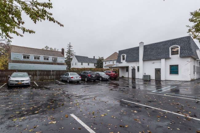
Property Record
119 Cooper St, Babylon, NY 11702


NEARBY LISTINGS FOR SALE OR LEASE
Property Detail
119 Cooper St
0102-011-00-01-00-003-000
N-LITWIN LOT 2 E-S HENKIN LOT12 S-OTT LOT 4 W-COOPER ST
Financialbuilding
Suffolk
X
New York
36103C0854H
3
2024
0.22 AC
2024
Southwestern Suffolk
124602
Long Island (New York)
5,980 SF
Nassau County-Suffolk County, NY
DEMOGRAPHICS near 119 Cooper St
1 mile
3 mile
5 mile
2024 Total Population
12,935
101,887
243,883
2029 Population
12,736
99,879
238,224
Pop Growth 2024-2029
(1.54%)
(1.97%)
(2.32%)
Average Age
41
42
40
2024 Total Households
4,614
34,789
78,585
HH Growth 2024-2029
(1.82%)
(2.22%)
(2.49%)
Median Household Inc
$144,937
$121,003
$112,264
Avg Household Size
2.70
2.80
3.00
2024 Avg HH Vehicles
2.00
2.00
2.00
Median Home Value
$609,774
$473,074
$451,480
Median Year Built
1955
1959
1961
Nearby Places
Map Layers
Map Styles
 Street
 Aerial
Transit
 Traffic
 Biking
Places
Listings with unknown addresses are not visible on the map
- Restaurants
- Banks
- Shops
- Fitness
- Groceries
PUBLIC TRANSPORTATION
TRANSIT/SUBWAY
Babylon Station (Babylon Branch - Long Island Rail Road, Montauk Branch - Long Island Rail Road)
Drive
Walk
Distance
Babylon Station (Babylon Branch - Long Island Rail Road, Montauk Branch - Long Island Rail Road)
1 min
7 min
0.3 mi
COMMUTER RAIL
Babylon Station (Babylon Branch - Long Island Rail Road, Montauk Branch - Long Island Rail Road)
Drive
Walk
Distance
Babylon Station (Babylon Branch - Long Island Rail Road, Montauk Branch - Long Island Rail Road)
2 min
8 min
0.4 mi
Lindenhurst Station (Babylon Branch - Long Island Rail Road)
Drive
Walk
Distance
Lindenhurst Station (Babylon Branch - Long Island Rail Road)
6 min
2.9 mi
AIRPORT
Long Island MacArthur
Drive
Walk
Distance
Long Island MacArthur
26 min
16.1 mi
John F Kennedy International
Drive
Walk
Distance
John F Kennedy International
43 min
28.7 mi
LaGuardia
Drive
Walk
Distance
LaGuardia
53 min
36.2 mi
Freight Ports
NY - Red Hook Container Terminal
Drive
Walk
Distance
NY - Red Hook Container Terminal
63 min
40.3 mi
SALE & LEASE HISTORY
LISTING DATE
SALE/LEASE

Sep 25, 2016
For Lease
Sep 24, 2016
For Sale
Nearby Properties
Address
Land Use
TOTAL SIZE
Lot Size
Zoning
Address
Land Use
TOTAL SIZE
Lot Size
Zoning
48.97 AC
GSC
Address
Land Use
TOTAL SIZE
Lot Size
Zoning
37,072 SF
14.68 AC
R60
Address
Land Use
TOTAL SIZE
Lot Size
Zoning
256 SF
24.20 AC
GSC
Address
Land Use
TOTAL SIZE
Lot Size
Zoning
8,334 SF
1.84 AC
R80
Address
Land Use
TOTAL SIZE
Lot Size
Zoning
4,172 SF
0.88 AC
R60
Address
Land Use
TOTAL SIZE
Lot Size
Zoning
20 AC
A
Address
Land Use
TOTAL SIZE
Lot Size
Zoning
10.07 AC
Address
Land Use
TOTAL SIZE
Lot Size
Zoning
1,400 SF
10.27 AC
BD
Address
Land Use
TOTAL SIZE
Lot Size
Zoning
5,040 SF
0.70 AC
VILLA
Address
Land Use
TOTAL SIZE
Lot Size
Zoning
3,526 SF
0.81 AC
CR60
Address
Land Use
TOTAL SIZE
Lot Size
Zoning
2,418 SF
0.15 AC
VILLA
Address
Land Use
TOTAL SIZE
Lot Size
Zoning
19.56 AC
BUS3
Address
Land Use
TOTAL SIZE
Lot Size
Zoning
3,781 SF
0.89 AC
CR60
Address
Land Use
TOTAL SIZE
Lot Size
Zoning
3,387 SF
0.84 AC
CR60
Address
Land Use
TOTAL SIZE
Lot Size
Zoning
20.50 AC
B
Address
Land Use
TOTAL SIZE
Lot Size
Zoning
15 AC
A
Address
Land Use
TOTAL SIZE
Lot Size
Zoning
231.30 AC
AAA
Address
Land Use
TOTAL SIZE
Lot Size
Zoning
20.10 AC
A
Address
Land Use
TOTAL SIZE
Lot Size
Zoning
2,929 SF
0.93 AC
CR60
Address
Land Use
TOTAL SIZE
Lot Size
Zoning
2,140 SF
0.19 AC
VILLA
Address
Land Use
TOTAL SIZE
Lot Size
Zoning
2,416 SF
0.28 AC
VILLA
Address
Land Use
TOTAL SIZE
Lot Size
Zoning
4,290 SF
1.50 AC
VILLA
Address
Land Use
TOTAL SIZE
Lot Size
Zoning
2,627 SF
0.36 AC
VILLA
Address
Land Use
TOTAL SIZE
Lot Size
Zoning
2,980 SF
0.46 AC
VILLA
Address
Land Use
TOTAL SIZE
Lot Size
Zoning
3,917 SF
0.85 AC
CR200
Address
Land Use
TOTAL SIZE
Lot Size
Zoning
10.44 AC
BUS3
Address
Land Use
TOTAL SIZE
Lot Size
Zoning
9,309 SF
1.02 AC
R40
Address
Land Use
TOTAL SIZE
Lot Size
Zoning
18.70 AC
A
Address
Land Use
TOTAL SIZE
Lot Size
Zoning
6.66 AC
A
Address
Land Use
TOTAL SIZE
Lot Size
Zoning
19.70 AC
B
The World's #1 Commercial Real Estate Marketplace
Connect with us
© 2026 CoStar Group
The information above has been obtained from sources believed reliable. While we do not doubt its accuracy we have not verified it and make no guarantee, warranty or representation about it. It is your responsibility to independently confirm its accuracy and completeness. Any projections, opinions, assumptions, or estimates used are for example only and do not represent the current or future performance of the property. The value of this transaction to you depends on tax and other factors which should be evaluated by your tax, financial, and legal advisors. You and your advisors should conduct a careful, independent investigation of the property to determine to your satisfaction the suitability of the property for your needs.