Property Record
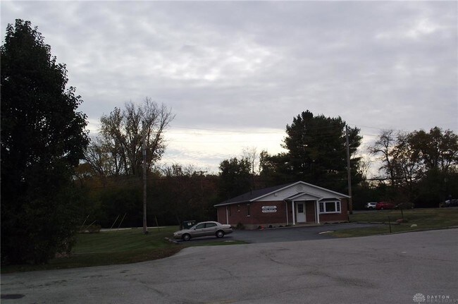
119 E Franklin St, Bellbrook, OH 45305


Property Detail
119 E Franklin St
L35-0002-0005-0-0076-00
6-3-32 S W 1/4 119 E FRANKLIN ST
Medicalbuilding
Greene
AE The base floodplain where base flood elevations are provided. AE Zones are now used on new format FIRMs instead of A1-A30 Zones.
Ohio
2025
0.71 AC
2025
Southeast Dayton
220102
Cincinnati/Dayton
1,914 SF
Dayton, OH
NEARBY LISTINGS FOR SALE OR LEASE
DEMOGRAPHICS near 119 E Franklin St
1 mile
3 mile
5 mile
2025 Total Population
2,806
18,173
71,484
2030 Population
2,869
18,535
72,035
Pop Growth 2025-2030
+ 2.25%
+ 1.99%
+ 0.77%
Average Age
42
43
43
2025 Total Households
977
6,991
29,338
HH Growth 2025-2030
+ 2.35%
+ 2.03%
+ 0.74%
Median Household Inc
$160,139
$127,820
$102,026
Avg Household Size
2.80
2.60
2.40
2025 Avg HH Vehicles
2.00
2.00
2.00
Median Home Value
$411,765
$362,109
$316,182
Median Year Built
1992
1985
1977
Nearby Places
Map Layers
Map Styles
 Street
 Aerial
Transit
 Traffic
 Biking
Places
Listings with unknown addresses are not visible on the map
- Restaurants
- Banks
- Shops
- Fitness
- Groceries
PUBLIC TRANSPORTATION
AIRPORT
James M Cox Dayton International
Drive
Walk
Distance
James M Cox Dayton International
43 min
24.9 mi
SALE & LEASE HISTORY
LISTING DATE
SALE/LEASE

Nov 20, 2019
For Sale
Nearby Properties
Address
Land Use
TOTAL SIZE
Lot Size
Zoning
Address
Land Use
TOTAL SIZE
Lot Size
Zoning
508,366 SF
114.86 AC
Address
Land Use
TOTAL SIZE
Lot Size
Zoning
16.21 AC
Address
Land Use
TOTAL SIZE
Lot Size
Zoning
1,180 SF
23.28 AC
Address
Land Use
TOTAL SIZE
Lot Size
Zoning
6,120 SF
48.39 AC
Address
Land Use
TOTAL SIZE
Lot Size
Zoning
9,233 SF
22.26 AC
Address
Land Use
TOTAL SIZE
Lot Size
Zoning
161,615 SF
23.20 AC
Address
Land Use
TOTAL SIZE
Lot Size
Zoning
19.76 AC
Address
Land Use
TOTAL SIZE
Lot Size
Zoning
187,824 SF
27.52 AC
Address
Land Use
TOTAL SIZE
Lot Size
Zoning
119,701 SF
71.85 AC
Address
Land Use
TOTAL SIZE
Lot Size
Zoning
9,344 SF
9.08 AC
Address
Land Use
TOTAL SIZE
Lot Size
Zoning
126,299 SF
15.04 AC
Address
Land Use
TOTAL SIZE
Lot Size
Zoning
149,306 SF
15.23 AC
Address
Land Use
TOTAL SIZE
Lot Size
Zoning
47,376 SF
15.67 AC
Address
Land Use
TOTAL SIZE
Lot Size
Zoning
3,200 SF
39.23 AC
Address
Land Use
TOTAL SIZE
Lot Size
Zoning
211,007 SF
114.86 AC
Address
Land Use
TOTAL SIZE
Lot Size
Zoning
2.73 AC
Address
Land Use
TOTAL SIZE
Lot Size
Zoning
87,647 SF
7.08 AC
Address
Land Use
TOTAL SIZE
Lot Size
Zoning
33,912 SF
13.45 AC
Address
Land Use
TOTAL SIZE
Lot Size
Zoning
71,736 SF
8.09 AC
Address
Land Use
TOTAL SIZE
Lot Size
Zoning
125,817 SF
12.72 AC
Address
Land Use
TOTAL SIZE
Lot Size
Zoning
40,780 SF
59.81 AC
Address
Land Use
TOTAL SIZE
Lot Size
Zoning
118,000 SF
11.01 AC
Address
Land Use
TOTAL SIZE
Lot Size
Zoning
103,936 SF
9.03 AC
Address
Land Use
TOTAL SIZE
Lot Size
Zoning
3,600 SF
422 AC
Address
Land Use
TOTAL SIZE
Lot Size
Zoning
84,672 SF
15.39 AC
Address
Land Use
TOTAL SIZE
Lot Size
Zoning
62,243 SF
6.37 AC
Address
Land Use
TOTAL SIZE
Lot Size
Zoning
28,389 SF
3.59 AC
Address
Land Use
TOTAL SIZE
Lot Size
Zoning
Address
Land Use
TOTAL SIZE
Lot Size
Zoning
127,184 SF
14.30 AC
Address
Land Use
TOTAL SIZE
Lot Size
Zoning
54,352 SF
7.47 AC
The World's #1 Commercial Real Estate Marketplace
Connect with us
© 2026 CoStar Group
The information above has been obtained from sources believed reliable. While we do not doubt its accuracy we have not verified it and make no guarantee, warranty or representation about it. It is your responsibility to independently confirm its accuracy and completeness. Any projections, opinions, assumptions, or estimates used are for example only and do not represent the current or future performance of the property. The value of this transaction to you depends on tax and other factors which should be evaluated by your tax, financial, and legal advisors. You and your advisors should conduct a careful, independent investigation of the property to determine to your satisfaction the suitability of the property for your needs.