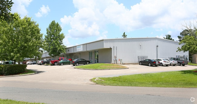
Property Record
119 Hamilton Park Dr, Tallahassee, FL 32304


Current Lease Availabilities
NEARBY LISTINGS FOR SALE OR LEASE
Property Detail
119 Hamilton Park Dr
Tallahassee, FL
Unplatted Land
21-33-20-442-000.0
1N 1W 33 2.85 IN SW 1/4 OF SW 1/4 OR 1744/518 1899/375 2062/1952 AKA HAMILTON PARK LOT 9 UNREC
Warehouse
Leon
X
Florida
12073C0287F
9
2025
2.85 AC
2025
SW Tallahassee
002003
Tallahassee
32,405 SF
DEMOGRAPHICS near 119 Hamilton Park Dr
1 Mile
3 Mile
5 Mile
2024 Total Population
5,375
62,964
125,309
2029 Population
5,635
65,346
131,289
Pop Growth 2024-2029
+ 4.84%
+ 3.78%
+ 4.77%
Average Age
32
30
32
2024 Total Households
1,805
25,771
52,492
HH Growth 2024-2029
+ 4.16%
+ 3.73%
+ 4.93%
Median Household Inc
$37,256
$30,851
$38,797
Avg Household Size
2.30
2.20
2.10
2024 Avg HH Vehicles
2.00
2.00
2.00
Median Home Value
$107,895
$134,767
$167,446
Median Year Built
1985
1985
1982
Nearby Places
Map Layers
Map Styles
 Street
 Aerial
- Restaurants
- Banks
- Shops
- Fitness
- Groceries
PUBLIC TRANSPORTATION
AIRPORT
Tallahassee International
DRIVE
WALK
Distance
Tallahassee International
8 min
3.8 mi
Freight Ports
Port of Panama City
DRIVE
WALK
Distance
Port of Panama City
136 min
96.8 mi
Nearby Properties
Address
Land Use
TOTAL SIZE
Lot Size
Zoning
Address
Land Use
TOTAL SIZE
Lot Size
Zoning
1,635,322 SF
29.76 AC
UT
Address
Land Use
TOTAL SIZE
Lot Size
Zoning
6,686,582 SF
86.50 AC
UT
Address
Land Use
TOTAL SIZE
Lot Size
Zoning
4,577,528 SF
108.47 AC
UT
Address
Land Use
TOTAL SIZE
Lot Size
Zoning
3,647,358 SF
49.17 AC
UT
Address
Land Use
TOTAL SIZE
Lot Size
Zoning
1,604,893 SF
175.71 AC
MR1
Address
Land Use
TOTAL SIZE
Lot Size
Zoning
704,857 SF
4.95 AC
UT
Address
Land Use
TOTAL SIZE
Lot Size
Zoning
959,505 SF
32.03 AC
M1
Address
Land Use
TOTAL SIZE
Lot Size
Zoning
664,514 SF
2.49 AC
UT
Address
Land Use
TOTAL SIZE
Lot Size
Zoning
981,563 SF
2,146.52 AC
GO2
Address
Land Use
TOTAL SIZE
Lot Size
Zoning
369,383 SF
4.51 AC
UT
Address
Land Use
TOTAL SIZE
Lot Size
Zoning
758,762 SF
20.82 AC
UT
Address
Land Use
TOTAL SIZE
Lot Size
Zoning
452,530 SF
10.30 AC
UV
Address
Land Use
TOTAL SIZE
Lot Size
Zoning
719,149 SF
40.73 AC
MR1
Address
Land Use
TOTAL SIZE
Lot Size
Zoning
445,676 SF
23.50 AC
PUD
Address
Land Use
TOTAL SIZE
Lot Size
Zoning
652,729 SF
1.71 AC
UT
Address
Land Use
TOTAL SIZE
Lot Size
Zoning
721,205 SF
6.19 AC
UT
Address
Land Use
TOTAL SIZE
Lot Size
Zoning
556,751 SF
20.60 AC
CP
Address
Land Use
TOTAL SIZE
Lot Size
Zoning
859,666 SF
20.17 AC
MR1
Address
Land Use
TOTAL SIZE
Lot Size
Zoning
479,705 SF
9.24 AC
UT
Address
Land Use
TOTAL SIZE
Lot Size
Zoning
538,290 SF
11.05 AC
Address
Land Use
TOTAL SIZE
Lot Size
Zoning
392,437 SF
10 AC
UT
Address
Land Use
TOTAL SIZE
Lot Size
Zoning
222,994 SF
2.52 AC
UV
Address
Land Use
TOTAL SIZE
Lot Size
Zoning
225,370 SF
3.76 AC
CU45
Address
Land Use
TOTAL SIZE
Lot Size
Zoning
181,104 SF
1.78 AC
UV
Address
Land Use
TOTAL SIZE
Lot Size
Zoning
604,638 SF
2.26 AC
Address
Land Use
TOTAL SIZE
Lot Size
Zoning
459,568 SF
10.10 AC
CU45
Address
Land Use
TOTAL SIZE
Lot Size
Zoning
424,591 SF
2.77 AC
UT
Address
Land Use
TOTAL SIZE
Lot Size
Zoning
607,000 SF
37.55 AC
PUD
Address
Land Use
TOTAL SIZE
Lot Size
Zoning
385,361 SF
1.45 AC
UT
Address
Land Use
TOTAL SIZE
Lot Size
Zoning
828,694 SF
25.98 AC
MR1
The World's #1 Commercial Real Estate Marketplace
Connect with us
© 2026 CoStar Group
The information above has been obtained from sources believed reliable. While we do not doubt its accuracy we have not verified it and make no guarantee, warranty or representation about it. It is your responsibility to independently confirm its accuracy and completeness. Any projections, opinions, assumptions, or estimates used are for example only and do not represent the current or future performance of the property. The value of this transaction to you depends on tax and other factors which should be evaluated by your tax, financial, and legal advisors. You and your advisors should conduct a careful, independent investigation of the property to determine to your satisfaction the suitability of the property for your needs.