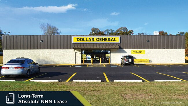
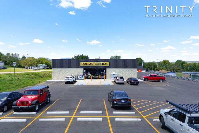
Property Record
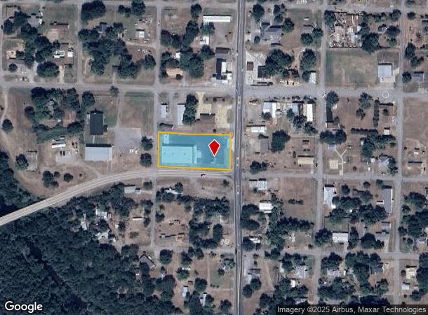
119 Highway 71 S, Huntington, AR 72940
NEARBY LISTINGS FOR SALE OR LEASE
Property Detail
119 Highway 71 S
Fort Smith, AR-OK
Huntington Original Town-Hunt
67950-0020-00012-00
LOTS 13-20 L & E PT LOT 15 & 16
Storebuilding
Sebastian
X
Arkansas
05131C0350E
13-20
2025
1.25 AC
2025
Outlying Sebastian County
010303
Fort Smith
968 SF
DEMOGRAPHICS near 119 Highway 71 S
1 Mile
3 Mile
5 Mile
2024 Total Population
580
2,383
4,489
2029 Population
586
2,406
4,525
Pop Growth 2024-2029
+ 1.03%
+ 0.97%
+ 0.80%
Average Age
42
42
42
2024 Total Households
228
945
1,780
HH Growth 2024-2029
+ 1.32%
+ 0.95%
+ 0.79%
Median Household Inc
$35,536
$41,958
$43,147
Avg Household Size
2.50
2.50
2.50
2024 Avg HH Vehicles
2.00
2.00
2.00
Median Home Value
$127,692
$112,319
$123,378
Median Year Built
1975
1979
1980
Nearby Places
Map Layers
Map Styles
 Street
 Aerial
- Restaurants
- Banks
- Shops
- Fitness
- Groceries
PUBLIC TRANSPORTATION
AIRPORT
Fort Smith Regional
DRIVE
WALK
Distance
Fort Smith Regional
37 min
23.6 mi
Freight Ports
Tulsa Port of Inola
DRIVE
WALK
Distance
Tulsa Port of Inola
164 min
129.3 mi
SALE & LEASE HISTORY
LISTING DATE
SALE/LEASE

Dec 08, 2022
For Sale
Aug 18, 2023
For Sale
Nearby Properties
Address
Land Use
TOTAL SIZE
Lot Size
Zoning
Address
Land Use
TOTAL SIZE
Lot Size
Zoning
33,327 SF
49.70 AC
Address
Land Use
TOTAL SIZE
Lot Size
Zoning
9,320 SF
0.43 AC
Address
Land Use
TOTAL SIZE
Lot Size
Zoning
3,528 SF
1.20 AC
Address
Land Use
TOTAL SIZE
Lot Size
Zoning
20,496 SF
0.38 AC
Address
Land Use
TOTAL SIZE
Lot Size
Zoning
4,514 SF
0.50 AC
Address
Land Use
TOTAL SIZE
Lot Size
Zoning
2,320 SF
0.45 AC
Address
Land Use
TOTAL SIZE
Lot Size
Zoning
8,415 SF
15.52 AC
Address
Land Use
TOTAL SIZE
Lot Size
Zoning
11,659 SF
2.51 AC
Address
Land Use
TOTAL SIZE
Lot Size
Zoning
6,432 SF
1.04 AC
Address
Land Use
TOTAL SIZE
Lot Size
Zoning
11,918 SF
2.24 AC
Address
Land Use
TOTAL SIZE
Lot Size
Zoning
10,080 SF
9.19 AC
Address
Land Use
TOTAL SIZE
Lot Size
Zoning
10,500 SF
2.56 AC
Address
Land Use
TOTAL SIZE
Lot Size
Zoning
4,600 SF
1.33 AC
Address
Land Use
TOTAL SIZE
Lot Size
Zoning
3,576 SF
0.34 AC
Address
Land Use
TOTAL SIZE
Lot Size
Zoning
2,560 SF
0.56 AC
Address
Land Use
TOTAL SIZE
Lot Size
Zoning
12,760 SF
0.83 AC
Address
Land Use
TOTAL SIZE
Lot Size
Zoning
3,600 SF
2.65 AC
Address
Land Use
TOTAL SIZE
Lot Size
Zoning
1,376 SF
0.35 AC
Address
Land Use
TOTAL SIZE
Lot Size
Zoning
4,880 SF
0.64 AC
Address
Land Use
TOTAL SIZE
Lot Size
Zoning
12,176 SF
0.46 AC
Address
Land Use
TOTAL SIZE
Lot Size
Zoning
1,944 SF
0.24 AC
Address
Land Use
TOTAL SIZE
Lot Size
Zoning
5,320 SF
1.13 AC
Address
Land Use
TOTAL SIZE
Lot Size
Zoning
7,200 SF
1.16 AC
Address
Land Use
TOTAL SIZE
Lot Size
Zoning
1,748 SF
0.50 AC
Address
Land Use
TOTAL SIZE
Lot Size
Zoning
1,196 SF
0.69 AC
Address
Land Use
TOTAL SIZE
Lot Size
Zoning
3,845 SF
0.17 AC
Address
Land Use
TOTAL SIZE
Lot Size
Zoning
3,168 SF
1.19 AC
Address
Land Use
TOTAL SIZE
Lot Size
Zoning
1,500 SF
0.40 AC
Address
Land Use
TOTAL SIZE
Lot Size
Zoning
2,980 SF
0.66 AC
The World's #1 Commercial Real Estate Marketplace
Connect with us
© 2026 CoStar Group
The information above has been obtained from sources believed reliable. While we do not doubt its accuracy we have not verified it and make no guarantee, warranty or representation about it. It is your responsibility to independently confirm its accuracy and completeness. Any projections, opinions, assumptions, or estimates used are for example only and do not represent the current or future performance of the property. The value of this transaction to you depends on tax and other factors which should be evaluated by your tax, financial, and legal advisors. You and your advisors should conduct a careful, independent investigation of the property to determine to your satisfaction the suitability of the property for your needs.