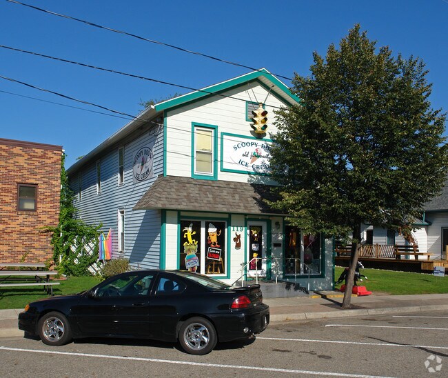
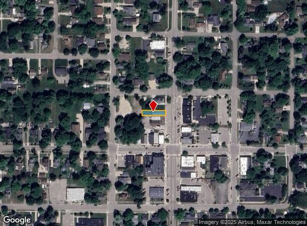
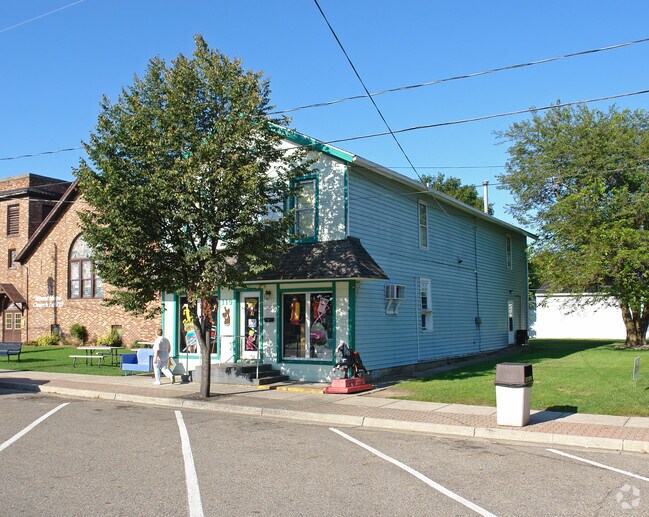
Property Record
119 N Bridge St, Dewitt, MI 48820
NEARBY LISTINGS FOR SALE OR LEASE
-
-
View all Dewitt listings for sale on LoopNet.com
Property Detail
119 N Bridge St
Lansing-East Lansing, MI
Geneva Shores No 1 Subd
200-100-000-110-00
LOT 154 GENEVA SHORES NO 1 SUBD, CITY OF DEWITT DE 2948
Retailwithmorethanonenonretailuse
Clinton
X
Michigan
26065C0025D
154
2024
0.09 AC
2025
Outlying Clinton County
010105
West Michigan
2,640 SF
DEMOGRAPHICS near 119 N Bridge St
1 Mile
3 Mile
5 Mile
2024 Total Population
4,656
16,848
25,371
2029 Population
4,750
17,214
25,957
Pop Growth 2024-2029
+ 2.02%
+ 2.17%
+ 2.31%
Average Age
40
41
42
2024 Total Households
1,782
6,387
9,819
HH Growth 2024-2029
+ 2.02%
+ 2.18%
+ 2.30%
Median Household Inc
$92,003
$94,564
$86,009
Avg Household Size
2.60
2.60
2.50
2024 Avg HH Vehicles
2.00
2.00
2.00
Median Home Value
$328,923
$307,468
$269,355
Median Year Built
1989
1990
1985
Nearby Places
Map Layers
Map Styles
 Street
 Aerial
- Restaurants
- Banks
- Shops
- Fitness
- Groceries
PUBLIC TRANSPORTATION
AIRPORT
Capital Region International
DRIVE
WALK
Distance
Capital Region International
15 min
7.6 mi
Freight Ports
Port of Toledo
DRIVE
WALK
Distance
Port of Toledo
158 min
123.7 mi
Nearby Properties
Address
Land Use
TOTAL SIZE
Lot Size
Zoning
Address
Land Use
TOTAL SIZE
Lot Size
Zoning
4,312 SF
30.47 AC
M3
Address
Land Use
TOTAL SIZE
Lot Size
Zoning
5,180 SF
16.94 AC
M2
Address
Land Use
TOTAL SIZE
Lot Size
Zoning
3,252 SF
10.16 AC
M3
Address
Land Use
TOTAL SIZE
Lot Size
Zoning
4,976 SF
6.23 AC
MF-N
Address
Land Use
TOTAL SIZE
Lot Size
Zoning
8,270 SF
13.15 AC
M3
Address
Land Use
TOTAL SIZE
Lot Size
Zoning
20,000 SF
25.53 AC
BC
Address
Land Use
TOTAL SIZE
Lot Size
Zoning
14,276 SF
6.42 AC
M3
Address
Land Use
TOTAL SIZE
Lot Size
Zoning
207,565 SF
11.50 AC
BC
Address
Land Use
TOTAL SIZE
Lot Size
Zoning
10,992 SF
10.43 AC
M3
Address
Land Use
TOTAL SIZE
Lot Size
Zoning
56,579 SF
8.48 AC
BSC
Address
Land Use
TOTAL SIZE
Lot Size
Zoning
4,464 SF
8.29 AC
MF
Address
Land Use
TOTAL SIZE
Lot Size
Zoning
86,211 SF
32.56 AC
BC
Address
Land Use
TOTAL SIZE
Lot Size
Zoning
39,372 SF
5.86 AC
BSC
Address
Land Use
TOTAL SIZE
Lot Size
Zoning
19,000 SF
CB
Address
Land Use
TOTAL SIZE
Lot Size
Zoning
8,247 SF
3.75 AC
BC
Address
Land Use
TOTAL SIZE
Lot Size
Zoning
26,110 SF
6.73 AC
OP
Address
Land Use
TOTAL SIZE
Lot Size
Zoning
15,000 SF
44.67 AC
A/BC
Address
Land Use
TOTAL SIZE
Lot Size
Zoning
15,576 SF
5.75 AC
M3
Address
Land Use
TOTAL SIZE
Lot Size
Zoning
17,490 SF
3.48 AC
BC
Address
Land Use
TOTAL SIZE
Lot Size
Zoning
22,413 SF
3.32 AC
M4
Address
Land Use
TOTAL SIZE
Lot Size
Zoning
5,536 SF
95.10 AC
PQ
Address
Land Use
TOTAL SIZE
Lot Size
Zoning
24,012 SF
2.31 AC
BC
Address
Land Use
TOTAL SIZE
Lot Size
Zoning
2,640 SF
7.20 AC
BC
Address
Land Use
TOTAL SIZE
Lot Size
Zoning
3,900 SF
2.75 AC
BC
Address
Land Use
TOTAL SIZE
Lot Size
Zoning
12,915 SF
0.95 AC
BL
Address
Land Use
TOTAL SIZE
Lot Size
Zoning
32,906 SF
4.72 AC
BC
Address
Land Use
TOTAL SIZE
Lot Size
Zoning
6,155 SF
4.19 AC
PO
Address
Land Use
TOTAL SIZE
Lot Size
Zoning
1,912 SF
6.61 AC
M3
Address
Land Use
TOTAL SIZE
Lot Size
Zoning
5,126 SF
1.59 AC
BSC
Address
Land Use
TOTAL SIZE
Lot Size
Zoning
10,582 SF
1.43 AC
BC
The World's #1 Commercial Real Estate Marketplace
Connect with us
© 2025 CoStar Group
The information above has been obtained from sources believed reliable. While we do not doubt its accuracy we have not verified it and make no guarantee, warranty or representation about it. It is your responsibility to independently confirm its accuracy and completeness. Any projections, opinions, assumptions, or estimates used are for example only and do not represent the current or future performance of the property. The value of this transaction to you depends on tax and other factors which should be evaluated by your tax, financial, and legal advisors. You and your advisors should conduct a careful, independent investigation of the property to determine to your satisfaction the suitability of the property for your needs.