Property Record
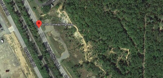
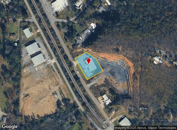
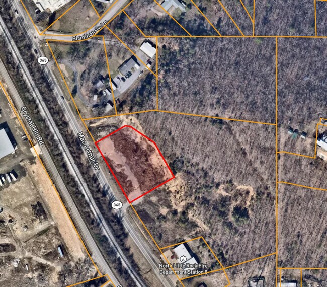
1.19 N Highway 365 Hwy, North Little Rock, AR 72118
NEARBY LISTINGS FOR SALE OR LEASE
Property Detail
1.19 N Highway 365 Hwy
Little Rock-North Little Rock-Conway, AR
Heilmans Sub
33N-017-79-003-01
PART OF LOT 2 HEILMANS SUB MPDA PT NW NE COM AT NE COR OF NW NE TH S00*4045W 347.53 FT N83*0803W 490.36 FT S80*4650W 154.37 FT S80*4705W 104.88 FT S26*5822E 78.5 FT TO POB N62*4411E 134.8 FT S80*4549E 20 FT S53*5026E 115.
Storebuilding
Pulaski
AE
Arkansas
05119C0337G
2b
2025
1.20 AC
2025
Outlying Pulaski County
004302
Little Rock/N Little Rock
9,320 SF
DEMOGRAPHICS near 1.19 N Highway 365 Hwy
1 Mile
3 Mile
5 Mile
2024 Total Population
1,270
26,704
101,724
2029 Population
1,278
26,638
101,761
Pop Growth 2024-2029
+ 0.63%
(0.25%)
+ 0.04%
Average Age
40
38
40
2024 Total Households
542
11,903
47,968
HH Growth 2024-2029
+ 0.55%
(0.34%)
+ 0.08%
Median Household Inc
$49,031
$44,626
$55,519
Avg Household Size
2.20
2.20
2.00
2024 Avg HH Vehicles
2.00
2.00
2.00
Median Home Value
$135,555
$134,832
$193,882
Median Year Built
1966
1970
1971
Nearby Places
- Restaurants
- Banks
- Shops
- Fitness
- Groceries
PUBLIC TRANSPORTATION
COMMUTER RAIL
Little Rock Union Station (Texas Eagle - Amtrak)
DRIVE
WALK
Distance
Little Rock Union Station (Texas Eagle - Amtrak)
11 min
6.6 mi
AIRPORT
Bill and Hillary Clinton Ntl/Adams Field
DRIVE
WALK
Distance
Bill and Hillary Clinton Ntl/Adams Field
18 min
11.0 mi
Freight Ports
Port of Shreveport
DRIVE
WALK
Distance
Port of Shreveport
256 min
237.8 mi
Nearby Properties
Address
Land Use
TOTAL SIZE
Lot Size
Zoning
Address
Land Use
TOTAL SIZE
Lot Size
Zoning
124,774 SF
21.05 AC
Address
Land Use
TOTAL SIZE
Lot Size
Zoning
7,859 SF
175.11 AC
Address
Land Use
TOTAL SIZE
Lot Size
Zoning
65.57 AC
Address
Land Use
TOTAL SIZE
Lot Size
Zoning
173,209 SF
26.54 AC
Address
Land Use
TOTAL SIZE
Lot Size
Zoning
199,466 SF
38.24 AC
Address
Land Use
TOTAL SIZE
Lot Size
Zoning
35,964 SF
10.59 AC
Address
Land Use
TOTAL SIZE
Lot Size
Zoning
456,896 SF
18.54 AC
Address
Land Use
TOTAL SIZE
Lot Size
Zoning
40,758 SF
6.43 AC
Address
Land Use
TOTAL SIZE
Lot Size
Zoning
153,981 SF
10.95 AC
Address
Land Use
TOTAL SIZE
Lot Size
Zoning
174,878 SF
7.55 AC
Address
Land Use
TOTAL SIZE
Lot Size
Zoning
135,844 SF
3.11 AC
Address
Land Use
TOTAL SIZE
Lot Size
Zoning
93,503 SF
34.50 AC
Address
Land Use
TOTAL SIZE
Lot Size
Zoning
21,168 SF
8.30 AC
Address
Land Use
TOTAL SIZE
Lot Size
Zoning
94,248 SF
23.30 AC
Address
Land Use
TOTAL SIZE
Lot Size
Zoning
32,408 SF
9.36 AC
Address
Land Use
TOTAL SIZE
Lot Size
Zoning
74,384 SF
16.97 AC
Address
Land Use
TOTAL SIZE
Lot Size
Zoning
49.39 AC
Address
Land Use
TOTAL SIZE
Lot Size
Zoning
48.52 AC
Address
Land Use
TOTAL SIZE
Lot Size
Zoning
54,445 SF
157.11 AC
Address
Land Use
TOTAL SIZE
Lot Size
Zoning
16,030 SF
6.18 AC
Address
Land Use
TOTAL SIZE
Lot Size
Zoning
24,951 SF
143.50 AC
Address
Land Use
TOTAL SIZE
Lot Size
Zoning
69,609 SF
4.15 AC
Address
Land Use
TOTAL SIZE
Lot Size
Zoning
48,142 SF
10.99 AC
Address
Land Use
TOTAL SIZE
Lot Size
Zoning
1,353 SF
3.76 AC
Address
Land Use
TOTAL SIZE
Lot Size
Zoning
78,310 SF
3.44 AC
Address
Land Use
TOTAL SIZE
Lot Size
Zoning
52,370 SF
5.27 AC
Address
Land Use
TOTAL SIZE
Lot Size
Zoning
38,493 SF
15.79 AC
Address
Land Use
TOTAL SIZE
Lot Size
Zoning
14,311 SF
10.47 AC
Address
Land Use
TOTAL SIZE
Lot Size
Zoning
78,857 SF
9.83 AC
Address
Land Use
TOTAL SIZE
Lot Size
Zoning
74,690 SF
6.14 AC
The World's #1 Commercial Real Estate Marketplace
Connect with us
© 2025 CoStar Group
The information above has been obtained from sources believed reliable. While we do not doubt its accuracy we have not verified it and make no guarantee, warranty or representation about it. It is your responsibility to independently confirm its accuracy and completeness. Any projections, opinions, assumptions, or estimates used are for example only and do not represent the current or future performance of the property. The value of this transaction to you depends on tax and other factors which should be evaluated by your tax, financial, and legal advisors. You and your advisors should conduct a careful, independent investigation of the property to determine to your satisfaction the suitability of the property for your needs.