Property Record
119 S Brady Ave, Newton, NC 28658


NEARBY LISTINGS FOR SALE OR LEASE
-
-
View all Newton listings for sale on LoopNet.com
Property Detail
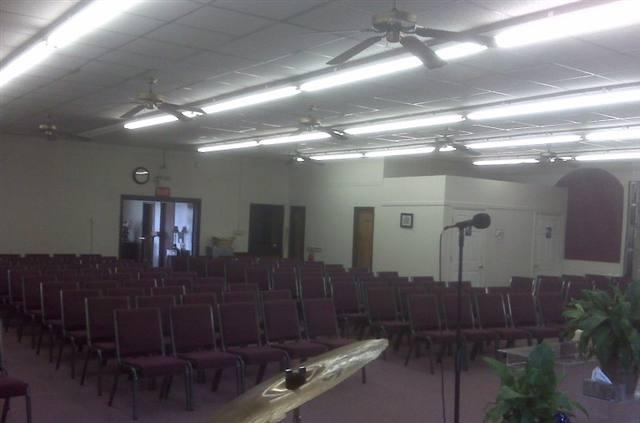
119 S Brady Ave
3740130236430000
Boundary Survey For The City Of Newton
Policefirecivildefense
PLAT 73-54
X
Catawba
3710374000J
North Carolina
0
1.90 AC
2025
Catawba County
011200
Charlotte
22,709 SF
Hickory-Lenoir-Morganton, NC
DEMOGRAPHICS near 119 S Brady Ave
1 Mile
3 Mile
5 Mile
2024 Total Population
5,278
20,062
37,338
2029 Population
5,552
21,024
39,051
Pop Growth 2024-2029
+ 5.19%
+ 4.80%
+ 4.59%
Average Age
39
40
41
2024 Total Households
2,134
7,847
14,669
HH Growth 2024-2029
+ 5.20%
+ 4.77%
+ 4.53%
Median Household Inc
$57,658
$58,210
$58,233
Avg Household Size
2.40
2.50
2.40
2024 Avg HH Vehicles
2.00
2.00
2.00
Median Home Value
$142,963
$159,280
$177,614
Median Year Built
1975
1978
1983
Nearby Places
Map Layers
Map Styles
 Street
 Aerial
- Restaurants
- Banks
- Shops
- Fitness
- Groceries
Nearby Properties
Address
Land Use
TOTAL SIZE
Lot Size
Zoning
Address
Land Use
TOTAL SIZE
Lot Size
Zoning
125,462 SF
18.74 AC
PD-O&I
Address
Land Use
TOTAL SIZE
Lot Size
Zoning
6,751 SF
85.40 AC
PD-CCRC
Address
Land Use
TOTAL SIZE
Lot Size
Zoning
1,937 SF
62 AC
PD-CCRC
Address
Land Use
TOTAL SIZE
Lot Size
Zoning
248,173 SF
53.73 AC
B-4
Address
Land Use
TOTAL SIZE
Lot Size
Zoning
222,605 SF
20.66 AC
EM-1
Address
Land Use
TOTAL SIZE
Lot Size
Zoning
188,250 SF
32.34 AC
EM-1
Address
Land Use
TOTAL SIZE
Lot Size
Zoning
218,009 SF
90.48 AC
M-1
Address
Land Use
TOTAL SIZE
Lot Size
Zoning
174,666 SF
50.07 AC
M-1
Address
Land Use
TOTAL SIZE
Lot Size
Zoning
103,090 SF
36.13 AC
R-9
Address
Land Use
TOTAL SIZE
Lot Size
Zoning
124,940 SF
33.32 AC
M-1
Address
Land Use
TOTAL SIZE
Lot Size
Zoning
150,498 SF
11.27 AC
M-1
Address
Land Use
TOTAL SIZE
Lot Size
Zoning
270,125 SF
19.98 AC
EM-1
Address
Land Use
TOTAL SIZE
Lot Size
Zoning
222,786 SF
14.02 AC
EM-1
Address
Land Use
TOTAL SIZE
Lot Size
Zoning
226,704 SF
24.60 AC
EM-1
Address
Land Use
TOTAL SIZE
Lot Size
Zoning
67,085 SF
15.80 AC
PD-SC-M
Address
Land Use
TOTAL SIZE
Lot Size
Zoning
213,422 SF
33.51 AC
M-1
Address
Land Use
TOTAL SIZE
Lot Size
Zoning
7,680 SF
9.22 AC
PD-H
Address
Land Use
TOTAL SIZE
Lot Size
Zoning
20.90 AC
M-1
Address
Land Use
TOTAL SIZE
Lot Size
Zoning
318,757 SF
23.50 AC
M-1
Address
Land Use
TOTAL SIZE
Lot Size
Zoning
234,094 SF
15.22 AC
EM-1
Address
Land Use
TOTAL SIZE
Lot Size
Zoning
156,161 SF
17.22 AC
M-1
Address
Land Use
TOTAL SIZE
Lot Size
Zoning
136,903 SF
43.43 AC
EM-1
Address
Land Use
TOTAL SIZE
Lot Size
Zoning
10.85 AC
R-7
Address
Land Use
TOTAL SIZE
Lot Size
Zoning
249,849 SF
20.99 AC
M-1
Address
Land Use
TOTAL SIZE
Lot Size
Zoning
143,979 SF
11.68 AC
IND
Address
Land Use
TOTAL SIZE
Lot Size
Zoning
129,433 SF
15.57 AC
EM-1
Address
Land Use
TOTAL SIZE
Lot Size
Zoning
144,886 SF
12.53 AC
M-1
Address
Land Use
TOTAL SIZE
Lot Size
Zoning
47,490 SF
34.43 AC
EM-1-CD
Address
Land Use
TOTAL SIZE
Lot Size
Zoning
95,380 SF
7.97 AC
B-2
Address
Land Use
TOTAL SIZE
Lot Size
Zoning
142,720 SF
30.23 AC
M-1
The World's #1 Commercial Real Estate Marketplace
Connect with us
© 2025 CoStar Group
The information above has been obtained from sources believed reliable. While we do not doubt its accuracy we have not verified it and make no guarantee, warranty or representation about it. It is your responsibility to independently confirm its accuracy and completeness. Any projections, opinions, assumptions, or estimates used are for example only and do not represent the current or future performance of the property. The value of this transaction to you depends on tax and other factors which should be evaluated by your tax, financial, and legal advisors. You and your advisors should conduct a careful, independent investigation of the property to determine to your satisfaction the suitability of the property for your needs.