Property Record
119 Stonewood Ln, Latrobe, PA 15650
NEARBY LISTINGS FOR SALE OR LEASE
-
-
View all Latrobe listings for sale on LoopNet.com
Property Detail
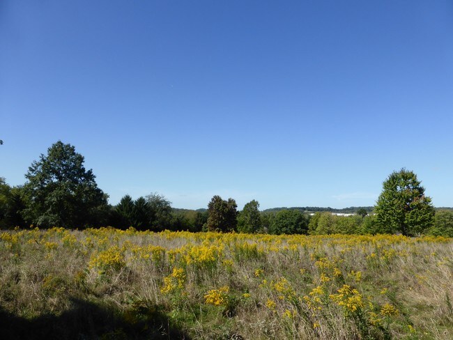
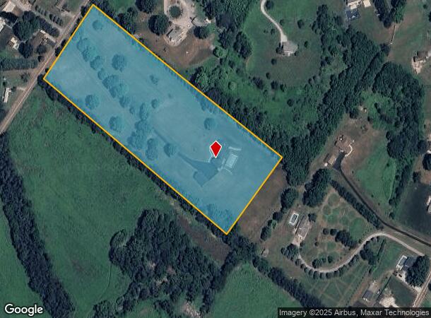
119 Stonewood Ln
61-26-00-0-147
HSE, GAR
Agriculturalnec
Westmoreland
X
Pennsylvania
42129C0443F
10 AC
2025
Westmoreland County
2025
Pittsburgh
807202
Pittsburgh, PA
4,582 SF
DEMOGRAPHICS near 119 Stonewood Ln
1 Mile
3 Mile
5 Mile
2024 Total Population
563
6,442
26,503
2029 Population
568
6,427
26,155
Pop Growth 2024-2029
+ 0.89%
(0.23%)
(1.31%)
Average Age
45
45
45
2024 Total Households
233
2,621
10,969
HH Growth 2024-2029
+ 1.29%
(0.27%)
(1.41%)
Median Household Inc
$76,875
$70,124
$72,492
Avg Household Size
2.30
2.30
2.30
2024 Avg HH Vehicles
2.00
2.00
2.00
Median Home Value
$198,275
$206,446
$219,324
Median Year Built
1990
1977
1971
Nearby Places
Map Layers
Map Styles
 Street
 Aerial
- Restaurants
- Banks
- Shops
- Fitness
- Groceries
PUBLIC TRANSPORTATION
COMMUTER RAIL
Latrobe Amtrak (Pennsylvanian - Amtrak)
DRIVE
WALK
Distance
Latrobe Amtrak (Pennsylvanian - Amtrak)
15 min
5.6 mi
AIRPORT
Arnold Palmer Regional
DRIVE
WALK
Distance
Arnold Palmer Regional
6 min
1.4 mi
Freight Ports
Port of Baltimore
DRIVE
WALK
Distance
Port of Baltimore
265 min
216.4 mi
Nearby Properties
Address
Land Use
TOTAL SIZE
Lot Size
Zoning
Address
Land Use
TOTAL SIZE
Lot Size
Zoning
216.80 AC
Address
Land Use
TOTAL SIZE
Lot Size
Zoning
44,220 SF
79 AC
Address
Land Use
TOTAL SIZE
Lot Size
Zoning
Address
Land Use
TOTAL SIZE
Lot Size
Zoning
25.30 AC
Address
Land Use
TOTAL SIZE
Lot Size
Zoning
19.60 AC
Address
Land Use
TOTAL SIZE
Lot Size
Zoning
1,846,029 SF
18.68 AC
Address
Land Use
TOTAL SIZE
Lot Size
Zoning
Address
Land Use
TOTAL SIZE
Lot Size
Zoning
Address
Land Use
TOTAL SIZE
Lot Size
Zoning
13.44 AC
Address
Land Use
TOTAL SIZE
Lot Size
Zoning
12.89 AC
Address
Land Use
TOTAL SIZE
Lot Size
Zoning
8.20 AC
Address
Land Use
TOTAL SIZE
Lot Size
Zoning
Address
Land Use
TOTAL SIZE
Lot Size
Zoning
2.16 AC
Address
Land Use
TOTAL SIZE
Lot Size
Zoning
124,311 SF
9.47 AC
Address
Land Use
TOTAL SIZE
Lot Size
Zoning
45,693 SF
1.66 AC
Address
Land Use
TOTAL SIZE
Lot Size
Zoning
75.50 AC
Address
Land Use
TOTAL SIZE
Lot Size
Zoning
7.49 AC
Address
Land Use
TOTAL SIZE
Lot Size
Zoning
79,004 SF
6.46 AC
Address
Land Use
TOTAL SIZE
Lot Size
Zoning
14,591 SF
0.65 AC
Address
Land Use
TOTAL SIZE
Lot Size
Zoning
7.06 AC
Address
Land Use
TOTAL SIZE
Lot Size
Zoning
69,178 SF
5.90 AC
Address
Land Use
TOTAL SIZE
Lot Size
Zoning
Address
Land Use
TOTAL SIZE
Lot Size
Zoning
44,750 SF
8.50 AC
Address
Land Use
TOTAL SIZE
Lot Size
Zoning
9,584 SF
3.29 AC
Address
Land Use
TOTAL SIZE
Lot Size
Zoning
110.60 AC
Address
Land Use
TOTAL SIZE
Lot Size
Zoning
16,556 SF
1.68 AC
Address
Land Use
TOTAL SIZE
Lot Size
Zoning
17,094 SF
2.16 AC
Address
Land Use
TOTAL SIZE
Lot Size
Zoning
4.80 AC
Address
Land Use
TOTAL SIZE
Lot Size
Zoning
2.40 AC
Address
Land Use
TOTAL SIZE
Lot Size
Zoning
17.50 AC
The World's #1 Commercial Real Estate Marketplace
Connect with us
© 2026 CoStar Group
The information above has been obtained from sources believed reliable. While we do not doubt its accuracy we have not verified it and make no guarantee, warranty or representation about it. It is your responsibility to independently confirm its accuracy and completeness. Any projections, opinions, assumptions, or estimates used are for example only and do not represent the current or future performance of the property. The value of this transaction to you depends on tax and other factors which should be evaluated by your tax, financial, and legal advisors. You and your advisors should conduct a careful, independent investigation of the property to determine to your satisfaction the suitability of the property for your needs.