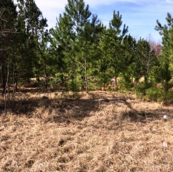
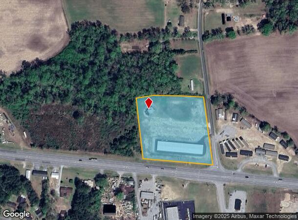
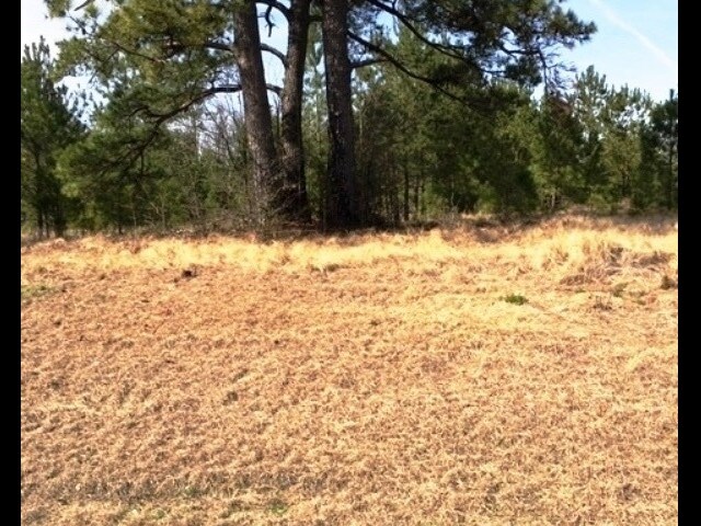
Property Record
119 Turkey Branch Rd, Beulaville, NC 28518
NEARBY LISTINGS FOR SALE OR LEASE
Property Detail
119 Turkey Branch Rd
07-2197
Duplin
Realpropertynec
North Carolina
X
117
3720346200K
4.92 AC
2025
North Carolina Southeast Area
2025
Other Market Areas
090505
DEMOGRAPHICS near 119 Turkey Branch Rd
1 Mile
3 Mile
5 Mile
2024 Total Population
873
3,453
6,154
2029 Population
856
3,447
6,162
Pop Growth 2024-2029
(1.95%)
(0.17%)
+ 0.13%
Average Age
43
42
42
2024 Total Households
390
1,448
2,515
HH Growth 2024-2029
(2.05%)
(0.41%)
0.00%
Median Household Inc
$50,439
$53,560
$53,625
Avg Household Size
2.20
2.30
2.40
2024 Avg HH Vehicles
2.00
2.00
2.00
Median Home Value
$113,291
$125,233
$116,044
Median Year Built
1993
1991
1987
Nearby Places
Map Layers
Map Styles
 Street
 Aerial
- Restaurants
- Banks
- Shops
- Fitness
- Groceries
PUBLIC TRANSPORTATION
AIRPORT
Albert J Ellis
DRIVE
WALK
Distance
Albert J Ellis
28 min
16.6 mi
Freight Ports
Port of Wilmington
DRIVE
WALK
Distance
Port of Wilmington
82 min
63.2 mi
SALE & LEASE HISTORY
LISTING DATE
SALE/LEASE

Aug 05, 2019
For Sale
Nearby Properties
Address
Land Use
TOTAL SIZE
Lot Size
Zoning
Address
Land Use
TOTAL SIZE
Lot Size
Zoning
0.96 AC
Address
Land Use
TOTAL SIZE
Lot Size
Zoning
104,128 SF
26.52 AC
Address
Land Use
TOTAL SIZE
Lot Size
Zoning
1 SF
42.84 AC
Address
Land Use
TOTAL SIZE
Lot Size
Zoning
14,447 SF
1.31 AC
Address
Land Use
TOTAL SIZE
Lot Size
Zoning
Address
Land Use
TOTAL SIZE
Lot Size
Zoning
21.40 AC
Address
Land Use
TOTAL SIZE
Lot Size
Zoning
81,208 SF
6.46 AC
Address
Land Use
TOTAL SIZE
Lot Size
Zoning
15.23 AC
Address
Land Use
TOTAL SIZE
Lot Size
Zoning
Address
Land Use
TOTAL SIZE
Lot Size
Zoning
Address
Land Use
TOTAL SIZE
Lot Size
Zoning
2,924 SF
1.17 AC
Address
Land Use
TOTAL SIZE
Lot Size
Zoning
3,621 SF
2.11 AC
Address
Land Use
TOTAL SIZE
Lot Size
Zoning
784 SF
6 AC
Address
Land Use
TOTAL SIZE
Lot Size
Zoning
4,692 SF
4.21 AC
Address
Land Use
TOTAL SIZE
Lot Size
Zoning
4,100 SF
3.44 AC
Address
Land Use
TOTAL SIZE
Lot Size
Zoning
Address
Land Use
TOTAL SIZE
Lot Size
Zoning
3,437 SF
0.65 AC
Address
Land Use
TOTAL SIZE
Lot Size
Zoning
31,860 SF
4.46 AC
Address
Land Use
TOTAL SIZE
Lot Size
Zoning
71.32 AC
Address
Land Use
TOTAL SIZE
Lot Size
Zoning
10,465 SF
7.21 AC
Address
Land Use
TOTAL SIZE
Lot Size
Zoning
Address
Land Use
TOTAL SIZE
Lot Size
Zoning
19,920 SF
3.66 AC
Address
Land Use
TOTAL SIZE
Lot Size
Zoning
8,120 SF
0.86 AC
Address
Land Use
TOTAL SIZE
Lot Size
Zoning
243,377 SF
34.32 AC
Address
Land Use
TOTAL SIZE
Lot Size
Zoning
11.28 AC
Address
Land Use
TOTAL SIZE
Lot Size
Zoning
Address
Land Use
TOTAL SIZE
Lot Size
Zoning
9,000 SF
35.30 AC
Address
Land Use
TOTAL SIZE
Lot Size
Zoning
10,250 SF
1.04 AC
Address
Land Use
TOTAL SIZE
Lot Size
Zoning
7,360 SF
0.60 AC
Address
Land Use
TOTAL SIZE
Lot Size
Zoning
231.23 AC
The World's #1 Commercial Real Estate Marketplace
Connect with us
© 2026 CoStar Group
The information above has been obtained from sources believed reliable. While we do not doubt its accuracy we have not verified it and make no guarantee, warranty or representation about it. It is your responsibility to independently confirm its accuracy and completeness. Any projections, opinions, assumptions, or estimates used are for example only and do not represent the current or future performance of the property. The value of this transaction to you depends on tax and other factors which should be evaluated by your tax, financial, and legal advisors. You and your advisors should conduct a careful, independent investigation of the property to determine to your satisfaction the suitability of the property for your needs.